3D Scanner Drones: Revolutionizing Exploration & Discovery 🗺️
Senior Associate Copy Editor
Unleash 3D scanning drone tech! Explore hidden details, from intricate engineering to vast archaeological sites. See how drones revolutionize discovery! Click to learn more.
Unleashing New Perspectives: 3D Scanner Drones in Exploration and Discovery
The hum of a drone is now a familiar sound across diverse landscapes, but equip that drone with a precision 3D scanner, and you unlock a revolution in how we explore and understand our world. From the intricate components of engineering design to the vast expanse of archaeological sites and natural resource mapping, 3D scanner drones are rapidly becoming indispensable tools. Imagine the ability to digitally capture every detail of a historical artifact still embedded in the earth, or to create a highly accurate model of a critical infrastructure component without ever setting foot in a hazardous environment. This is the evolving reality powered by 3D scanner drone technology. The following video highlights offer a glimpse into this dynamic field, showcasing the diverse applications and technological advancements that are reshaping exploration and discovery as we know it.
Key Insights from the Field: 3D Scanner Drone Applications
Precision in Engineering and Design (Video 1: Miraco vs. LEO): The quest for accuracy in 3D scanning is relentless, particularly in engineering. Video 1’s head-to-head test between the Revopoint MIRACO and Artec LEO scanners highlights the critical need for precise measurements in design and manufacturing. While not drone-mounted in this test, the takeaway is clear: the advancement of handheld scanners directly informs the development of lighter, more accurate payloads for 3D scanner drones. The ability to capture intricate details of components like steering racks, as demonstrated, translates to drone-based inspections of complex infrastructure – bridges, turbines, and even aircraft – ensuring structural integrity through meticulous digital replication and analysis.
Expanding the Search: Ground Penetrating Possibilities (Videos 2 & 4: Phoenix 3D & Ground Scope): Venturing beneath the surface opens up entirely new realms of discovery. Videos 2 and 4, featuring ground scanners like the Phoenix 3D and Ground Scope, showcase the allure of unearthing hidden treasures and mapping subsurface structures. While these videos focus on terrestrial treasure hunting and metal detection, they spotlight the core technology applicable to drone-based ground penetrating radar (GPR) and similar subsurface imaging systems. Imagine drones equipped to map underground utilities before excavation, locate buried archaeological sites without disturbing the terrain, or assess soil composition for agricultural optimization – extending the reach of exploration from the aerial to the subterranean.
Scaling Up: Capturing Large and Complex Structures (Video 3: Einscan Libre): The sheer scale of some subjects demands powerful scanning solutions. Video 3’s demonstration of digitizing a complete airplane fuselage with the Einscan Libre underscores the capability to capture vast and complex objects in detail. While this example is ground-based, the principles directly apply to 3D scanner drones used for infrastructure inspection, environmental monitoring of large areas (like coastlines or forests), or creating digital twins of entire buildings or industrial facilities. Combining IR and laser scanning, as featured in the video, showcases techniques that enhance data richness and accuracy even when scanning large, reflective, or varied surfaces – critical for effective drone-based mapping.
Outdoor Environments: Versatility and Accuracy Unleashed (Video 6: FARO Orbis): The rugged reality of outdoor operations requires robust and reliable equipment. Video 6 featuring the FARO Orbis mobile scanner emphasizes accuracy in geospatial workflows within outdoor settings. The Orbis’s ability to deliver millimeter-level precision in mobile and stationary scans directly translates to the demanding conditions faced by 3D scanner drones. Whether it’s mapping challenging terrains for construction planning, monitoring environmental changes in remote locations, or conducting detailed site surveys, drones equipped with scanners like the Orbis are providing unparalleled data capture capabilities in diverse outdoor environments.
Technology Advancement: Hybrid Approaches and Enhanced Performance (Video 5: CR-SCAN RAPTOR): The rapid evolution of 3D scanning technology is constantly pushing the boundaries of what’s possible. Video 5’s introduction to the Creality CR-SCAN RAPTOR highlights the trend toward hybrid scanning technologies, combining NIR and Blue Laser for enhanced versatility and precision. This innovation is crucial for drone-based scanners, offering the ability to effectively scan a wider range of materials and surface types under varying lighting conditions. The pursuit of "precision and polyvalence," as the video title states, is a driving force in making 3D scanner drones more adaptable and effective across a broader spectrum of applications, from intricate inspections to large-scale environmental surveys.
The Horizon of 3D Scanning: Drones Leading the Way
Looking ahead, the insights from these videos coalesce into a clear trend: 3D scanner drones are not just tools; they are catalysts for a more detailed and data-rich understanding of our world. We’re seeing advancements in scanner accuracy, portability, and versatility converging with drone technology to create powerful new workflows. The ability to capture high-resolution 3D data from the air, across diverse environments, and even beneath the surface, is transforming industries ranging from engineering and construction to archaeology and environmental science. The future promises even greater integration, with AI-powered data processing and autonomous flight capabilities further streamlining workflows and expanding the horizons of exploration and discovery.
Dive Deeper: Watch the Video Highlights
Want to see these cutting-edge technologies and applications in action? Scroll down to explore the video highlights and witness firsthand the revolution being driven by 3D scanner drones.
See the featured videos below
Head to Head 3D Scanner Test – MIRACO vs. LEO – steering rack testThrottle Stop Garage3,675 views | 277 | December 31 2024 01:51:09 (47 comments)[ Read more … ]
I need a scan of my steering rack and some critical dimensions for the suspension design. It’s time to test our scanners. I put the Revopoint MIRACO scanner head to head with an Artec LEO. These are not comparible scanners based on price, but will they stack up?
Consider SendCutSend.com for your next project. Follow the link for discount code. https://sendcutsend.com/throttlestopgarage/
Please consider supporting the channel through our merchandise. https://throttle-stop-garage.creator-spring.com
Uncover Hidden Treasures with the Phoenix 3D Ground Scanner | The Ultimate Tool for Treasure HuntersMetal detector – Golden Detector company738 views | 27 | December 30 2024 11:30:15 (1 comments)[ Read more … ]
✨The Phoenix 3D Ground Scanner is a premium metal detector for serious treasure hunters. Featuring advanced 3D scanning technology, it provides precise visualizations of underground structures and artifacts.
🌟The user-friendly app for Android allows easy access to real-time scan data. Lightweight and ergonomic, this scanner is suitable for both beginners and experts, making it ideal for discovering historical relics, lost valuables, or natural resources in various terrains.
Contact us for more information, price, payment methods, and shipping details. 📞Mobile: +971563592447 📲WhatsApp: +971563592447 👉Order Now‼ WhatsApp Link: https://wa.me/971563592447
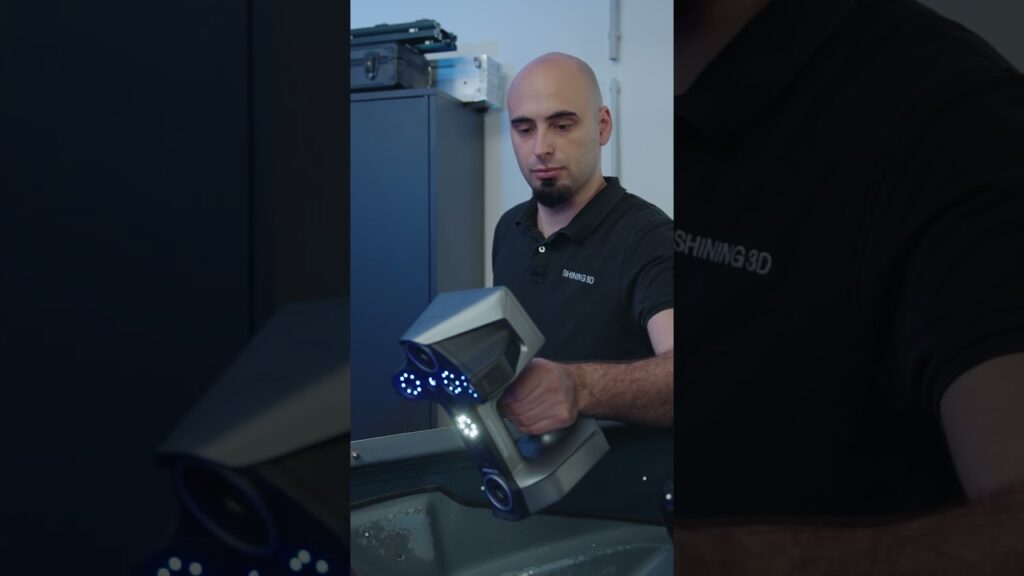
#3Dscanning Complete Fuselage with #Einscan LibreSHINING 3D552 views | 14 | January 14 2025 23:00:49 (0 comments)[ Read more … ]
Learn how to utilize EinScan Libre to digitize a complete Airplane Fuselage with, combining the strengths of IR and Laser Scanning in one 3D model with full 48MP Texture. Video out now on our YouTube Channel!
3D Ground scanner for detecting gold (Ground scope) #gold_detector #exploreشركة العريمان لاجهزة كشف الذهب والمعادن و المياه 589 views | 34 | January 5 2025 15:12:11 (0 comments)[ Read more … ]
3d Ground Imaging Metal Detector” GROUND SCOPE is a specialized device to detecting gold, treasures, metal and caves underground to maximum depth up to 14 meters, it operates with the radar imaging system and provides 2D and 3D data for the shape of the detected object underground and measures the depth of the target. ————————————————————————– You can check all device’s details from the following link:
https://alareeman.com/en/product/ground-scope/ …………………………………………………………………………………………. For more information you can contact us at the following details: Mobile1: 0096590084437 Mobile2: 0096590084436 Mobile3: 0096566145558 landline:0096522629196 e-mail: info@alareeman.com website: www.alareeman.com Kuwait – Hawali – Abdullah Al-Othman Street commercial Khaled Mal Allah Complex- Fourth Floor Near to Al-Adsani compound ————————————————————————— #gold_detector #detector #Metal_Detector #Water_Detector #gemstones_detector #alareeman_company
CR-SCAN RAPTOR : Pr cision et polyvalence!|La Bizounerie2,372 views | 213 | December 30 2024 11:00:40 (21 comments)[ Read more … ]
Aujourd’hiu je fais un premier tour d’horizon des fonctionnalit s du nouveau scanner CR-SCAN RAPTOR de Creality. Avec une technologie hybride NIR et Laser Bleu, il promet d’ tre polyvalent et efficace.
Est-ce que mes premiers tests seront prometteurs?
Lien vers le RAPTOR :
Boutique CA: https://bit.ly/4iVQ4nJ 15%DE RABAIS! Prix final : CA$1,819.00
Boutique EU: https://bit.ly/4gWuuxE Prix final: €1.599,00
================================================
ABONNEZ-VOUS LA BIZOUNERIE pour ne rien manquer des prochains projets de l’atelier : https://www.youtube.com/channel/UCAFeQz1RX8BP-91AG05qjWg?sub_confirmation=1
SI VOUS AVEZ ENVIE DE SUPPORTER LA BIZOUNERIE (un norme MERCI!!!) :
Pour me payer un caf virtuel et d’autres options de contributions : https://buymeacoffee.com/labizounerie
ADRESSE POSTALE: Pour m’envoyer une carte postale, une lettre ou un cadeau (on ne sait jamais) : La Bizounerie (Marc Bilodeau) 239, Rte 138 Saint-Tite-des-Caps, Qu bec CANADA, G0A 4J0
POUR AIDER LA CHA NE GRANDIR (SANS FRAIS POUR VOUS), UTILISEZ MES LIENS AFFILI S AMAZON (PEU IMPORTE CE QUE VOUS ACHETEZ)
Liens amazon CANADA:
POUR TOUT ACHAT sur Amazon.ca : https://amzn.to/2S2MY6N
QUIPEMENT VID O : Cam ra : Nikon D5200 (mod le discontinu , mais la D5300 est top!) : https://amzn.to/2VUJmF6 Microphone shotgun Moukey MCM-1 : https://amzn.to/3cOW2UV Micro-cravate AGPTEK : https://amzn.to/2VBlmYJ Tr pied Amazon Basics : https://amzn.to/3eIwEBQ Chariot motoris pour cam ra : https://amzn.to/3cMc41Q Ensemble de micros sans-fil SYNCO: https://amzn.to/3HX35d5 Ensemble d’ clairage Neewer : https://amzn.to/3cLgJ9I Liens amazon FRANCE:
POUR TOUT ACHAT sur Amazon.fr : https://amzn.to/3lhjsZ6
QUIPEMENT VID O : Cam ra : Nikon D5200 (mod le discontinu , mais la D5300 est top!) : https://amzn.to/2MSDWqM Microphone shotgun Moukey MCM-1 : https://amzn.to/2MPSIyA Microphone Behringer B1 : https://amzn.to/36ck0qD Tr pied Amazon Basics : https://amzn.to/2p6W47n Ensemble de micros sans-fil SYNCO: https://amzn.to/3MAgaN8 Ensemble d’ clairage Neewer : https://amzn.to/3KLqbqi
*Note : La plupart des liens fournis dans cette description sont des liens affili s qui donnent un petit coup de pouce l’atelier lorsque vous les utilisez. Merci!
*musique du g n rique gracieuset de KOJAK RODRIGUEZ
Using the #faro #orbis #laserscanner for #outdoor EnvironmentsFARO Technologies586 views | 10 | December 27 2024 14:00:27 (0 comments)[ Read more … ]
The FARO Orbis Mobile Scanner offers advanced solutions for geospatial workflows in outdoor environments.
With 4mm accuracy for mobile scans and an impressive 2mm accuracy during stationary Flash scans, the Orbis ensures precision across varying conditions.
Whether you’re documenting a large area or detailed site features, this versatile scanner provides the accuracy needed for effective data capture.
About the Author
Patryk Alexander is an associate copy editor at 4kVideoDrones.com, where he sharpens articles and helps keep the website's content clean and error-free. With a background in creative writing, Patryk brings a unique perspective to his editing that helps make 4kVideoDrones.com's content engaging and informative. When he's not editing or writing, Patryk enjoys spending time with his family and exploring the great outdoors.