Drone-Powered Wildlife Monitoring: A Sky’s-the-Limit Approach 🔭
Senior Associate Copy Editor
Drones & Wildlife : Soar into the future of conservation! See how drones are revolutionizing tracking & protection. Click to explore!
Taking Flight for Conservation: How Drones are Revolutionizing Wildlife Management
Ever wonder how conservationists track elusive animals across vast, challenging terrains? These curated YouTube videos offer a fascinating glimpse into the rapidly evolving world of drone-powered wildlife monitoring. From innovative radio-tracking systems that pinpoint tagged animals with unprecedented precision to thermal imaging that reveals hidden wildlife even in dense foliage, drones are providing conservationists with powerful new tools. These videos showcase real-world applications, cutting-edge research, and the incredible potential of drones to transform how we study and protect wildlife. Get ready to explore how these flying machines are giving us a sky-high perspective on conservation.
Key Insights from the Drone Frontier:
Precision Tracking: Learn how Wildlife Drones has pioneered a system that integrates drone technology with radio tracking, allowing researchers to follow multiple tagged animals simultaneously, gathering real-time location data with minimal effort. Imagine the possibilities for studying animal movement patterns and habitat use!
Thermal Vision in Action: Discover how thermal imaging drones are being used by organizations like Forestry and Land Scotland (FLS) to conduct “minimum count” surveys of deer populations, providing crucial data for managing these populations effectively.
Conservation Through Collaboration: Explore how the Jane Goodall Institute empowers local communities with app-based data collection and mapping tools, enabling them to monitor and protect their forests. This highlights how drone data can be integrated with broader conservation initiatives.
Combating Invasive Species: Witness the innovative use of drones for targeted herbicide application to control invasive trees in hard-to-reach areas. This showcases the potential of drones for habitat restoration and sustainable land management.
Education and Training: Get an inside look at Liverpool John Moores University’s MSc program in Wildlife Conservation and Drone Applications, including a field trip to Tanzania to observe chimpanzees. This highlights the growing importance of drone skills in the conservation field.
Beyond the Horizon: The Future of Drones in Conservation
The videos reveal a clear trend: drone technology is becoming increasingly integrated with traditional wildlife management practices. As drone hardware and software continue to advance, we can expect even more sophisticated applications. Imagine AI-powered drones that can autonomously identify and track specific species, or swarms of drones working collaboratively to map vast ecosystems in real time. The possibilities are truly “sky’s the limit”!
Ready for Takeoff?
These videos provide an inspiring overview of the power of drone technology in wildlife conservation. Scroll down to watch the highlighted videos and see for yourself how drones are giving us a whole new perspective on protecting our planet’s precious biodiversity.
Swipe down to discover the videos
Drone radio-tracking and thermal imaging with Dr Debbie SaundersWildlife Drones1,732 views | 40 | December 9 2020 22:07:58 (5 comments)[ Read more … ]
Conservation ecologist and CEO of Wildlife Drones, Dr Debbie Saunders, shared the latest advancements and applications of drone radio-tracking and thermal imaging technology at the 2020 Australasian Wildlife Management Society (AWMS) virtual conference.
Wildlife Drones has developed the world’s most innovative radio animal-tracking system using drones so you can track your radio-tagged animals like never before. Join us as we take to the skies and show you how drones can make animal tracking so much easier! We empower you to collect more data, more often with less effort using innovative drone technology
» Rapidly survey difficult terrain
» Track multiple animals simultaneously
» Get real-time location data
Check out our other videos here: https://www.youtube.com/c/WildlifeDrones
Follow us on Facebook: https://www.facebook.com/WildlifeDrones
Follow us on LinkedIn: https://au.linkedin.com/company/wildlife-drones
Follow us on Twitter: https://twitter.com/WildlifeDrones1
Follow us on Instagram: https://www.instagram.com/wildlifedrones
Sign up for our Newsletter: https://wildlifedrones.net/mailing-list-sign-up/
Interested to find out more? Book a free virtual demo here: https://meetings.hubspot.com/Debbie50/wildlife-drones-virtual-demo
Conservation Through Coordination | Exploring with GISNational Geographic Education16,595 views | 461 | July 11 2020 14:00:07 (1 comments)[ Read more … ]
From the Education Resource Library! Primatologist and conservation hero, Jane Goodall, took her work from observation and research to conservation and activism when she saw the effects of deforestation first hand. Through app based data collection, mapping, and collaboration with the Jane Goodall Institute, local forest monitors are able to generate maps to monitor and protect their forests for generations to come.
Here are some activities for your students:
K-5: Draw a picture or photo strip of something you learned.
Grades 5-8: Write a short “news article” about what you learned.
High School: Produce a short video that explains something you learned today.
Share your students activities by @NatGeoEducation and using #ExplorerClassroom on Twitter. Our team will share your student work with the Explorer.
We invite you to explore collections of activities that have been developed for educators, parents, and caregivers to implement with K-12 learners. https://www.nationalgeographic.org/education/classroom-resources/learn-at-home/
WHAT IS THE RESOURCE LIBRARY
The National Geographic Resource Library provides online materials that take students on thought-provoking journeys, engaging them with entertaining stories and rich photography. The Resource Library features nonfiction articles, videos, photographs, maps, and infographics that investigate the science, geography, and history behind the important phenomena, discoveries, and ideas of our time. Learn more: https://www.nationalgeographic.org/education/resource-library/
WHO WE ARE
The National Geographic Society is an impact-driven global nonprofit organization based in Washington, D.C. Since 1888, the National Geographic Society uses the power of science, exploration, education, and storytelling to illuminate and protect the wonder of our world. To learn more about the Society and its programs, visit www.nationalgeographic.org.
WHERE TO FIND US
On YouTube: https://www.youtube.com/c/NatGeoEdOrg?sub_confirmation=1
On Facebook: https://www.facebook.com/natgeoeducation/
On Twitter: https://twitter.com/natgeoeducation
Our Newsletter: https://www.nationalgeographic.org/education/newsletter/
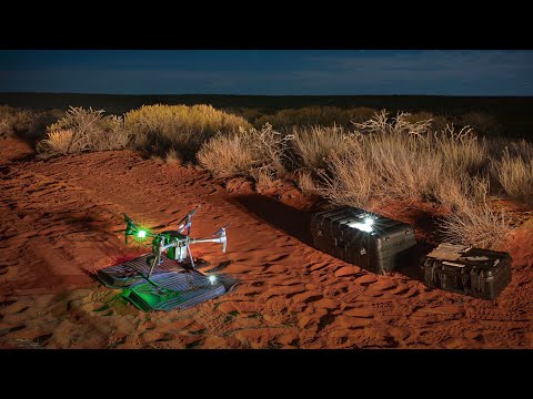
AWC trials new drone technology for monitoring wildlifeAustralian Wildlife Conservancy8,894 views | 90 | November 28 2019 00:03:12 (3 comments)[ Read more … ]
Innovations in technology are rapidly changing the way our team of scientists are working at the frontline of conservation. Australian Wildlife Conservancy (AWC) recently trialled a range of exciting new tools that are transforming the way we detect elusive species, monitor wildlife populations and track reintroduced native animals through the landscape.
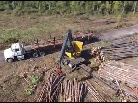
Drones vs. Invasive Trees: The Future of Forest ManagementManagementAdvantage1,177 views | 35 | October 9 2024 23:13:49 (8 comments)[ Read more … ]
Time can get away from a land manager and parts of a farm can get overtaken with undesirables. Which is exactly the case on this Alabama farm. A low lying area has been overtaken by pines and sweet gum trees. Being low lying, moisture often prohibits the ability to get the Vail equipment or a bush hog in there. To fix the problem, we had Taft Drone Services come in to spray the area. A fall spraying is optimum to get rid of the woody undesirables versus mowing that would likely lead to a regeneration next spring. An aerial application of herbicide is the perfect method for hard to reach locations, low lying areas, and for a guy without the equipment to cover a large area. Next spring, this chunk of the farm will be void of invasives and full of natives that are beneficial to all wildlife.
Watch this and more wildlife management videos at http://www.themanagementadvantage.com… Be sure to sign up for our weekly updates that will send our newest wildlife management videos and articles straight to your inbox!
Study MSc Wildlife Conservation and Drone Applications at Liverpool John Moores UniversityLiverpool John Moores University703 views | 11 | January 7 2020 10:27:24 (0 comments)[ Read more … ]
Enjoy an overseas field trip to Tanzania (included in your fees) and observe chimpanzees in the wild as you practice and develop advanced skills in behavioural observation and conservation monitoring.
https://www.ljmu.ac.uk/study/courses/postgraduates/wildlife-conservation-and-drone-applications
Enhancing wildlife management surveys on Scotland’s forest using drone captured data with FLS – SC23Esri UK180 views | 1 | April 30 2024 10:34:50 (0 comments)[ Read more … ]
Traditionally Forestry and Land Scotland (FLS) assessed deer populations with sample plot field surveys and data extrapolations. Recent innovative work with BH Wildlife Consultancy has enhanced FLS wildlife management operations by acquiring ‘minimum count’ data from thermal imaging drones, using a combination of ESRI’s ArcGIS apps. Scotland’s deer population has doubled in the last 30 years, increasing negative impacts on forests and other habitats. Data and thermal imagery showing deer densities is now an important part of FLS work to manage deer at a landscape scale, in partnership with other land managers. These outputs are also helping policy makers and regulators understand the issues, as well as helping FLS communicate publicly the need for sustainable deer management – often an emotive and controversial subject.
Following this innovative story from FLS and BH Wildlife Consultancy, Esri UK will take you on a flight through the changing landscape of remote sensed data and look at how ArcGIS analysis tools can yield insight from this view of our world. We’ll then touch down with a look at how ArcGIS can unlock access to imagery for wider audience.
Speakers: Douglas Knox, Ben Harrower, Eve Selbie & Catherine Clarke.
About the Author
Patryk Alexander is an associate copy editor at 4kVideoDrones.com, where he sharpens articles and helps keep the website's content clean and error-free. With a background in creative writing, Patryk brings a unique perspective to his editing that helps make 4kVideoDrones.com's content engaging and informative. When he's not editing or writing, Patryk enjoys spending time with his family and exploring the great outdoors.