Drone Surveying: Level Up Site Surveys with YouTube Tutorials ✈️
Senior Associate Copy Editor
Take your surveying to new heights! Learn time-saving drone techniques & software from top YouTube tutorials. Boost accuracy & dominate your workflow. Click to learn more!
Drone Surveying: Soar Above the Competition with YouTube! ✈️
Tired of slow, tedious site surveys? Ready to ditch the measuring tape and embrace the efficiency of drone technology? Then you’ve landed in the right place! This page dives into the best YouTube tutorials that’ll transform your surveying game. We’ve sifted through countless videos to bring you the gold—practical tips and techniques to dramatically improve the speed and accuracy of your site surveys using drones. Whether you’re a seasoned pro or just starting out, these videos offer something for everyone looking to level up their skills. We’ll show you how to leverage the power of aerial imagery and data analysis to optimize your workflow and deliver superior results, saving you time and money along the way.
Key Takeaways from Top Drone Surveying Tutorials:
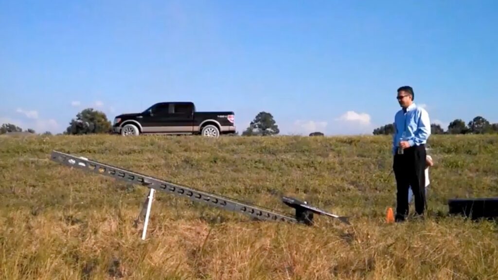
Mastering Ground Control Points (GCPs): Learn the crucial role of GCPs in achieving survey-grade accuracy with your drone data. Several tutorials emphasize proper GCP placement and the importance of precise measurements for optimal results.
Choosing the Right Drone and Software: Discover which drones are best suited for surveying tasks, and understand the software options available for processing the captured data and generating accurate maps and 3D models. The videos help to identify compatible and cost-effective options for different project scales.
Workflow Optimization: Several videos breakdown the entire process from pre-flight planning to data processing and analysis. The tutorials provide time-saving techniques and best practices to streamline your workflow.
Beginner-Friendly Tutorials: From basic drone operation to advanced techniques like volumetric calculations, resources are available for all skill levels. You’ll find educational pathways suitable whether you’re just beginning your drone surveying journey or looking to sharpen your existing expertise.
Real-World Applications: See drone surveying in action through case studies and real-world examples, showcasing the versatility and effectiveness of this technology across various industries.
Beyond the Buzz: The Future of Drone Surveying
The drone surveying field is evolving rapidly. We’re seeing increased integration with other technologies, like AI-powered image processing and automated data analysis, promising even greater efficiency and accuracy in the future. Expect to see more user-friendly software and affordable drone options emerge, making drone surveying accessible to a broader range of professionals. The trend towards automated flight planning and obstacle avoidance will further enhance safety and productivity.
Take Flight!
Ready to transform your site surveys? Scroll down to check out our curated selection of YouTube video highlights and start learning today! You’ll be amazed at how quickly you can level up your skills and gain a competitive edge. Don’t just survey your site; dominate it with the power of drones!
The videos are just a scroll away
Drone Surveying for BeginnersRami Tamimi136,560 views | 4,501 | November 29 2021 21:00:17 (176 comments)[ Read more … ]
Join The Survey School – https://thesurveyschool.com/
👕 Survey Shirts – https://www.SurveyShirts.com
Surveying with Drones for Beginners. We will cover the fundamentals of drone mapping. Using ground control points (GCP) and check points (CHK) to make sure our aerial mapping project has survey grade accuracy.
Chapters:
0:00 Intro
1:40 What are Ground Control & Check Points
5:04 Setting GCPs and CHKs
7:20 Setting up the Drone
11:38 Flying the Drone
13:04 Outro
E38 Survey Solutions – https://e38surveysolutions.com/collections/drones
Emlid Store – https://store.emlid.com/rami
Join me on Social Media:
🖥️ Website: https://www.tamimi.biz
👤 Facebook: https://www.facebook.com/tamimibiz
👥 Private Facebook Group: https://www.facebook.com/groups/iamasurveyor
📸 Instagram: https://www.instagram.com/ramitamimi
👔 LinkedIn: https://www.linkedin.com/ramitamimi
✉️ Email: rami@tamimi.biz
About Professor Rami Tamimi:
Rami Tamimi is an American doctorate student at The Ohio State University working towards his Doctor of Philosophy in Geodetic Engineering. With over 8 years of experience in the Land Development Industry, his experience revolves around traditional field surveying, civil design work using AutoCAD Civil 3D, and geospatial technology including LiDAR, SONOR, and Photogrammetric data acquisition and processing with the use of Unmanned Aircraft Systems or Drones. He is also a University Professor and creates instructional video content on YouTube.
#Surveying #Drones #DJI
Putting Drones to Work for YouEsri Industries871 views | 4 | June 9 2017 22:12:10 (0 comments)[ Read more … ]
1. SFWMD joined with Florida Atlantic University to create an opportunity to explore and leverage their resources to implement the use of drones to perform image acquisition, volumetric calculations, and 3D analysis for district projects. In this video, you will learn about their specific projects, the challenges to getting started, and the benefits gained.youtube.com
SFWMD & FAU paired their drone with Drone2Map for ArcGIS. Want to put your drone to work also? Get it now, http://arcg.is/2raJvmt
About the Author
Patryk Alexander is an associate copy editor at 4kVideoDrones.com, where he sharpens articles and helps keep the website's content clean and error-free. With a background in creative writing, Patryk brings a unique perspective to his editing that helps make 4kVideoDrones.com's content engaging and informative. When he's not editing or writing, Patryk enjoys spending time with his family and exploring the great outdoors.