
Pinpointing the Action: Drone Footage, Timestamps & Geolocation 🚀
Ever wish you could instantly pinpoint the exact moment and location of a key event captured in your drone footage? This isn’t science fiction, folks. The 2014 video we’re highlighting, "Interactive GPS Drone Video Survey – Soccer Park Test," showcases the power of integrating GPS data with video timestamps – a game-changer even back then! We’ll explore how this early example laid the groundwork for the precise geolocation and timestamping tools we rely on today. Why does this matter? Think search and rescue, infrastructure inspection, or even precisely tracking the winning goal in your next local soccer match. We’re diving into the how and why of this crucial drone technology.
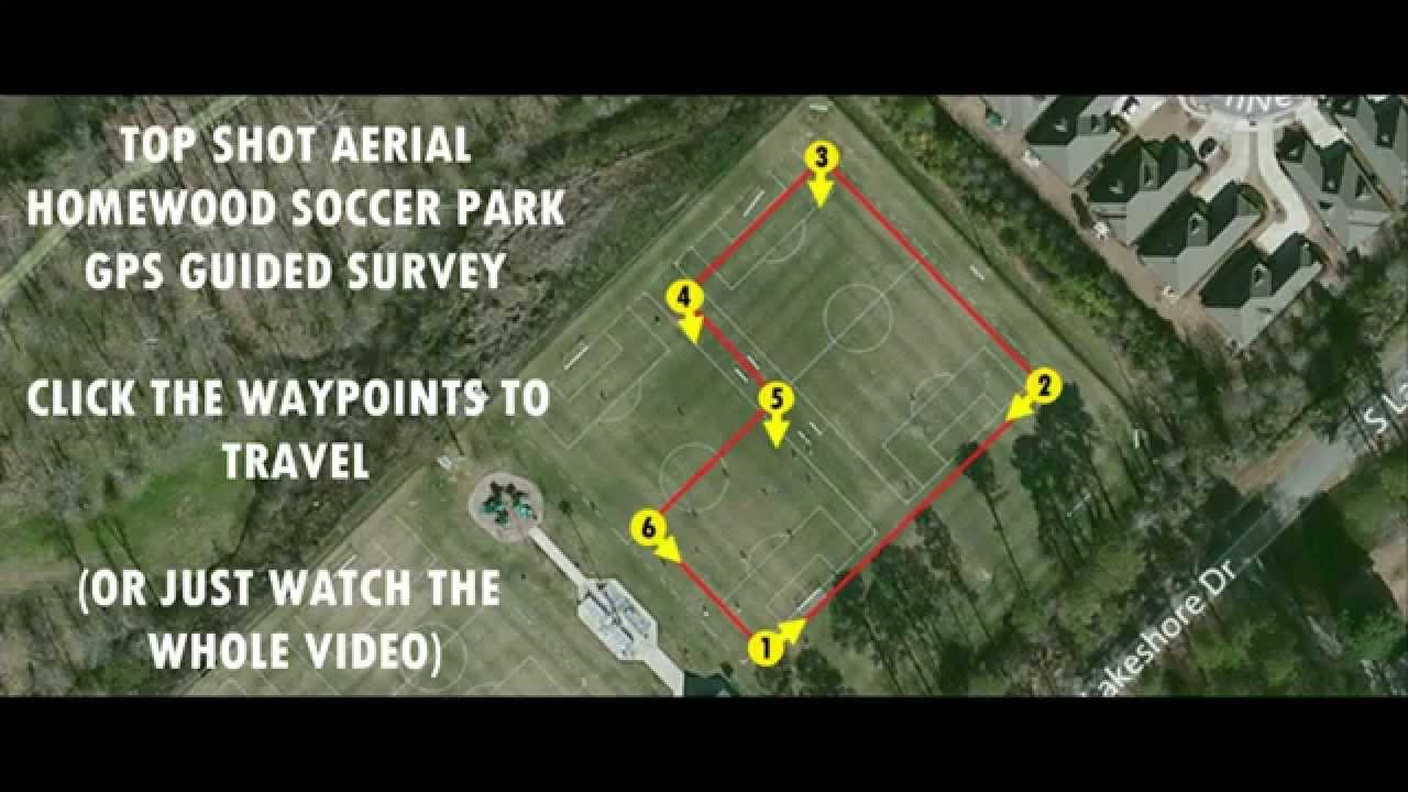
Key Highlights from the Soccer Park Test
- Timestamped Waypoints: The video demonstrates the use of timestamps linked to specific waypoints in a drone survey of a soccer park. This allows viewers to jump to precise moments in the flight corresponding to specific locations on the field.
- Early Interactive Mapping: While the implementation is basic by today’s standards, the video showcases an early attempt at creating an interactive map linked to the drone’s flight path and video feed.
- Practical Applications (Then and Now): Even in 2014, the benefits of this technology were clear for applications like surveying and asset inspection. Today, these principles are fundamental to a wide range of drone operations.
- FAA Compliance (A Blast from the Past): The video’s disclaimer regarding FAA regulations regarding commercial drone operations offers a glimpse into the evolving regulatory landscape of the drone industry.
Looking Ahead: Where We Are Now
Since this 2014 video, advancements in GPS technology, data processing, and software integration have revolutionized how we use drones. Today’s drones can seamlessly integrate high-accuracy GPS data with video, enabling precise geolocation tagging and automated flight logging. This has opened up exciting possibilities in fields like precision agriculture, environmental monitoring, and even filmmaking.
Ready for Takeoff?
This 2014 soccer park test flight might seem simple now, but it was a significant step toward the sophisticated drone technology we enjoy today. Scroll down to check out the video highlights and see the origins of location-based drone data in action! You won’t want to miss it!


