
Geospatial Precision in the Cloud: Visualizing Accretegeo WebODM Outputs on Cesium ion
For drone pilots and geospatial professionals, efficient data processing and visualization are paramount. Accretegeo WebODM has become a go-to tool for generating rich geospatial datasets from drone imagery. But unlocking the full potential of these outputs requires seamless integration with powerful visualization platforms. The question becomes: How do we bridge the gap between local processing and global accessibility? The answer lies in platforms like Cesium ion. This article, and the video highlights below, delve into the practical steps of displaying Accretegeo WebODM outputs – specifically orthophotos and textured 3D models – within the Cesium ion environment. This integration is a game-changer, allowing for cloud-based access, sharing, and analysis of high-fidelity drone-derived geospatial data.
Key Insights: WebODM to Cesium ion Workflow
- Streamlined Visualization: The video directly addresses the need to move beyond local processing by demonstrating a clear pathway to display Accretegeo WebODM outputs directly within Cesium ion. This eliminates the bottleneck of desktop-bound analysis, making geospatial data more accessible.
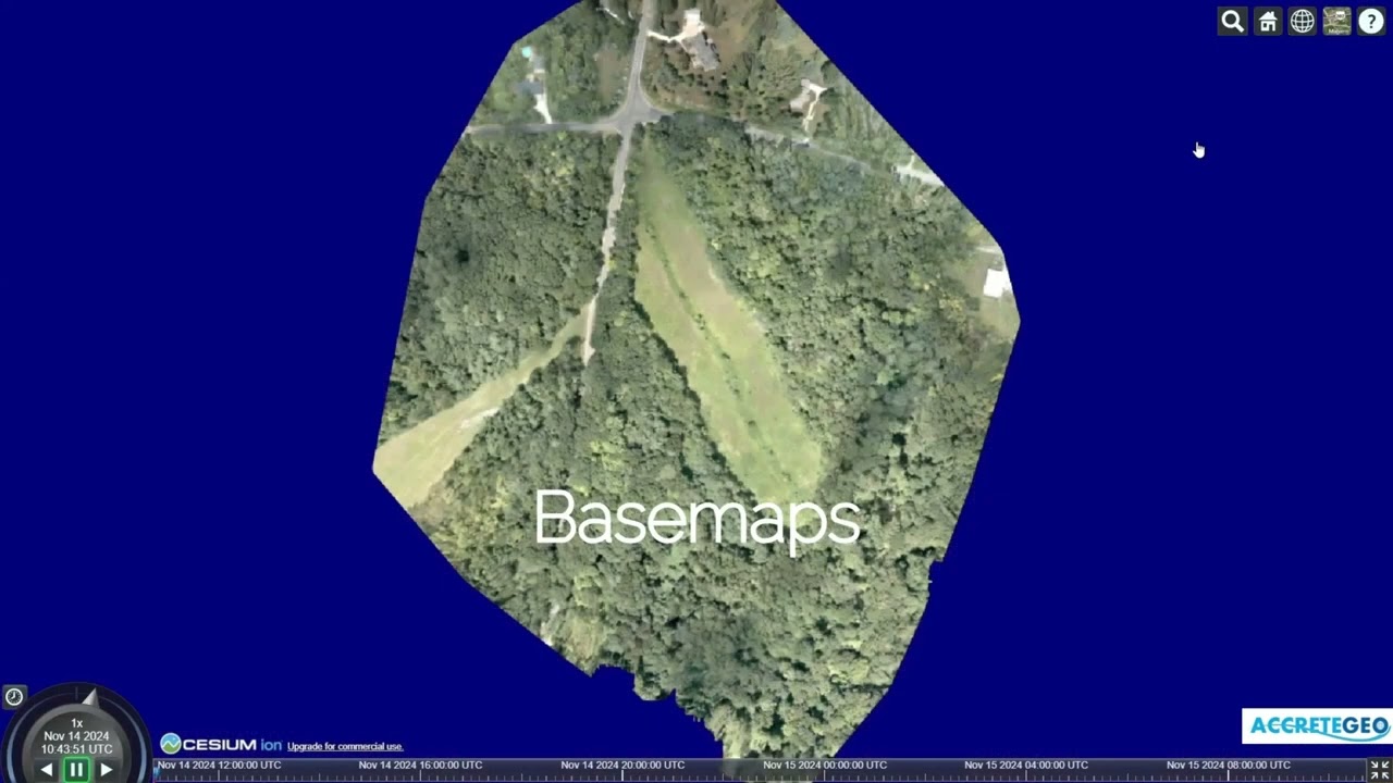
- Orthophoto and Textured Model Focus: The emphasis is placed on two crucial outputs from WebODM: orthophotos and textured 3D models. Orthophotos provide geometrically corrected, map-accurate imagery essential for precise measurements and analysis. Textured models offer immersive 3D representations, crucial for visual inspections, site planning, and engaging stakeholders.
- Practical Implementation: The video is designed to be a how-to guide, focused on the practical steps of transferring and displaying these specific output types within Cesium ion. This is invaluable for users looking for actionable steps, not just theoretical concepts.
- Platform Synergy: By highlighting the integration of WebODM and Cesium ion, the video underscores the power of combining open-source processing with a robust cloud-based visualization and sharing platform. This synergy creates a more efficient and collaborative geospatial workflow.
Unlock Cloud-Based Geospatial Intelligence
Visualizing drone data shouldn’t be confined to your workstation. Cesium ion empowers you to take your Accretegeo WebODM outputs to the cloud, enabling broader access and deeper insights. Scroll down to explore the video highlight and see firsthand how to bring your orthophotos and textured models to life in a dynamic, shareable, and globally accessible 3D environment.
Keep reading for the highlighted videos


