Ever wondered how those stunning 3D models and precise maps are created from raw drone data? It’s not magic, but it is incredibly powerful technology transforming how we see and interact with the world. This page dives into the fascinating world of processing drone data, drawing insights from leading experts and tutorials. We’ll unpack the workflow, highlighting key software and techniques to help you turn your own drone footage into actionable information. We’ll specifically focus on leveraging LiDAR data for incredibly detailed results, something many hobbyists may overlook as a viable approach.
Key Takeaways
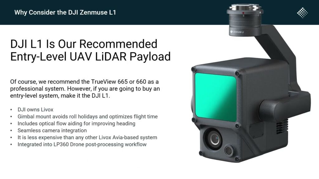
- LiDAR Data Processing is Key: Efficient processing of LiDAR data (like that from DJI’s L1) is crucial for generating high-quality maps and models. Software like LP360 Drone simplifies this complex process.
- Software Streamlines Workflow: Dedicated software solutions significantly reduce the time and effort required for data processing, making it accessible to a wider range of users, including hobbyists.
- High-Resolution Models are Achievable: With the right tools and techniques, even hobbyist-level drone missions can produce incredibly detailed 3D models, suitable for various applications like surveying, construction, and even just personal projects.
Unlocking the Potential: LiDAR and Beyond
The videos showcased here reveal a significant trend: the increasing accessibility of advanced data processing tools for drone users. What once required specialized skills and expensive software is now becoming more user-friendly, democratizing the power of aerial data analysis. The ability to generate precise 3D models opens doors for countless applications – from environmental monitoring and precision agriculture to architectural design and historical preservation. We anticipate a surge in innovative applications as both the quality and affordability of drone technology and processing software continue to improve. The use of LiDAR in particular is exciting; its fine detail for elevation maps could change many drone projects from being “good enough” to being extremely useful for professional tasks!
Ready to Take Flight?
This introduction only scratches the surface of the exciting possibilities offered by drone data processing. Click below to explore the video highlights and unlock your aerial potential! Prepare to transform your drone footage into powerful, usable tools. You might be surprised at what you can achieve!
The videos are waiting below
