Drone Surveying: Site Assessments & Renewable Energy 🌎
Senior Associate Copy Editor
Drone pilot reveals how aerial surveys are revolutionizing renewable energy. Click to explore!
Taking to the skies for site assessments is revolutionizing renewable energy projects. Imagine soaring above a vast solar farm, not just observing, but meticulously mapping every inch of the terrain. This isn’t science fiction; it’s the reality of drone surveying. These videos highlight the crucial role drones play in planning, optimizing, and assessing renewable energy sites, from solar panel layouts to post-weather event site evaluations. From faster surveys to improved accuracy, drones are streamlining the process, making renewable energy projects more efficient and cost-effective. Let’s dive into the key insights.
Key Takeaways & Video Highlights
Optimizing Solar Panel Layouts: Drones equipped with high-resolution cameras and specialized mapping software can capture detailed aerial imagery of potential solar panel sites. This data allows for precise 3D modeling, enabling engineers to optimize panel placement for maximum sunlight exposure and energy production. The videos showcase how this process is significantly faster and more accurate than traditional ground-based methods.
Post-Weather Event Site Assessments: Drones provide a crucial tool for assessing damage and identifying areas requiring attention after significant weather events. This is particularly important in renewable energy projects, where accurate site assessments are critical for determining the extent of damage and planning for repairs or adjustments. The videos demonstrate how drones can quickly survey large areas, providing valuable data for efficient recovery and restoration.
Enhanced Site Assessment Efficiency: Drones significantly reduce the time and cost associated with traditional site assessments. The videos emphasize the speed and efficiency of drone-based surveys, allowing for quicker decision-making and faster project timelines. This translates to substantial cost savings and improved project management.
Access to Difficult Terrain: Drones can access areas that are difficult or dangerous for human surveyors, such as steep slopes, rocky terrain, or areas with dense vegetation. This capability is critical for renewable energy projects, ensuring safety and comprehensive data collection. The videos highlight the practical application of drones in these challenging environments.
Analyzing the Aerial Advantage: Future Trends in Drone Surveying
The videos reveal a clear trend towards integrating drone technology into the entire renewable energy project lifecycle. From initial site assessment to ongoing monitoring, drones are becoming indispensable tools. We’re likely to see further advancements in drone technology, including:
Multispectral Imaging: Drones equipped with multispectral sensors can provide detailed information about the health and condition of vegetation, soil, and other factors crucial for site assessment. This will allow for more comprehensive and accurate assessments, potentially leading to more sustainable energy solutions.
AI-Powered Analysis: Integrating AI algorithms with drone imagery can automate the analysis process, further accelerating site assessments and providing more detailed insights. This will lead to even more efficient and accurate data interpretation.
Integration with GIS Systems: The seamless integration of drone data with Geographic Information Systems (GIS) will enable more comprehensive and interactive visualizations of site data, facilitating better decision-making and project planning.
The Sky’s the Limit: Drone Surveying’s Impact
Drone surveying is rapidly transforming site assessments, particularly in the renewable energy sector. The videos demonstrate the significant advantages of using drones, from improved efficiency and cost savings to enhanced safety and access to challenging terrain. The future of drone surveying looks bright, with continued advancements in technology and integration with other systems. This technology is not just about efficiency; it’s about creating a more sustainable and resilient future for renewable energy. Ready to see how drones are changing the game? Scroll down to watch the video highlights!
Continue below to watch the videos
Using Drones to Plan a Better Solar Panel Layout:St. Louis Corporate Photographer11 views | 0 | November 21 2024 22:31:00 (0 comments)[ Read more … ]
Revolutionizing the Energy Industry with Advanced Aerial Photography
As the demand for renewable energy solutions like solar power continues to rise, businesses in the energy sector are increasingly turning to innovative technologies to improve their operations and efficiency. One of the most groundbreaking tools in this transformation is drone technology. Drones have become invaluable assets in a wide range of industries, and the solar power sector is no exception. By providing unique aerial perspectives, drones can help businesses optimize their solar panel layouts, resulting in better energy production, cost savings, and improved project planning.
The Role of Drones in Solar Panel Layout Design
Planning the layout of solar panels for a large-scale installation requires careful consideration of various factors such as terrain, sunlight exposure, and the angle of installation. Traditionally, this process involved time-consuming surveys and manual measurements. However, drones equipped with high-definition cameras and specialized mapping software can now quickly capture precise aerial images and data, allowing engineers to analyze the land from all angles.
Drones can fly over the land and capture detailed imagery, even in hard-to-reach areas, allowing engineers and project managers to assess potential sites more thoroughly and efficiently. The collected data can be used to create 3D models, which are incredibly valuable in optimizing solar panel placement and ensuring that each panel receives maximum exposure to sunlight. This level of detail and precision would have been difficult, if not impossible, to achieve through traditional ground-based methods.
The Advantages of Using Drones for Solar Panel Layouts
Faster Surveys and Assessments: Drones can survey large areas in a fraction of the time it would take a team of surveyors on foot. This increased speed allows for quicker decision-making and faster project timelines.
Cost Efficiency: The cost of drone services is often much lower than hiring survey crews for manual site assessments. In addition, drones can reduce the need for expensive equipment like cranes or ladders, making the overall process more cost-effective.
Improved Accuracy and Data Quality: Drones can capture high-resolution imagery and other sensor data with a level of accuracy that is hard to match. This data can be used to generate precise digital models, enabling solar engineers to design layouts that optimize energy output and efficiency.
Access to Hard-to-Reach Areas: Drones can access areas that are difficult or dangerous to survey on foot. For example, steep slopes, rocky terrain, or areas with vegetation can all be effectively surveyed using drones, reducing the risk of injury to personnel.
Real-Time Feedback: Drones provide immediate feedback, allowing solar designers to make adjustments on the fly. This quick turnaround helps improve the decision-making process and ensures the project stays on schedule.
St. Louis Corporate Photographer: Bringing Expertise to Solar Panel Layout Planning
At St. Louis Corporate Photographer, we understand the power of cutting-edge technology like drones to bring greater precision and efficiency to your projects. With decades of experience in commercial photography and video production, our team has the expertise to create tailored drone photography and video solutions for your solar panel layout planning needs.
Our company is a full-service professional commercial photography and video production provider, offering a wide range of services to meet your unique requirements. From studio and location video and photography to editing, post-production, and licensed drone pilots, St. Louis Corporate Photographer has everything you need for your next solar energy project.
We specialize in repurposing your photography and video branding, helping you gain more traction in your marketing efforts. Our skilled team is well-versed in all file types and media styles, ensuring that we can meet the diverse needs of any project. Our private studio offers a controlled environment for small productions and interview scenes, and it is large enough to accommodate props and other elements to round out your set.
Whether you need a custom interview studio setup, sound and camera operators, or specialized drones for indoor flights, we have the equipment and creative expertise to make your solar panel layout planning and video production seamless and successful. Since 1982, we’ve worked with countless businesses, marketing firms, and agencies in the St. Louis area, helping them elevate their visual content and achieve their goals.
Let St. Louis Corporate Photographer be your partner in leveraging drone technology to enhance your solar panel layout planning. We bring the right equipment and the experience to take your projects to new heights.
314-913-5626
stlouiscorporatephotographer@gmail.com
Site Assessments After a Significant Weather Event with Dr. Tanya Peres – Ep 125Archaeology Podcast Network9 views | 0 | August 28 2024 12:44:41 (0 comments)[ Read more … ]
Way back on episode 93 Paul and Chris talked about the article linked below but couldn’t work out a schedule with the authors. Well, now we have Dr. Tanya Peres on to talk about that article and the challenges and successes experienced when assessing sites after a major rain storm in Tennessee.
Links
• Episode 93: Disaster Preparedness for Archaeology Sites (https://www.archaeologypodcastnetwork.com/archaeotech/93) • Finding the Positive in the Negative – Article from SAA Advances (https://doi.org/10.1017/aap.2018.29)
Contact
• Chris Webster • Twitter: @archeowebby (http://www.twitter.com/archeowebby) • Email: chris@archaeologypodcastnetwork.com • Paul Zimmerman • Twitter: @lugal (http://www.twitter.com/lugal) • Email: paul@lugal.com
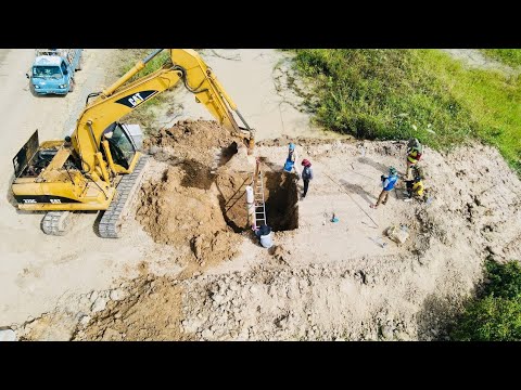
Surveys use drones for visiting sites work #testing #drone #survey #escavator #construction #workDaily Work 24H51 views | 0 | December 8 2023 07:05:20 (0 comments)[ Read more … ]
Surveys use drones for visiting sites work #testing #drone #survey #escavator #construction #work My real activities work at site no edit Thanks for watching my video help subscribe to my Youtube: 🙏❤️️@Daliy Work
About the Author
Patryk Alexander is an associate copy editor at 4kVideoDrones.com, where he sharpens articles and helps keep the website's content clean and error-free. With a background in creative writing, Patryk brings a unique perspective to his editing that helps make 4kVideoDrones.com's content engaging and informative. When he's not editing or writing, Patryk enjoys spending time with his family and exploring the great outdoors.