Drone Photogrammetry: Mapping the World From Above 🌎 – Unlocking New Perspectives
Ready to transform your drone from a fun flying gadget into a powerful mapping tool? These videos dive into the exciting world of drone photogrammetry, exploring everything from free software options for beginners to the nitty-gritty of overlaps and even a head-to-head comparison with LiDAR. Whether you’re aiming to create stunning 3D models, accurate 2D maps, or just curious about the tech, this collection of insights will get your propellers spinning.
Key Takeaways: Mapping Out the Essentials
Free and Accessible Mapping: Discover how free software and readily available drones like the DJI Mavic 3, Air 3, or Mini 4 Pro can be leveraged for professional-grade mapping projects.
Photogrammetry vs. LiDAR Showdown: Get a front-row seat to a real-world comparison of photogrammetry and LiDAR, uncovering the strengths and weaknesses of each technology for various applications.
Mastering Overlaps: Learn why proper front and side overlaps are crucial for achieving accurate and high-quality results in your drone mapping missions, and how to adjust for terrain variations.
Deep Dive into the DJI Air 3S: Explore the capabilities of the DJI Air 3S for commercial photogrammetry and 3D modeling, and see real-world examples of its output.
Budget-Friendly Photogrammetry with WebODM: Get acquainted with WebODM, an open-source platform ideal for beginners looking for a cost-effective entry point into drone photogrammetry.
Beyond the Pixels: Emerging Trends in Drone Mapping
As drone technology rapidly evolves, we’re seeing increasingly accessible and powerful tools for photogrammetry. The rise of free software options and simplified workflows empowers hobbyists and professionals alike to create detailed maps and models. The ongoing debate between photogrammetry and LiDAR highlights the dynamic nature of the field, with each technology finding its niche. Expect further advancements in both hardware and software to drive even greater accuracy, efficiency, and accessibility in the near future.
Ready for Takeoff?
This curated collection of video insights provides a comprehensive overview of drone photogrammetry, from the basics to advanced techniques. Scroll down to watch the highlights and start your journey toward mapping the world from above!
Check out the videos just below
Photogrammetry VS LiDAR – Which Is BETTER?Dylan Gorman7,097 views | 343 | December 8 2024 18:00:18 (46 comments)[ Read more … ]
This is the ultimate showdown between Photogrammetry and LiDAR! This video explores these cutting-edge 3D mapping technologies, testing them in two unique environments to determine which reigns supreme. Watch as we capture data, process it, and compare the results, providing valuable insights into their strengths, weaknesses, and real-world applications.
THIS VIDEO IS FOR DEMONSTRATION PURPOSES ONLY, I AM NOT A SURVEYOR.
Sources: @DJIEnterprise
– Drone LiDAR Market Size: https://bit.ly/3VvoPX7
– Get DJI Terra For FREE: https://enterprise.dji.com/dji-terra
—
► Join us on Pilot Byte! Our platform provides current and aspiring drone operators with information and resources to promote growth and development in the drone industry: https://www.pilotbyte.com
► Subscribe to my channel here: https://www.youtube.com/c/dylangorman
—
My Camera Equipment!
Canon R5: https://amzn.to/36YsAP1
Canon 24-70 2.8L: https://amzn.to/2S2KVCK
Rode Microphone: https://amzn.to/3pfokiM
Drone: https://amzn.to/3x9GHLW
__
Follow me online!
LinkedIn: https://www.linkedin.com/in/dylan-g-099961101/
Instagram: https://www.instagram.com/dylang_1
—
Chapters
00:00 Intro
01:06 What Is Photogrammetry?
02:44 What Is LiDAR?
03:56 Equipment Breakdown
06:11 LIVE Data Capture
06:48 Urban Photogrammetry Data Review
09:17 Urban LiDAR Data Review
10:38 Where Photogrammetry Shines
11:18 Vegetation Photogrammetry Data Review
12:31 Vegetation LiDAR Data Review
14:13 So Which Technology Is Better?
Advertisement
Turn Your DJI Drone Into A Mapping Machine For FREE!Dylan Gorman148,074 views | 6,673 | November 8 2024 18:00:27 (458 comments)[ Read more … ]
Discover how to transform your DJI Mavic 3, Air 3, or Mini 4 Pro into a powerful mapping tool without spending a dime on expensive software. This guide unveils the best free drone mapping solutions, allowing you to create professional-grade 2D maps and 3D models.
Become a MASTER at drone mapping with our extensive online course: https://www.pilotbyte.com/drone-mapping-mastery
BEST DRONES TO USE WITH THIS WORKFLOW:
DJI Mavic 3 Classic: https://amzn.to/4figwWC
DJI Mavic 3 Pro: https://amzn.to/4ff4EEP
DJI Air 3: https://amzn.to/3Avugy8
DJI Mini 4 Pro: https://amzn.to/3YGMWmp
Access to sample data: https://bit.ly/4hE9UDo
—
► Join us on Pilot Byte! Our platform provides current and aspiring drone operators with information and resources to promote growth and development in the drone industry: https://www.pilotbyte.com
► Subscribe to my channel here: https://www.youtube.com/c/dylangorman
—
My Camera Equipment!
Canon R5: https://amzn.to/36YsAP1
Canon 24-70 2.8L: https://amzn.to/2S2KVCK
Rode Microphone: https://amzn.to/3pfokiM
Drone: https://amzn.to/3x9GHLW
__
Follow me online!
LinkedIn: https://www.linkedin.com/in/dylan-g-099961101/
Instagram: https://www.instagram.com/dylang_1
—
Chapters
00:00 Intro
01:17 Why Can’t You Use 3rd Party Apps Anymore?
02:22 How To Get Any DJI Drone To Map Autonomously
02:52 Compatible Drones
03:40 Getting Our Drones Ready For Mapping
05:00 Mission Planning
07:40 Mission Upload To DJI FLY App
10:26 Capturing Data Live In The Field Autonomously
13:58 Processing A 2D & 3D Model For FREE
17:06 Master Drone Mapping Online
17:42 Closing
DJI Air 3S For Photogrammetry and 3D Modeling ReviewJays Tech Vault6,927 views | 197 | November 2 2024 16:00:04 (30 comments)[ Read more … ]
This is an in-depth look at the new DJI Air 3S when used for photogrammetry in a commercial capacity. How well does it perform? How good is it? Can you use your DJI Air 3S to make money from your photogrammetry models? How good are the 3d models and maps that the dji Air 3S makes? This is the ultimate tutorial for how to do photogrammetry.
Website for planning mapping missions:
https://www.waypointmap.com
Updated tutorial:
https://youtu.be/5660bWlE8TQ
Website for making the 3d models:
https://www.aerialmodel.com
3d models to view
Air 3S Overhead Map:
https://www.aerialmodel.com/Home/Viewer?id=8415&token=8730b4bf-4a5a-4249-9ae8-847fa606e5f8
Air 3S Circle Baseball 1x:
https://www.aerialmodel.com/Home/Viewer?id=8101&token=3e005952-32a9-41d3-92dc-f2db2546ba15
Air 3 Baseball 1x:
https://www.aerialmodel.com/Home/Viewer?id=241&token=61be705f-0100-4b86-a442-72102fa38c86
Air 3 Baseball 3x:
https://www.aerialmodel.com/Home/Viewer?id=242&token=7a657b7f-f3f7-4905-a68b-8cf2d1199694
Air 3 Picnic 1x:
https://www.aerialmodel.com/Home/Viewer?id=238&token=a686d651-2ffc-41fc-bcca-fc85bfede566
Air 3 Picnic 3x:
https://www.aerialmodel.com/Home/Viewer?id=239&token=66f5bdc2-8a5d-409f-a225-0bd3dbabb16e
=================== [Sponsors] =======================
Interested in sponsoring a video? I welcome all kinds of sponsorships but please keep them tech & computer related. I love reviewing products so drop me an email at jaystechvault@gmail.com and we can get in touch.
#dji #air3s #djiair3s
dji air 3s photogrammetry dji air 3s 3d modeling photogrammetry drone photogrammetry 3d modeling dji air 3 dji air 3 review. review dji air 3 dji air 3s photogrammetry review dji air 3s 3d. mapping 3d mapping dji air 3s mapping dji air 3s camera test dji air 3s photogrammetry test dji air 3s mission planning tutorial. Tutorial.
Advertisement
Low-Cost Photogrammetry Made Simple: A Quick Look at WebODMRich Charpentier339 views | 25 | December 11 2024 16:00:40 (10 comments)[ Read more … ]
Looking to break into photogrammetry for drones? Mapping and modeling with WebODM is a great option if you’re on a budget. This Open Source platform is a great place to start for beginners. Check out our free preview videos in the WebODM class as well!
Our 2024 Holiday Sale currently offers our 18 Class Bundle for 50% off!
📢 Coupon Code: BLACKFRIDAY2024
👉 Class Bundle Link – https://tinyurl.com/m6yjtyz4
Looking to build your own drone construction progression business in 2025? Our 18-class bundle is now just $137.50—50% off the regular price of $275! This limited-time offer is available through New Year’s 2025.
🎓 What’s Included:
Drone Photogrammetry Basics
Drone Construction Progression Techniques
3D Modeling & 2D Mapping
Drone Job Deliverables for Clients
On-Site Demonstrations from Real Client Jobs
Most classes are based on real-world projects we’ve been working on for years, giving you insider knowledge to jumpstart your drone career.
✨ Why Choose Our Classes?
With years of real-world drone construction experience, we’ve designed these courses to help you start and grow your own drone business in 2025. Try before you buy—each class includes free previews! We also offer a 14 Day Money Back guarantee.
https://classes.azdrone.net/
Become a Patreon Member Today – https://www.patreon.com/RichCharpentier
Looking to support this channel so I can provide more mobile tech and mobile living videos?
Feel free to make a donation to the channel through Paypal: https://paypal.me/RichardCharpentier
Advertisement
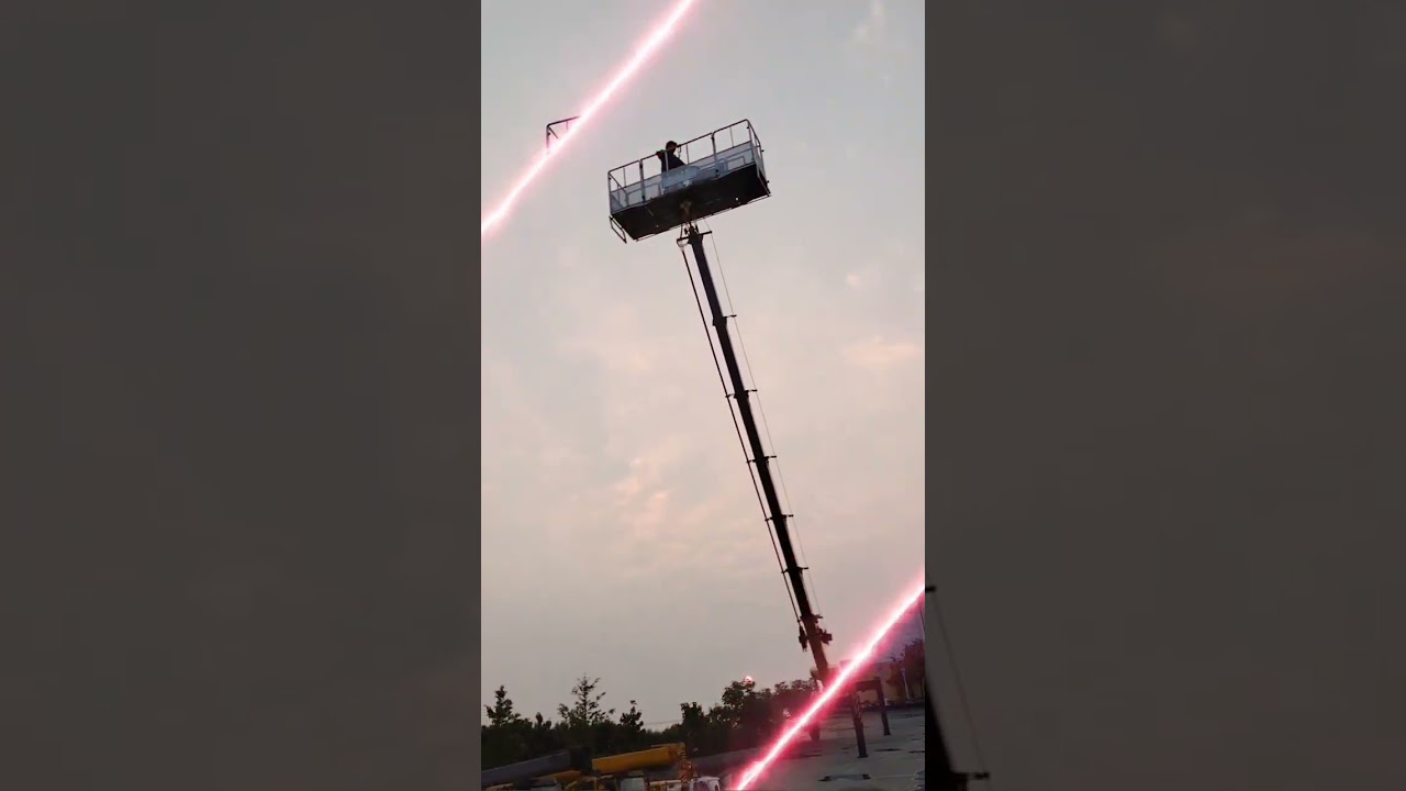
Drone Concepts: Understanding Overlaps in Drone MappingAvios Media371 views | 22 | December 13 2024 01:27:41 (2 comments)[ Read more … ]
Getting the perfect drone map isn’t just about flying—it’s about understanding overlaps! In this video, we dive into why front and side overlaps are critical for high-quality maps, 3D models, and photogrammetry accuracy. Learn how to set up your mission, avoid gaps, and ensure consistent coverage every time. Whether you’re mapping for construction, surveying, or agriculture, these tips will elevate your skills!
🛩 What You’ll Learn:
✅ Why overlaps matter in drone mapping
✅ How to handle terrain differences
✅ Tips for planning and flying your drone mapping missions
💡 Pro Tip: Proper overlaps save time in post-processing and give you sharper, more reliable results.
0:00 Introduction
0:20 What are overlaps?
0:45 Why are overlaps important?
1:20 Overlaps on uneven terrain
1:50 Adjusting overlaps for terrain differences
3:30 Avoid rejections for insufficient overlaps
3:40 Pro tip for mapping roofs
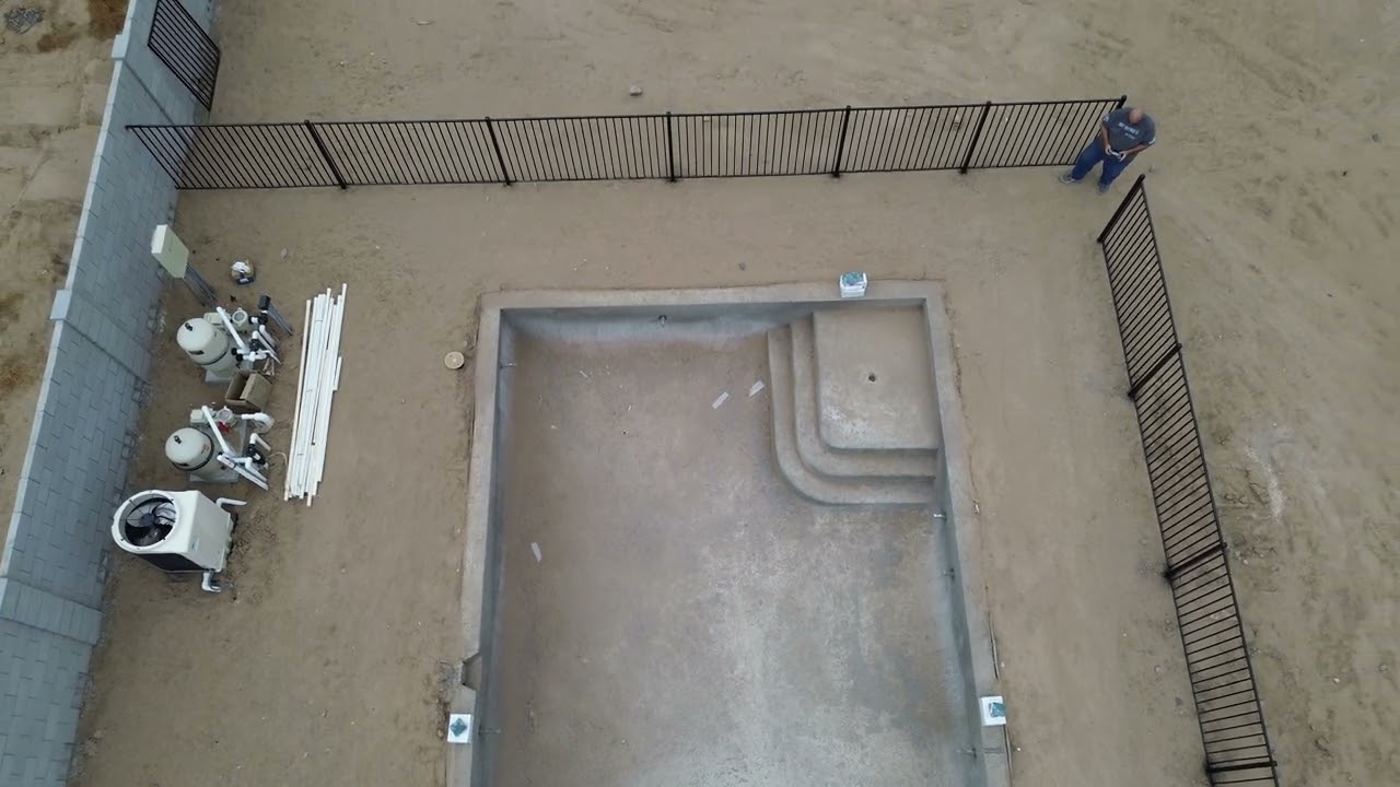
From Blueprint to Reality: Drone Monitoring of 54 Home SitesRich Charpentier100 views | 17 | December 14 2024 15:16:08 (0 comments)[ Read more … ]
Discover how drones revolutionize construction progress monitoring in this 2-year project covering a 54-home residential community build-out. Learn how mapping, modeling, and timelapse videos provide powerful insights. Watch how data transforms into videos, 3D models, and custom web pages that tell the story of a construction site’s evolution
Our 2024 Holiday Sale currently offers our 18 Class Bundle for 50% off!
📢 Coupon Code: BLACKFRIDAY2024
👉 Class Bundle Link – https://tinyurl.com/m6yjtyz4
Looking to build your own drone construction progression business in 2025? Our 18-class bundle is now just $137.50—50% off the regular price of $275! This limited-time offer is available through New Year’s 2025.
🎓 What’s Included:
Drone Photogrammetry Basics
Drone Construction Progression Techniques
3D Modeling & 2D Mapping
Drone Job Deliverables for Clients
On-Site Demonstrations from Real Client Jobs
Most classes are based on real-world projects we’ve been working on for years, giving you insider knowledge to jumpstart your drone career.
✨ Why Choose Our Classes?
With years of real-world drone construction experience, we’ve designed these courses to help you start and grow your own drone business in 2025. Try before you buy—each class includes free previews! We also offer a 14 Day Money Back guarantee.
https://classes.azdrone.net/
Become a Patreon Member Today – https://www.patreon.com/RichCharpentier
Looking to support this channel so I can provide more mobile tech and mobile living videos?
Feel free to make a donation to the channel through Paypal: https://paypal.me/RichardCharpentier
Advertisement
About the Author
Patryk Alexander is an associate copy editor at 4kVideoDrones.com, where he sharpens articles and helps keep the website's content clean and error-free. With a background in creative writing, Patryk brings a unique perspective to his editing that helps make 4kVideoDrones.com's content engaging and informative. When he's not editing or writing, Patryk enjoys spending time with his family and exploring the great outdoors.