
Stepping into the Future of Flight: Waypoint & Reality Capture Takes Center Stage
For us drone aficionados, the sky isn’t just the limit, it’s a canvas. And lately, that canvas is being painted with ever-increasing detail and precision thanks to the power of waypoint mapping and reality capture. Remember the days of simply buzzing around, capturing stunning aerial shots? While that’s still a thrill, the real excitement for many of us lies in unlocking the data hidden within those flights. These videos illuminate just how accessible and powerful these techniques have become, turning our trusty DJI drones into sophisticated surveying and 3D modeling powerhouses. Whether you’re a seasoned mapper or just curious about taking your drone skills to the next level, these insights are your launchpad into a new era of drone capabilities.
Unveiling the Mapping Secrets: Key Takeaways from the Experts
- Free Mapping Power is Here! Video 1, "Turn Your DJI Drone Into A Mapping Machine For FREE!", absolutely grabbed my attention. It’s a game-changer to see how readily available free solutions are for turning your consumer DJI Mavic 3, Air 3, or Mini 4 Pro into a capable mapping tool. No more excuses about expensive software! This video dives deep into creating professional-grade 2D maps and even impressive 3D models without breaking the bank. The fact that it details setting up autonomous missions directly within the DJI Fly app is huge for streamlining the workflow.
- Autonomous Missions Unleashed: Speaking of autonomy, Video 1 brilliantly showcases how to get your DJI drone flying pre-planned mapping routes. Forget manual flying – we’re talking precise, repeatable paths for consistent data capture. The demonstration of uploading missions directly to the DJI Fly app is something every hobbyist should know. Imagine the possibilities for surveying, site documentation, or even just creating detailed maps of your favorite flying spots!
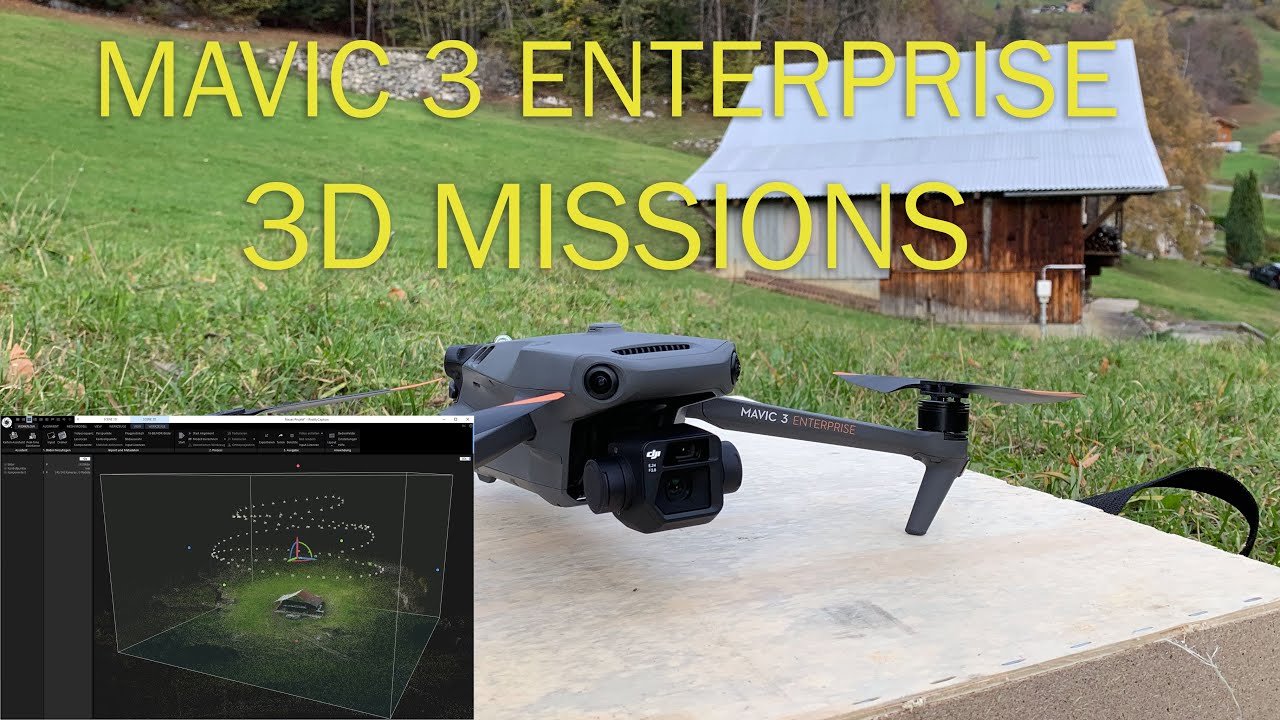
- Diving Deeper with Enterprise Tools: Video 2, focusing on the Mavic 3 Enterprise, reveals the more advanced capabilities available in DJI’s professional line. The introduction of 3D mission types like the helix and cross-elevation, along with KML/KMZ file import within DJI Pilot 2, opens up a whole new dimension of precision and control. For those tackling more complex mapping tasks, these features are invaluable.
- Visualizing Data in 3D: Both videos touch on the crucial step of processing the captured data. Video 1 specifically highlights free methods for generating both 2D orthomosaics and 3D models. Seeing the transformation of aerial imagery into tangible, measurable 3D representations is genuinely fascinating. Video 2 even shows examples of the 3D helix flight translated into a 3D model using Reality Capture – visualizing the flight path in the final output is incredibly insightful.
- KML/KMZ Integration: Bridging the Gap: The emphasis on KML/KMZ file support in Video 2 underscores its importance in professional workflows. Being able to import pre-defined areas and flight paths directly into the DJI Pilot 2 app simplifies mission planning and ensures accurate execution, especially for larger or more intricate mapping projects. This kind of integration is what takes drone mapping from a hobbyist pursuit to a professional-grade tool.
Expanding Horizons: The Democratization of Spatial Data
What’s truly exciting about the information in these videos is how accessible advanced mapping techniques are becoming. It wasn’t long ago that creating accurate maps and 3D models from drone data required specialized hardware and expensive software. Now, as shown in the first video, even hobbyists with consumer-grade DJI drones can tap into this powerful capability using readily available (and often free) tools. This "democratization of spatial data" empowers individuals and smaller teams to undertake projects that were previously the domain of large organizations. Imagine surveying your property for potential construction, documenting environmental changes over time, or even creating incredibly detailed 3D models of historical landmarks – all within reach of the passionate drone pilot.
Ready to Map Your World?
The "Drone Mapping Revolution" isn’t some far-off future; it’s happening right now. These video highlights offer a taste of the incredible potential that waypoint mapping and reality capture bring to our drone flights. To truly appreciate the nuances and practical steps involved, you’ll want to dive into the full videos. Scroll down, grab your popcorn (or maybe just your drone!), and prepare to be inspired by the possibilities!
Discover the videos below


