Drone Terrain Mapping: A Bird’s-Eye View of the Future
From snowy peaks to construction sites, the world of drone terrain mapping is exploding with possibilities. These videos showcase the incredible power and versatility of drones, transforming how we capture, analyze, and interact with the world around us. Whether you’re a seasoned surveyor or just starting your drone journey, these insights offer a glimpse into the exciting future of terrain mapping.
Key Takeaways: Mapping the Landscape of Innovation
Free and Accessible Mapping: Even entry-level drones like the DJI Mini series can be used for detailed terrain mapping without expensive software, opening up this technology to hobbyists and beginners.
Understanding the Lingo: Mastering key terminology in drone mapping, such as GSD (Ground Sampling Distance), GCP (Ground Control Point), and RTK (Real-Time Kinematic), is crucial for successful and accurate data collection.
Software Solutions Simplify Analysis: Cloud-based platforms like SkyDeck streamline terrain analysis, providing valuable insights for construction, engineering, and other industries.
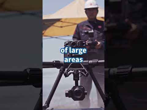
LiDAR Integration Enhances Precision: Integrating LiDAR sensors with drones provides highly accurate 3D point clouds, enabling detailed terrain modeling and analysis for professional applications.
Accuracy Matters: Defining and understanding "survey-grade accuracy" is essential for professional mapping projects. Factors like check shots, data validation, and the limitations of GPS rovers all play a role.
The Future is Up in the Air: Emerging Trends in Drone Terrain Mapping
The rapid advancement of drone technology and software suggests an exciting future for terrain mapping. We can expect to see even more accessible and user-friendly tools, enabling anyone with a drone to create detailed maps and 3D models. The integration of AI and machine learning will further automate data processing and analysis, unlocking deeper insights from collected data. As sensor technology evolves, expect greater precision and the ability to capture even more detailed information about the terrain.
Ready for Takeoff? Explore the World of Drone Terrain Mapping
The videos highlighted above offer a diverse range of perspectives on drone terrain mapping, from basic techniques to advanced applications. Scroll down to watch the video highlights and discover how this revolutionary technology can change the way you see the world!
Scroll down to explore the videos
A quick little snow mapping mission today #mavic3 #drone #photography #mapping #snowUnoDroneSpecialists557 views | 13 | January 22 2025 23:10:35 (0 comments)[ Read more … ]
Advertisement
Terrain and Topographic Analysis on SkyDeck – Cloud-based Drone Data Management PlatformAsteria Aerospace59 views | 2 | October 15 2024 04:25:45 (0 comments)[ Read more … ]
Watch this video and start your free trial of SkyDeck today (bit.ly/3YlUWdJ) to accurately assess terrain slopes for avoiding costly issues like drainage problems, structural instability, and rework. In this video, you’ll learn: The importance of accurate slope assessments – How SkyDeck’s 2D maps & visualization layers provide actionable insights – Detailed slope insights to design projects safely and efficiently – How to make optimal design decisions with precise terrain data – Ready to take your terrain analysis to the next level? Sign up today!
50 Drone Mapping Words – Explained! | Hammer MissionsHammer Missions450 views | 27 | July 23 2024 10:43:02 (3 comments)[ Read more … ]
In this video, Varun from Hammer Missions will walk you through 50 of the most commonly used drone mapping words! ————————————————————————–
#dronemapping #droneinspections ————————————————————————– About Us:
Hammer Missions is a software platform for drone professionals and Enterprise UAS programmes to collect & process high-quality drone data for aerial surveys & inspections.
To try Hammer Missions on our 14 day trial, visit: ➤➤➤ https://www.hammermissions.com ————————————————————————– Related Videos:
1. GSD: https://youtu.be/xfcf4B_HdBw 2. GCPs: https://youtu.be/ogUOBJigu3Y 3. Aligning Drone Images: https://youtu.be/2_ulJZTYJwA 4. Relative vs Absolute Accuracy: https://youtu.be/eNwrXBuMqZg 5. Drone Data Formats: https://youtu.be/ZtyJE8i8B58 6. Scan to BIM: https://youtu.be/pzgUdDd5e9Y ————————————————————————–
What is Survey grade accuracy? | Drone Photogrammetry Mapping & Lidar Deep DiveSteel City Drones4,976 views | 159 | November 2 2023 10:01:03 (21 comments)[ Read more … ]
For more information on Mapping and or Lidar drone Technology go to www.steelcitydrones.com or contact us at 866-376-6375
01:20 Dave is called out on Accuracy claims 01:44 Is Drone Lidar Technology as accurate as Photogrammetry 02:13 Practical cost limits of most customers 04:57 What is the definition of Survey Grade Accuracy? 06:09 What are check shots and data validation? 06:46 Limitations of GPS Rovers 08:23 Precision versus Accuracy 09:24 Horizontal Accuracy versus Vertical Accuracy 09:47 The role of Terrain Following 10:18 Heavy Lifter limitations
Advertisement
STOP Wasting Money on Drone Mapping SoftwareFlying Surveyor25,730 views | 687 | October 9 2023 16:31:12 (79 comments)[ Read more … ]
Need Geospatial Consultancy? https://www.stefanengineering.co.uk/contact
Discover how to harness the power of your DJI Mini series drones (Mini 2, Mini 3, and Mini 3 Pro) to conduct precise drone mapping absolutely for free! Dive deep into step-by-step techniques and insider tips that will elevate your aerial photography into professional-quality maps. Ideal for drone enthusiasts, surveyors, and hobbyists seeking to expand their skills. Don’t miss out on transforming your DJI Mini flights into detailed maps without breaking the bank! Subscribe for more expert guidance and drone mapping secrets.
#dji #dronemapping #FreeMappingTips
Advertisement
About the Author
Patryk Alexander is an associate copy editor at 4kVideoDrones.com, where he sharpens articles and helps keep the website's content clean and error-free. With a background in creative writing, Patryk brings a unique perspective to his editing that helps make 4kVideoDrones.com's content engaging and informative. When he's not editing or writing, Patryk enjoys spending time with his family and exploring the great outdoors.