Unleash epic aerial adventures! Top 5 drone apps for breathtaking footage & safe flights. Learn how to fly like a pro!
Unleash Epic Aerial Adventures: Top 5 Drone Apps You Need in Your Flight Bag 🚀
As a certified drone pilot and instructor, I’ve witnessed firsthand the transformative power of the right software. You can have the most advanced drone on the market, but without the right apps, you’re only scratching the surface of its potential. The videos we’ve analyzed highlight a crucial point: the digital tools we use are just as vital as our piloting skills when it comes to capturing breathtaking aerial footage and ensuring safe, efficient flights. Whether you’re chasing that perfect sunset shot or conducting a critical infrastructure inspection, the apps you choose can make all the difference. Let’s dive into the top contenders that can elevate your drone missions from routine to truly epic.
Key Takeaways for Epic Drone Flights
Based on our analysis of popular YouTube content, here are the essential insights into the top drone apps for enhancing your aerial adventures:
DJI Fly App: The Cornerstone of Control (Videos 1 & 3): Unsurprisingly, the native DJI Fly app consistently ranks as essential. It’s the primary interface for controlling your DJI drone, managing camera settings, accessing intelligent flight modes, and ensuring firmware is up-to-date. Think of it as the cockpit of your aerial vehicle – intuitive, feature-rich, and absolutely indispensable for a seamless flying experience. The crisp visuals and responsive controls directly impact the quality of your aerial captures.
Safety First with Drone Assist & UAV Forecast (Videos 1 & 3): Responsible piloting demands a keen awareness of your surroundings. Apps like Drone Assist and UAV Forecast are critical for pre-flight planning and in-flight situational awareness. They provide vital information on airspace restrictions, no-fly zones, weather conditions (including wind speed and direction – crucial for flight stability), and even the number of GPS satellites available. Ignoring these factors is a recipe for disaster, potentially leading to flyaways or encounters with other aircraft.
Flightradar24: Know Your Airspace (Videos 1 & 3): Sharing the skies responsibly means being aware of other air traffic. Flightradar24 provides a real-time view of manned aircraft in your vicinity. This is particularly important when operating near airports or in controlled airspace. While drones operate at lower altitudes, understanding the broader air traffic picture enhances safety and helps you make informed decisions about your flight path. Imagine the peace of mind knowing you’re not inadvertently crossing paths with a helicopter or small plane.
Google Maps: Your Pre-Flight Reconnaissance Tool (Videos 1 & 3): Effective mission planning starts on the ground. Google Maps is an invaluable tool for scouting potential launch and landing sites, identifying obstacles like trees or power lines, and visualizing the terrain you’ll be flying over. The satellite imagery and street view features allow for detailed pre-flight reconnaissance, ensuring a safer and more efficient operation. I often use it to identify clear, open areas that minimize the risk of snagging a prop during takeoff or landing.
Beyond the Basics: Exploring Specialized Apps: While the core apps focus on flight control and safety, the broader drone ecosystem includes apps for specific needs. While not explicitly detailed as a "Top 5" in these videos, consider apps for advanced flight planning (like Litchi), photogrammetry (for creating 3D models), or specialized inspection software. These cater to more advanced users and specific mission requirements.
The Analytical Pilot’s Perspective: Beyond the Hype
It’s important to note that the "best" apps can vary depending on your drone model, your flying environment, and your specific goals. The DJI ecosystem is well-supported, as highlighted by the frequent mention of the DJI Fly app. However, pilots using other drone brands will have their own equivalent control applications and may rely on different third-party tools.
The emphasis on safety apps like Drone Assist and UAV Forecast underscores a critical aspect of responsible drone operation. These aren’t just optional extras; they are essential for mitigating risks and ensuring compliance with regulations. Ignoring weather conditions or airspace restrictions is not only illegal but also incredibly dangerous.
The inclusion of Google Maps highlights the importance of pre-flight planning. A successful and safe drone mission is often won or lost before you even launch. Thoroughly assessing your operating environment is a hallmark of a professional pilot.
Elevate Your Flight: It’s More Than Just Flying
Ultimately, the "epic aerial adventures" we seek are a result of careful planning, skillful execution, and the smart use of technology. These top 5 apps, as highlighted in the videos, provide the foundation for safer, more efficient, and ultimately more rewarding drone flights. They empower us to capture stunning visuals, conduct precise inspections, and explore the world from a unique perspective.
Ready to take your drone piloting to the next level? Scroll down to explore the video highlights and see these apps in action!
Scroll down for the highlighted videos
TOP 5 APPS FOR FLYING DJI DRONESRobin Drones21,117 views | 248 | December 3 2023 16:55:21 (44 comments)[ Read more … ]
00:00 intro 00:10 Dji fly app 02:15 Drone assist 03:31 Flight radar 24 04:10 UAV forcast 05:32 Google maps
Please like and subscribe if you want to see more drone videos.
DJI mini 2 se, https://amzn.to/3C7pMec 309 27/5/23 https://amzn.to/3IW3FuZ 439 27/5/23 Fly more kit 2 batteries, charger and bag
DJI Mini 3 Pro, https://amzn.to/3q4bk4p https://amzn.to/3OeE1DF Fly more kit 2 batteries, charger and bag
DJI Mini 4 Pro Fly More Combo with DJI RC 2, https://amzn.to/3Qb40Ne
DJI Mini 4 Pro (DJI RC-N2), https://amzn.to/46L8LUG Strobe light Get one here, https://amzn.to/3oEFhXN 12.99 27/5/23
DJI mini 2 skin, https://amzn.to/3ONVcOk
Other gear i use and recommend, K&F Concept Tripod for Camera and Phone, https://amzn.to/3GnAorA Victiv 63inch Tripod Stand, https://amzn.to/3OPbTsL HSU Extendable Selfie Stick, https://amzn.to/3WJmszz Samsung EVO Select microSDXC UHS-I U3 130MB/s Full HD & 4K UHD Memory Card, 128GB, https://amzn.to/43qJKvO 256GB, https://amzn.to/44trenE 512GB, https://amzn.to/3ruIwCp FULAIM X5 Wireless Lavalier Microphone, https://amzn.to/3qgdzS0 DJI Osmo Action 3 Standard Combo, https://amzn.to/3CbwOie DJI Osmo Action 3 Adventure Combo, https://amzn.to/43XBvbl SYMIK LP500 Drone Landing Pad 20 inch (50cm), https://amzn.to/3qszgOs ONTOMYO Original Mini 2 Carrying Case, https://amzn.to/45GcPpb DJI Mini 2/Mini SE Two-Way Charging Hub, https://amzn.to/3oJQG8V Propeller Strap for DJI Mini 2, https://amzn.to/3Oj8XCQ
INIU Power Bank, 22.5W Fast Charging 20000mAh Powerbank, PD3.0 QC4.0 Portable Charger, https://amzn.to/44tinT9
Anker Power Bank, USB-C Portable Charger 20000mAh with 20W Power Delivery, https://amzn.to/44qm4sM
Drone footage was taken with a DJI mini 2 se at 2.7K: 2720 1530@30 fps
Camera footage was taken with a DJI pocket 3 at 4K: 3840 x 2160 @30 fps
BEST COMMERCIAL DRONE 2025 – PROFESSIONAL ENTERPRISE DRONES 2025 – BUSINESS/INSPECTION/SEARCH/RESCUEHonest Review3,923 views | 262 | March 25 2024 18:00:25 (2 comments)[ Read more … ]
Welcome to our guide to the Top 5 Best Commercial Professional Enterprise Drones of 2025, tailored for industrial applications like mapping, inspection, search and rescue, photogrammetry, and surveying, or if you need an enterprise thermal camera drone to detect heat loss, poor insulation, water leaks, and much more. From budget-friendly options to cutting-edge technology, these drones redefine performance and precision. Whether you’re a professional seeking unparalleled accuracy or a business aiming to streamline operations, our selection ensures you have the perfect tool for the job. Join us as we explore the pinnacle of drone innovation, designed to elevate your enterprise to new heights. Don’t miss out on the ultimate drone solutions for your industrial needs.
0:00 – Intro 0:46 ✪ Autel Robotics EVO II Pro Enterprise V3 Bundle, 2025 NEWEST 6K 1″ CMOS Sensor UAV, 15KM Video Transmission, 42Mins Flight, ADS-B Receiver & Data Encryption, for Public Safety/Traffic/Power Inspection/Solar Roof Inspection ● 🌎 ► https://amzn.to/49BZdga ◄
7:06 ✪ DJI Mavic 3 Enterprise Drones – The DJI Mavic 3 Enterprise drones are versatile tools for professionals, offering high-resolution imaging, advanced flight capabilities, and modular accessories for various applications. With robust construction and intelligent features, they empower industries like public safety, infrastructure, and inspection to achieve superior results with ease and efficiency. ● 🌎 ► https://amzn.to/3uTUSpK ◄
18:55 ✪ Autel Drone Robotics EVO MAX 4T, Visiable/ Zoom / Thermal camera drone/ L-aser 4 Cameras in One UAV, 50MP&1/1.28″ CMOS 8K Camera, 1-160x Super Zoom, 640 512 High-Resolution Thermal Sensor, 16.4–3737 ft Laser Range, A-Mesh 1.0 Networking, 720 No Blind Spot, 42 Minutes Fly, SkyLink 3.0 for 20KM (12.4 Miles) Transmission, Moonlight Algorithm 2.0, Data Security, Multiple Mission Types, for Public Safety/Search & Rescue/Inspection/Firefighting ● 🌎 ► https://amzn.to/3TgZsHT ◄
22:55 ✪ DJI Matrice 30 Series – Industrial grade mapping inspection drones – The DJI Matrice 30 Series drones are versatile aerial platforms designed for demanding industrial applications. Solid choice for tasks like mapping, inspection, and surveillance. Trusted by professionals worldwide for critical missions and operations. ● 🌎 ► https://amzn.to/48FCRsU ◄
28:00 ✪ DJI Matrice 350 RTK Drone – 350 RTK from DJI is a powerhouse of precision and efficiency, featuring real-time kinematic (RTK) technology for centimeter-level accuracy. Ideal for industrial applications like surveying, mapping, and inspections, its advanced capabilities make it a trusted tool for professionals seeking outstanding performance in data collection and analysis. ● 🌎 ► https://amzn.to/3wEIHO6 ◄
✮✮✮ Try Amazon Prime 30-Day FREE Trial | Unlimited Fast and Free Two-Day Shipping with Amazon Prime ► https://amzn.to/3oJ04DB ◄ ✮✮✮ Get a FREE 6 Month Amazon Prime Shipping, if you’re a STUDENT: ► https://amzn.to/2MlVRZG ◄ ✮✮✮ Try FREE Audible Plus and Get Two Free Audiobooks ► https://amzn.to/3ar4Dxn ◄ ✮✮✮ Try 30 Days Free Amazon Prime Video ► https://amzn.to/36CQnk2 ◄ ✮✮✮ Try 30 Days Free Amazon Prime Music ► https://amzn.to/2YHtdEC ◄
Amazon Affiliate Disclosure Notice: Honest Review is a participant in the Amazon Services LLC Associates Program, an affiliate advertising program designed to provide a means for sites to earn advertising fees by advertising and linking to Amazon.com.
Business inquiries: honestreviewofficialyt[at]gmail[dot]com
Disclaimer: The footage in this video falls under fair use and was created as promotional/educational material. Some of the footage of these products were gathered from multiple sources including, manufactures, fellow creators, and various other sources. However, If you are the creator or owner of the footage and have reservations please notify us via email at [honestreviewofficialyt[at]gmail.com] and we will be happy to discuss the issue.
All rights reserved by respective owners
TOP 5 APPS FOR FLYING DJI DRONESRobin Drones21,117 views | 248 | December 3 2023 16:55:21 (44 comments)[ Read more … ]
00:00 intro 00:10 Dji fly app 02:15 Drone assist 03:31 Flight radar 24 04:10 UAV forcast 05:32 Google maps
Please like and subscribe if you want to see more drone videos.
DJI mini 2 se, https://amzn.to/3C7pMec 309 27/5/23 https://amzn.to/3IW3FuZ 439 27/5/23 Fly more kit 2 batteries, charger and bag
DJI Mini 3 Pro, https://amzn.to/3q4bk4p https://amzn.to/3OeE1DF Fly more kit 2 batteries, charger and bag
DJI Mini 4 Pro Fly More Combo with DJI RC 2, https://amzn.to/3Qb40Ne
DJI Mini 4 Pro (DJI RC-N2), https://amzn.to/46L8LUG Strobe light Get one here, https://amzn.to/3oEFhXN 12.99 27/5/23
DJI mini 2 skin, https://amzn.to/3ONVcOk
Other gear i use and recommend, K&F Concept Tripod for Camera and Phone, https://amzn.to/3GnAorA Victiv 63inch Tripod Stand, https://amzn.to/3OPbTsL HSU Extendable Selfie Stick, https://amzn.to/3WJmszz Samsung EVO Select microSDXC UHS-I U3 130MB/s Full HD & 4K UHD Memory Card, 128GB, https://amzn.to/43qJKvO 256GB, https://amzn.to/44trenE 512GB, https://amzn.to/3ruIwCp FULAIM X5 Wireless Lavalier Microphone, https://amzn.to/3qgdzS0 DJI Osmo Action 3 Standard Combo, https://amzn.to/3CbwOie DJI Osmo Action 3 Adventure Combo, https://amzn.to/43XBvbl SYMIK LP500 Drone Landing Pad 20 inch (50cm), https://amzn.to/3qszgOs ONTOMYO Original Mini 2 Carrying Case, https://amzn.to/45GcPpb DJI Mini 2/Mini SE Two-Way Charging Hub, https://amzn.to/3oJQG8V Propeller Strap for DJI Mini 2, https://amzn.to/3Oj8XCQ
INIU Power Bank, 22.5W Fast Charging 20000mAh Powerbank, PD3.0 QC4.0 Portable Charger, https://amzn.to/44tinT9
Anker Power Bank, USB-C Portable Charger 20000mAh with 20W Power Delivery, https://amzn.to/44qm4sM
Drone footage was taken with a DJI mini 2 se at 2.7K: 2720 1530@30 fps
Camera footage was taken with a DJI pocket 3 at 4K: 3840 x 2160 @30 fps
Top 5 Best Drones to Buy in 2024 Explore the Skies Like Never Beforwedertech1,014 views | 0 | November 15 2023 11:30:22 (3 comments)[ Read more … ]
Links to the Top 5 Best Drones to Buy in 2023 are listed below. ………………………………………………………………………………………….. 5. DJI Mini 2 – Best Drone for The Money // https://amzn.to/3QuZlWO 4. Holy Stone // https://amzn.to/3sgX9tI 3. DJI Air 2S – Best Drone For Most People // https://amzn.to/3sh7gi6 2. DJI FPV Combo // https://amzn.to/463cThD 1. DJI Mini SE // https://amzn.to/40twC9m ………………………………………………………………………………………….
WEDERtech is a participant in the Amazon Associates Program. As an Amazon Associate I earn from qualifying purchases.This video also contains affiliate links. I earn through amazon associates from qualifying purchases.
→ Disclaimer Portions of footage found in this video is not original content produced by WEDERtech. Portions of stock footage of products was gathered from multiple sources including, manufactures, fellow creators and various other sources for visual reference only. All thoughts and opinions expressed in this video are unique to WEDERtech. If you have any issue with the content or something belongs to you, and you want it to be removed,
please do not hesitate to contact me for any questions: wedertechnology@gmail.com
#technology #tech #amazonproducts #bestdrone
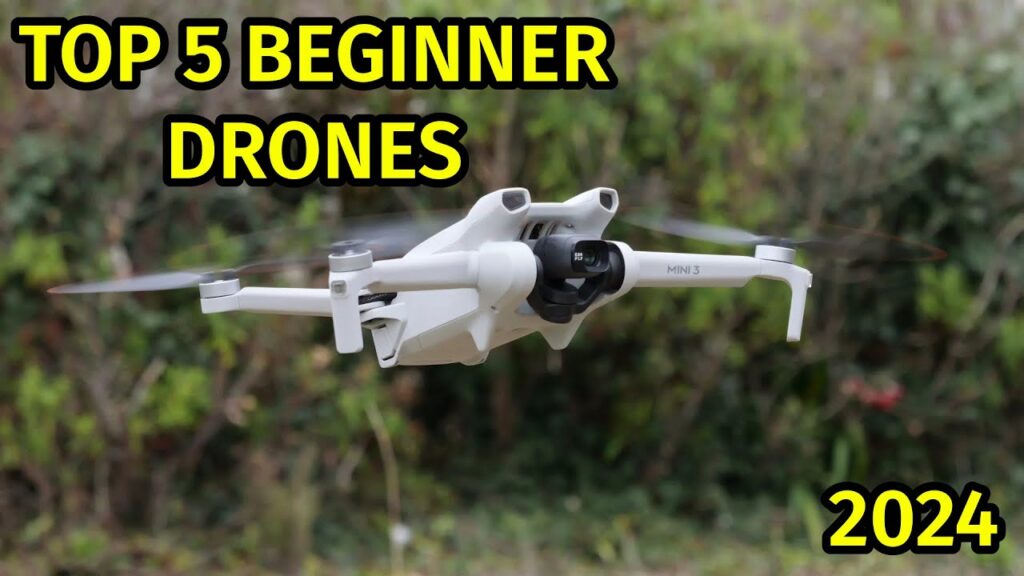
Best 5 Drones for Beginners 2025 [don’t buy one before watching this]Consumer Aura1,131 views | 6 | December 10 2024 18:03:11 (2 comments)[ Read more … ]
Best 5 Drones for Beginners 2025 [don’t buy one before watching this]
5: Ryze Tech Tello Boost Combo https://amzn.to/4isBNyQ 4: DJI Mini 4K https://amzn.to/49sVen9 3: Autel Robotics EVO Nano+ https://amzn.to/49uab8e 2: BETAFPV Cetus X 2S https://amzn.to/3ZtCcbE 1: Potensic ATOM LT GPS Drone Under 249g https://amzn.to/3VAfDku
Thanks for watching guys, i hope you liked this video. If this video was helpful to you, please remember to leave a like and subscribe to my channel to see more videos like this in the future, and if you have any questions related to the products we listed here, leave a comment down below and i will get back to you as soon as i can!
▶ Stages of creation of this video: The discovery of products and creation of content is done by the technology copywriter. After producing the necessary text, the voice actor works on the sound. The text and audio and the necessary visual content are brought together and edited, the final touches are made and uploaded to Youtube.
If you found this video useful, please like it Share it with someone who needs to see it Please Subscribe : https://youtube.com/@ConsumerAura
▶ Copyright Disclaimer under Section 107 of the copyright act 1976, allowance is made for fair use for purposes such as criticism, comment, news reporting, scholarship, and research. Fair use is a use permitted by copyright statute that might otherwise be infringing. Non-profit, educational or personal use tips the balance in favour of fair use. #bestdrones #drone #dronesforbeginners
consumeraura@gmail.com
Top 5 Best Drones In 2024TechTails4,936 views | 55 | July 26 2024 15:24:56 (5 comments)[ Read more … ]
▶️ Here The List Of top 5 Best Drones Under 500$ You Can Buy Now. #Ad •••••••••• 🛒 Shop On Amazon 🛒 •••••••••• ✔️1. Holy Stone GPS Drone : https://amzn.to/3YlnuUZ ✔️2. Ruko F11PRO Drones 4k :https://amzn.to/46oja9E ✔️3.DJI Mini 3 Pro (DJI RC) :https://amzn.to/3WlDOT9 ✔️4. DJI Mini 4 Pro (DJI RC 2) :https://amzn.to/3y4hHst ✔️5. Potensic ATOM 3-Axis Gimbal 4K GPS Drone: https://amzn.to/3WDSU7R
Today we are going to check out the Top 5 Best Drones Under 500$ available on the market. We made this list quality price, user experience, testing & based on customer reviews. If you want to see more information on the updated price on the products, make sure to check the product links down below in the description box. * ABOUT US: Welcome to “Pet Lovers” Youtube Channel In this channel, we review from daily life tech products to home essentials. It showcases new gadgets and the latest tools. The purpose of this channel is to help you simplify purchase decisions, so that you will be able to make an informed and best decision.
►DISCLAIMER◄ “Pet Lovers Channel is a participant in the Amazon Services LLC Associates Program, an affiliate advertising program designed to provide a means for sites to earn advertising fees by advertising and linking to amazon.com.”
►Copyright DISCLAIMER◄ Portions of footage found in this video are not original content produced by The Iconic Review. Portions of stock footage of products were gathered from multiple sources including, manufactures, fellow creators, and various other sources. If something belongs to you, and you want it to be removed, please do not hesitate to contact us.
👉Topics Covered In This Video – ruko drones with camera for adults,holy stone foldable gps drone with 4k uhd camera,deerc mini drone,contixo drones with camera for adults,sanrock drone with 1080p hd camera,foldable 4k uhd drones for adults,best foldable gps drone with 4k uhd camera,best foldable 4k hd drone reviews,amazon gadgets drones for beginners,best travel drones on amazon under 300$,best drones for beginners,best drones for videography,best drones for photography,best drones for beginners 2022,best drones for photography 2022,best drones for kids under 300$,best drones for the money,best drones on the market,best drones for video blogging,best drones for travel,best drones for fishing,best drones for filming,best drones to buy for beginners,best drones to buy on amazon,best drones to buy with camera,best travel drones on amazon 2022,best drones on the market 2022,best drones on the market for beginners,best drone under $500,best drones under $500,drone under $300,the best drones under $500,best drones under 300,best drone under 300,best drones under $500 in 2022,drones under $300,best drones under 300 dollars,best drone under $300 2022,best drones under $300 for beginners,drone under $500 2022,best drone with camera under $300,drone under 300,
Patryk Alexander is an associate copy editor at 4kVideoDrones.com, where he sharpens articles and helps keep the website's content clean and error-free. With a background in creative writing, Patryk brings a unique perspective to his editing that helps make 4kVideoDrones.com's content engaging and informative. When he's not editing or writing, Patryk enjoys spending time with his family and exploring the great outdoors.


![Best 5 Drones for Beginners 2025 [don’t buy one before watching this]](https://i.ytimg.com/vi/cVVe0MKt-hI/hqdefault.jpg)
