Drone-Based GPR: Unearthing Secrets From Above 🌍 – Introduction
Ever imagine peering beneath the earth’s surface from the comfort of your drone’s cockpit? That’s the power of drone-based Ground Penetrating Radar (GPR). These videos showcase how this cutting-edge technology is revolutionizing fields from archaeology and construction to glaciology and humanitarian demining. We’ll dive into real-world applications, explore the diverse GPR systems available, and even get a glimpse into the software and data processing that brings these subterranean landscapes to light. Prepare to be amazed by the hidden world revealed by drones equipped with GPR!
Key Takeaways: Decoding the Depths
Versatile Applications: Drone-based GPR isn’t a one-trick pony. These videos highlight its use in locating buried utilities, uncovering archaeological sites, assessing road construction needs, profiling sea ice, even detecting unexploded ordnance (UXO) and landmines. The potential seems limitless.
System Diversity: From commercial off-the-shelf solutions like those from SPH Engineering and AltoMaxx to open-source research platforms developed at ETH Zurich, the videos reveal a range of GPR systems tailored for different budgets and applications. This diversity fuels innovation and accessibility for hobbyists and professionals alike.
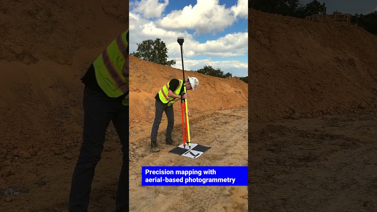
Autonomous Surveying: Forget tedious ground surveys. Drone-based GPR enables efficient, pre-planned autonomous flights, allowing us to map large areas quickly and access difficult or dangerous terrain. Imagine surveying a glacier crevasse field from a safe distance!
Data Processing is Key: Raw GPR data is just the beginning. The videos emphasize the crucial role of software like Geohammer, Prism2, and Geolitix in processing, visualizing, and interpreting the subsurface imagery. This is where the real "unearthing" happens, transforming radar signals into meaningful insights.
Open Source Opportunities: The ETH Zurich project offers a tantalizing glimpse into the open-source world of drone-based GPR. Their publicly available code for flight control, sensor integration, and data processing opens doors for hobbyists to experiment and contribute to this exciting field.
The Future is Underground: Trends in Drone-Based GPR
The videos suggest a clear trend: drone-based GPR is rapidly maturing, moving beyond proof-of-concept to practical application. Expect to see more refined hardware, integrated software solutions, and increasingly sophisticated data analysis techniques. Miniaturization of GPR units and improvements in battery technology will enable longer flight times and more detailed surveys. The convergence of drone technology, sensor development, and data processing will unlock even greater potential, allowing us to see deeper and with greater clarity. Imagine using AI to automatically identify buried objects within the 3D GPR datasets!
Explore the Subsurface: Dive into the Videos
Ready to see these incredible systems in action? Scroll down to explore the curated video highlights showcasing drone-based GPR at work. From the thrill of discovering buried artifacts to the humanitarian mission of landmine detection, you’ll witness firsthand the transformative power of this technology.
See the featured videos below
Webinar | GPR Technology: Detection of Underground Objects with DronesSPH Engineering – Control Your Drones!1,558 views | 38 | June 27 2024 14:27:05 (6 comments)[ Read more … ]
Discover the webinar, during which Alexey Dobrovolskiy, CEO of SPH Engineering, shares insights about drone-based Ground Penetrating Radars.
Topics covered:
• What are Ground Penetrating Radars? How it works?
• Current tools and methods available in the market
• Applications
• SPH GPR portfolio: GPR models, components, and benefits
• Differences between each model – technical & application
• Platforms (drones)
• Data examples
• Q&A session
Resources that Alexey provided during the presentation:
Study on evaluating airborne GPR’s potential for UXO and Landmine Detection in a Controlled Environment https://www.sphengineering.com/news/study-on-evaluating-airborne-gprs-potential-for-uxo-and-landmine-detection-in-a-controlled-environment
GPR calculator by SPH Engineering https://gpr-calculator.sphengineering.com/
Data examples:
Ice thickness https://app.geolitix.com/e/toPQ92mB
Sea ice profiling https://app.geolitix.com/e/tXpdJYKx
Bathymetry https://app.geolitix.com/e/Q7WT12Pb
Underground pipes and cables https://app.geolitix.com/e/bOO8Ehof
UXO and landmines https://app.geolitix.com/e/jc0uWgWT
Do you have any questions about GPR? Or maybe the webinar is not enough, and you’re eager to see drone-based GPR in action? Let us arrange a live demo for you, no matter your location.
Drop us a message, and we’ll get back to you! https://www.sphengineering.com/contacts
*********************************************
SPH Engineering (https://sphengineering.com)is an expert in drone technology development, providing UAV software solutions, integration services, and custom development to advance drone applications for surveying, data collection and processing, and entertainment.
Founded in 2013 in Latvia (EU), SPH Engineering has a global customer and partner network in over 150 countries.
***Core technologies developed by SPH Engineering***
– UgCS: Flight Planning & Control = One of the world’s leading flight-planning software for complex drone surveys.
– Integrated Systems = The core technology – SkyHub enables the advanced integration of drones, diverse sensors, and the UgCS software, expanding the capabilities of geophysical, hydrographic, industrial, archaeological surveying and environmental monitoring.
– Drone Show Technologies = Leading solution to manage drone light shows for entertainment and advertisement.
– Data Processing = Solutions for image, point cloud, geophysical data processing, and delivering essential technologies to facilitate your drone-based business.
– Custom Development = Knowledge-based services to implement, integrate and develop technologies for the drone industry.
Under the Sand: A UAV with Ground Penetrating Synthetic Aperture Radaraslteam6,776 views | 111 | July 26 2022 05:09:51 (4 comments)[ Read more … ]
This novel flying system combines an autonomous unmanned aerial vehicle with ground penetrating radar to detect buried objects such as landmines. The system stands out with sensor specific low altitude flight maneuvers and high accuracy position estimation. Experiments show radar detections of targets buried in sand.
Please view our accompanying Field Robotics publication:
https://doi.org/10.55417/fr.2022034
All flying system software components are available open-source! Have a look at:
github.com/ethz-asl/mav_findmine
github.com/ethz-asl/polygon_coverage_planning
github.com/ethz-asl/ethz_piksi_ros
github.com/ethz-asl/mav_gtsam_estimator
github.com/rikba/versavis/tree/feature/gnss_sync
This work was part of Project FindMine. A project initialized by the Urs Endress Foundation to develop new technologies for humanitarian demining. Have a look at the project page:
https://www.ue-stiftung.org/findmine
The system is further developed within the FindMine gGmbH company!
If you want to know more about humanitarian demining or support ongoing efforts please visit Fondation Suisse de Déminage (FSD)!
https://www.fsd.ch/
Advertisement
AltoMaxx Ground Penetrating Radar SurveysAltomaxx26,529 views | 270 | March 1 2022 16:52:20 (16 comments)[ Read more … ]
AltoMaxx unites Ground Penetrating Radar technology with a state-of-the-art drone fleet to collect data on underground objects, buried infrastructure, and soil composition.
GPR is a non-invasive method of data collection used in utility locating, archeology, disaster response, and a myriad of other industries. With a drone-based GPR sensor, AltoMaxx can perform autonomous pre-planned flights, survey traditionally inaccessible terrain, and quickly locate areas of special interest.
AltoMaxx’s experience in acquiring, analyzing, and interpreting GPR data ensures our clients have the critical information they need about their underground assets and infrastructure to make informed decisions and achieve project success.
Find out why the top companies are choosing AltoMaxx for their Ground Penetrating Radar needs at https://www.altomaxx.com/ground-penetrating-radar/
Advertisement
Live Webinar | GPR Surveys & Data ProcessingSPH Engineering – Control Your Drones!683 views | 16 | November 11 2024 11:35:08 (8 comments)[ Read more … ]
Discover the webinar, during which Alexey Dobrovolskiy, CEO of SPH Engineering, shares insights about different types of Ground Penetrating Radar (GPR) surveys and demonstrates how universal GPR models can enhance GPR surveying. Alexey also provides a hands-on tutorial on GPR data processing for four different data sets.
Topics covered:
✅ A brief introduction to GPR technology
✅ Types of GPR surveys
✅ Airborne vs. terrestrial applications of GPR
✅ How to process GPR data step-by-step
Do you want to learn more about GPR technology, its applications, and the know-how of surveying? Visit the page: https://www.sphengineering.com/integrated-systems/technologies/gpr
Resources mentioned during the webinar:
Data sets: https://files.ugcs.com/s/pjwttKyrP3E2Xed
Tools that Aexey used for data processing:
▪️ Geohammer for initial data assessment
▪️ Prism2 for 2d profiles
▪️ Geolitix for advanced processing
Case studies:
Mining: https://www.sphengineering.com/news/drone-based-gpr-and-echo-sounder-for-mining-operations-enhancement
Glaciology: https://www.sphengineering.com/news/airborne-gpr-integrated-system-a-way-for-safer-and-more-efficient-snow-and-ice-studies
Bathymetry: https://www.sphengineering.com/news/case-study-i-applicability-of-high-frequency-airborne-gpr-system-for-bathymetric-surveys
Study on evaluating airborne GPR’s potential for UXO and Landmine Detection in a Controlled Environment: https://www.sphengineering.com/news/study-on-evaluating-airborne-gprs-potential-for-uxo-and-landmine-detection-in-a-controlled-environment
Do you have any questions about GPR? Or maybe the webinar is not enough, and you’re eager to see drone-based GPR in action? Let us arrange a live demo for you, no matter your location.
Drop us a message, and we’ll get back to you! https://www.sphengineering.com/contacts
*********************************************
SPH Engineering (https://sphengineering.com)is an expert in drone technology development, providing UAV software solutions, integration services, and custom development to advance drone applications for surveying, data collection and processing, and entertainment.
Founded in 2013 in Latvia (EU), SPH Engineering has a global customer and partner network in over 150 countries.
***Core technologies developed by SPH Engineering***
– UgCS: Flight Planning & Control = One of the world’s leading flight-planning software for complex drone surveys.
– Integrated Systems = The core technology – SkyHub enables the advanced integration of drones, diverse sensors, and the UgCS software, expanding the capabilities of geophysical, hydrographic, industrial, archaeological surveying and environmental monitoring.
– Drone Show Technologies = Leading solution to manage drone light shows for entertainment and advertisement.
– Data Processing = Solutions for image, point cloud, geophysical data processing, and delivering essential technologies to facilitate your drone-based business.
– Custom Development = Knowledge-based services to implement, integrate and develop technologies for the drone industry.
Advertisement
Webinar | Assessing Soil and Subsurface Characteristics: Getting started with drone-based GPRSPH Engineering – Control Your Drones!1,502 views | 32 | August 21 2023 14:40:05 (1 comments)[ Read more … ]
Welcome to our webinar !
This session is crucial for anyone in the construction industry or interested in airborne #GPR technology. Drones are transforming construction, offering efficiency, safety, and accuracy.
We’ll explore drone-based GPR sensors, challenges, and opportunities. Our guest speakers, Jonathan from JB Unmanned, will share a GPR use case for road construction, followed by Jan Francke, who will talk about GPR data analytics and integration into engineering workflows. Whether you’re a construction professional, a tech enthusiast, or a decision-maker, this webinar will provide valuable insights into this game-changing technology.
Agenda:
– Welcome and introduction to the webinar’s agenda, subject matter, and presenters
– Overview of GPR for construction solutions portfolio (drone technology and sensor equipment)
– Training, flight preparation, and introduction to TTF kit for facilitating low-altitude flights
– Case study on the application of GPR in road construction (JBUAS)
– GPR data processing and visualization and integration in construction workflows (Geolitix)
– Q&A
✅ Discover https://www.sphengineering.com
✅ With any questions please get in touch with support@ugcs.com.
SPH Engineering (https://sphengineering.com) is a global provider of UAV software solutions, integration services, consulting and custom development to expand drone applications. Its innovations support UAVs of different manufacturers and advance drone technologies for surveying, data collection, and entertainment. Founded in 2013 in Latvia (EU), the company has a global customer and partner network in 150+ countries.
SPH Engineering is an expert in drone technology development providing solutions:
– #UgCS | Drone mission planning and flight control
– Integrated Systems – airborne integrated drone systems with sensors from diverse manufacturers
– Drone Show Technologies – to manage drone swarm flights,
– Consulting & Development – knowledge-based services to implement, integrate and develop technologies for the drone industry.
Advertisement
AGU23 – Rhône glacier – Drone-based GPR recording data over the collapse feature.Bastien Ruols39 views | 0 | November 27 2023 10:57:17 (0 comments)[ Read more … ]
American Geophysical Union 2023 – AGU23
Drone-based GPR system recording data over the collapse feature than evolved on the Rhône glacier along the summer of 2022.
High-density 4D GPR data acquisitions over three Swiss alpine glaciers.
Bastien Ruols, Ludovic Baron, Johanna Klahold, Mélissa Francey, and James Irving.
University of Lausanne, Institute of Earth Sciences, Lausanne, Switzerland.
Looking at the video carefully, you can spot the drone-based GPR system crossing the collapse feature. This is a type of application where high-density 3D GPR data could only be acquired with a drone-based system, as doing it walking at the surface would not be possible.
[RELATED SCIENTIFIC PUBLICATIONS]
Ruols B, Baron L, Irving J (2023). Development of a drone-based ground-penetrating radar system for efficient and safe 3D and 4D surveying of alpine glaciers. Journal of Glaciology 1–12. https://doi.org/10.1017/jog.2023.83
Advertisement
About the Author
Patryk Alexander is an associate copy editor at 4kVideoDrones.com, where he sharpens articles and helps keep the website's content clean and error-free. With a background in creative writing, Patryk brings a unique perspective to his editing that helps make 4kVideoDrones.com's content engaging and informative. When he's not editing or writing, Patryk enjoys spending time with his family and exploring the great outdoors.