High-Flying Precision: Unveiling the Power of Drone Mapping and Topography
The integration of drone technology into land surveying has revolutionized how we perceive and interact with our environment. From the intricate details of a small plot to the vast expanse of a large-scale project, drones offer unparalleled speed, accuracy, and efficiency. This collection of YouTube videos provides a compelling look at the practical applications of drone mapping and topography, raising critical questions about the technology’s potential, the necessary expertise, and the future of land surveying. We’ll explore the nuances of LiDAR technology, the importance of ground control points, and the selection of the right drone for the job, all while emphasizing the crucial role of safety and regulatory compliance.
Key Insights from the Field
LiDAR’s Precision Edge: Video 1 highlights the use of LiDAR (Light Detection and Ranging) technology, emphasizing its ability to deliver survey-grade accuracy, often within 2.5 cm. This precision is crucial for detailed topographical surveys and demonstrates the power of advanced sensors in drone mapping.
The Expertise Factor: The first video also underscores that drone piloting, especially with commercial-grade equipment, is a specialized profession requiring years of experience. It’s not just about flying; it’s about understanding the technology, safety protocols, and legal requirements.
Beyond the Flight: Video 1 stresses the importance of a comprehensive approach, including data processing and certified deliverables, to ensure the final product meets the needs of professional land surveyors.
Ground Control is Key: Video 4 emphasizes the critical role of ground control points (GCPs) in ensuring the accuracy of drone mapping. Proper placement and measurement of GCPs are essential for creating reliable and precise maps.
Diverse Applications: The videos showcase the versatility of drone mapping, from documenting property boundaries to supporting large-scale engineering projects, highlighting the broad impact of this technology across various industries.
Hardware Considerations:Video 3 offers a glimpse into the hardware side of drone mapping, discussing various drone models and their suitability for topographic surveys. It’s a reminder that the right tool for the job is crucial for optimal results.
Efficiency and Cost Savings: Several videos implicitly highlight the time and cost savings associated with drone surveys compared to traditional methods, making it an attractive option for many projects.
Regulatory Compliance: Video 1 provides a stark reminder of the legal and regulatory landscape surrounding commercial drone operations, emphasizing the need for proper certifications, flight planning, and adherence to safety protocols.
Navigating the Future of Drone Surveying
The videos collectively point towards a future where drone technology is not just a supplementary tool but an integral part of land surveying. The increasing sophistication of sensors like LiDAR, coupled with advancements in drone technology, will likely lead to even greater accuracy and efficiency. We can anticipate a growing demand for skilled drone pilots and data processing specialists who can navigate the complexities of this rapidly evolving field. The emphasis on safety and regulatory compliance will also become more critical as drone operations become more widespread. The future will likely see more sophisticated software and data processing tools that will streamline workflows and make drone mapping more accessible to a wider range of users.
Take Flight with Drone Mapping
These videos offer a compelling glimpse into the world of drone mapping and topography, showcasing its transformative potential and the expertise required to harness it effectively. From the precision of LiDAR to the importance of ground control, the insights shared here provide a solid foundation for understanding this dynamic field. Scroll down to explore the video highlights and see these concepts in action.
Watch the videos below
VAP using the new L2 LiDAR for topographic survey. LiDAR drone for hireVictoria Air Photos and Survey6,992 views | 110 | February 1 2024 19:59:29 (10 comments)[ Read more … ]
Victoria Air Photos and Survey is a drone service provider since 2013. VAP is located in Saanichton, South Vancouver Island, BC.
Call us at 250 507 6421
WARNING!!! While it may be tempting for a company to take on a drone program in-house you may want to seriously consider the following points. While it appears easy at first glance, it is wise to spare yourself and company the untold stresses of an in-house drone program! Hire VAP us for contract work with reasonable rates!
Firstly, As a company with 11 years in the Drone Industry, we conclude that piloting drones (especially larger commercial RPAS) is a profession. The technics and practice takes years of experience to build as aspiring drone pilots figure out in time. There is no shortcut or easy way to do it.
Safety is the number one concern and drones with their expensive payloads can, will crash casing damages, insurance claims, TSB investigations, and potential law suits. This is true even in the hands of semi-experienced pilots. Moreover, the workflows for flying drones legally in control zones can be daunting and very time consuming.
Transport Canada Advanced certification is required as is Nav Canada Flight Planning. If the flight happens to be located in one of many sensitive areas, 48 hours of prior notice must be given before any flight is authorized to Air Traffic Services. In addition, DJI geo Fly safe fencing must be notified and permission granted with all the documentation submitted.
On several operations we have done police or RCMP/peace officers have attended the site to ensure everything concerning the drone operation is being done legally and properly. Fines and criminal proceedings/investigations could happen for those not in compliance.
The best choice is the hire it out to a reputable company who has all the hardware on hand and ready. We are those who are familiar and experienced with its best use, safety limitations and capabilities. We assume the risk for you.
Drone hardware also has a relatively short shelf-life as do the batteries which power them. They require firmware updates and other maintenance on a regular basis. This is very time consuming as well. So an RPAS and sensor you purchased for a hefty price may be replaced by a system much more superior, within a time space as little as 12 months or less! The older hardware becomes worthless very fast when it comes to drones.
Lastly, drones cannot do everything! Most companies find that drone scans are only practical and useful for certain survey jobs. Therefore their use is spheritic. What sense do it make to invest all the expense, time, pilot training, and maintenance of and RPAS program you will only use a handful of times in a given year? What can we achieve working together? With out drone data, professional BC Land Surveyors have shown relative accuracies of tighter than 2.5 cm consistently on drone projects completed and processed. This proves we can make reliable survey grade topographical surveys.
In partnership with local professional BCLS, we are now offering high quality LiDAR data with certified, processed deliverables for topographical survey needs on Vancouver Island and beyond.
We are readily equipped and available to serve the community with topographic drones surveys and more.
We anticipate this will greatly improve the quality and speed of many land survey projects for end users looking to increase efficiency. We have also demonstrated that the L2 will complement rather than fully replace existing photogrammetry techniques using our P1 Survey Camera.
Topographical Drone Survey
Summary. Many benefits from topographic advancements including governmental land management to small local enterprises to huge international engineering and land surveying firms. As professional land surveyors, we can work on a wide range of tasks, from simple documenting of property boundaries (mapping) to large architectural and engineering projects. (Mapping, topography, building planning, and staking) to comprehensive measuring and mapping of acres for a variety of services.
LiDAR Point Cloud Survey. LIDAR is a methodology rather than a technology. Light Distance and Ranging is primarily a remote sensing technique that collects measurements to produce 3D models and maps of objects and environments.
Drone Survey for 3D ortho-mosaic mapping:
Drone survey has a lot of potential for GIS (Geographic Information System) specialists. Topographic surveys may be carried out with using an RPAS (with pro pilot, sensor and technique) and offer the same high quality or better results(GCS as those gathered using traditional methods, but in a fraction of the time. This significantly minimizes the expense of a site survey and resource expenses.
Topography Test On A 8066sqft Land VidAdrian Koh63 views | 1 | November 3 2024 16:00:33 (0 comments)[ Read more … ]
Always learning and experiencing new things in our line of work☺️
Doing a topography survey to maps land features, including elevations, structures, and natural elements, providing essential data for construction and planning to ensure designs align with the terrain, minimizing risks and issues.✅
#HereToWin
Advertisement
Top 4 Best Drone For Topography [2025] ✅OnlyBestOnes288 views | 3 | May 16 2024 00:00:20 (0 comments)[ Read more … ]
Let’s talk about the Best Drone For Topography 2025. I have made a list of Best Drone For Topography 2025 which will help you decide which one to choose.
I have prepared this video guide to Best Drone For Topography 2025 to give you the ins and outs to help you make the right choice. So let’s get started.
Subscribe to our channel for more videos: https://bit.ly/38RLBiF Visit our website: https://www.ibestones.com
Related Videos: https://youtu.be/D5Wpb22KS8E
https://youtu.be/5547BnBMLCM
https://youtu.be/FE61FXBuP0s
https://youtu.be/IOipXyBPblU
https://youtu.be/1OKIXFeFvV4
https://youtu.be/5wy_yknSXa0
Follow Us On: Social Media: Facebook: https://www.facebook.com/OnlybestonesCom/ Twitter: https://twitter.com/OnlyBestOnesCom
►Disclaimer◄
Portions of footage found in this video are not original content produced by OnlyBestOnes. Portions of stock footage of products were gathered from multiple sources including, manufactures, fellow creators and various other sources. If something belongs to you, and you want it to be removed, please do not hesitate to contact us at OnlyBestOnescom@gmail.com
OnlyBestOnes is a participant in the Amazon Services LLC Associates Program, an affiliate advertising program designed to provide a means for sites to earn advertising fees by advertising and linking to Amazon.com. As an Amazon Associate I earn from qualifying purchases.
#Onlybestones #Drones #Topography
Advertisement
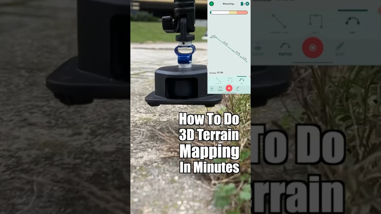
How To Set Drone Ground Control Using GPS #engineering #dronemapping #foryou #topography #shortsBad Elf280 views | 0 | May 29 2024 17:15:00 (1 comments)[ Read more … ]
Make the most out of your trip to the jobsite by setting proper ground control points for drone mapping. Taking these control points correctly can vastly improve the quality of your survey or mapping operation and will give you a much better way to process and proof any data collected or observations recorded. Stay tuned for our next short where we will see the drone fly and eventually see the final product of our map and comprehensive survey. Check out our website: bad-elf.com
Follow us on socials: https://www.linkedin.com/company/bad-elf/mycompany/ https://www.instagram.com/bad.elf/?hl=en https://www.facebook.com/badelfllc/
To take Survey on camp,How to make topography maps, Day 1of Surveye
Advertisement
#mapping#map#maps#drone #cartography#surveying #geography#phantom#dji #topography#gis#ar #topografiaMG Designer23493 views | 26 | October 20 2024 14:05:53 (0 comments)[ Read more … ]
Advertisement
About the Author
Patryk Alexander is an associate copy editor at 4kVideoDrones.com, where he sharpens articles and helps keep the website's content clean and error-free. With a background in creative writing, Patryk brings a unique perspective to his editing that helps make 4kVideoDrones.com's content engaging and informative. When he's not editing or writing, Patryk enjoys spending time with his family and exploring the great outdoors.