Drones redefine data collection! Automated flight, remote inspections, and 3D modeling unlock unprecedented insights. Click to learn more!
The Sky’s the Limit: How Drones Are Redefining Data Collection
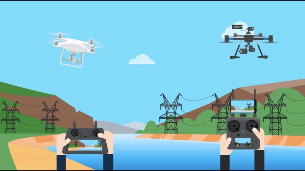
The world is awash in data, but gathering it efficiently, accurately, and safely can be a real challenge. Enter the drone: no longer just a cool hobby gadget, these flying marvels are rapidly becoming indispensable tools for data acquisition across diverse industries. From inspecting towering structures to meticulously mapping construction sites, drones are changing the way we see and interact with our world. The videos highlighted here delve into the cutting-edge of this technology, showcasing how automation, remote operation, and advanced data processing are transforming drone programs and unlocking unprecedented insights. We’ll explore software solutions, remote inspection capabilities, and the powerful synergy between drones and data analytics. Buckle up, because the future of data gathering is taking flight.
Key Takeaways: Drone Data Revolution
Automated Flight is Key: Dronelink software is pivotal for scaling drone programs, enabling autonomous data capture for inspections, mapping, and 3D modeling across multiple platforms. This automation allows for consistent, high-quality data collection, minimizing human error. The ability to rapidly iterate on new solutions and integrate drone automation into existing applications is a huge step forward.
Remote Inspections are Now a Reality: Cutting-edge livestreaming technology, like that used with the Flyability Elios 3 drone, allows for remote inspections, even across continents. This means experts can direct drone cameras and gather data from anywhere in the world, reducing travel costs and time while increasing safety.
Drone Docks Automate Construction Monitoring: Automated drone docks coupled with Pix4D technology streamline data collection and processing for construction projects. This allows for frequent progress tracking, 3D model generation, and real-time issue identification, all critical for effective project management and quality control. Imagine weekly updates, floor plan overlays, and precise measurements, all gathered autonomously!
3D Modeling Precision: Tools like Drone Harmony and Trendspek enable the creation of high-quality 3D models by automating flight planning. This process ensures detailed and reproducible data collection, especially in complex scenarios like vertical inspections. The combination of intelligent flight planning with robust data processing delivers true-to-life 3D models for analysis and collaboration.
Enterprise Platforms Compared: The showdown between enterprise drone platforms like DroneDeploy and Measure highlights the importance of choosing the right tools for your specific needs. Mobile app interfaces and data capture capabilities vary, underscoring the need for careful evaluation before committing to a platform.
Terrain Data Integration: Drone Harmony’s ability to work with terrain data, including 3D Digital Elevation Models (DEMs), opens up a world of possibilities. This feature is crucial for planning complex survey missions, inspecting linear infrastructure in challenging terrain, and optimizing data collection in areas with significant elevation changes.
The Future is Autonomous
The videos showcase a clear trend: the future of drone data gathering is increasingly autonomous. We’re moving beyond manual flight and into a realm where drones are pre-programmed to execute complex missions, gather precise data, and deliver actionable insights with minimal human intervention. This shift is driven by advancements in software, sensor technology, and data processing algorithms. The ability to integrate drones seamlessly into existing workflows, whether in construction, inspection, or mapping, is what will truly unlock the full potential of this technology. We can expect to see even more sophisticated AI-powered flight planning, data analysis, and autonomous systems in the coming years.
Take Off With Drone Data
The revolution in data gathering is already underway, and drones are at the forefront. From remote inspections to automated construction monitoring, the possibilities are vast and constantly expanding. The videos highlighted here provide a glimpse into the power and potential of drone data, offering a compelling vision of how these flying machines are transforming our world. Scroll down to explore the video highlights and discover how you can harness the power of drones for your own data-gathering needs.
Swipe down to discover the videos
Dronelink for Business – Scale and Future Proof Data Capture in Your Drone ProgramDronelink5,202 views | 32 | July 17 2021 00:26:56 (6 comments)[ Read more … ]
Learn why Dronelink drone flight automation software, is critical to scaling your drone program; packed with features to scale quality autonomous data capture from a large network of pilots across many use cases. Inspections, facades, mapping, 3D modeling and more. Dronelink provides the tools you need to rapidly iterate on new solutions, automate logistics and data management, future proof your missions across multiple hardware platforms, and with the Dronelink SDK, integrate drone automation into your own application.
Visit dronelink.com/business to learn more
Remote Drone Inspections: How to Do an Inspection with a Drone in the U.S. While Standing in EuropeFlyability2,113 views | 20 | July 29 2022 17:07:24 (2 comments)[ Read more … ]
What if you could do a drone inspection remotely?
Watch this webinar to see how cutting edge livestreaming technology from Unleash live is being used on Flyability’s new Elios 3 drone so that inspectors located offsite can get the data they need to do their inspections. In the webinar we’ll explain how the remote livestreaming feature works then do a live flight of the Elios 3 in which someone located in Europe will direct the Elios 3’s camera so they can get all the data they need.
Automating 3D Data Acquisition & Processing in Construction with Drone DocksFlytBase467 views | 8 | August 15 2024 04:51:02 (0 comments)[ Read more … ]
Interested in enhancing the efficiency and quality control of your construction projects?
Tune into this session, where we will demonstrate how automated drones and Pix4D technology can streamline your construction monitoring. Learn how to autonomously collect data and generate detailed maps and 3D models, track progress with weekly updates, and identify and correct issues in real-time.
Discover how features like floor plan overlays, volume, and distance measurements, and construction comparisons at different dates can enhance project management and ensure project success.
Automated Drone flight planning to create high-quality 3D models with Drone Harmony and TrendspekTrendspek1,818 views | 25 | November 5 2020 00:51:40 (0 comments)[ Read more … ]
Automated flight plans to create top-quality 3D models:
Trendspek: https://trendspek.com/ Book a call with Trendspek for a demo: https://trendspek.com/explore-trendspek Drone Harmony: https://droneharmony.com/
Trendspek and Drone Harmony are walking you through the end-to-end workflow of creating 3D digital models by drones for remote inspection, analysis and collaboration.
On this webinar, we begin with planning an automated drone flight of an asset using the intelligent flight planning features of Drone Harmony. We discuss how you efficiently execute the flight in the field.
Trendspek takes all the image data on your assets and turns them into visual models along with the tools you need for inspections, workflow, planning and collaboration so you can make quick yet fully-informed decisions based on water-tight data.
Know the exact condition of every millimetre of your physical assets through detailed 3D models with true-to-life resolution, all at your fingertips.
Drone Harmony automates mission planning in the most challenging vertical inspection scenarios, guaranteeing high quality, reproducible data collection by pilots with minimal training.
Join us to discuss: – Flight planning 3D structures – Executing automated flights in the field – Review 3D model results – Inspection workflows with Trendspek
Enterprise Drone Platform Showdown | DroneDeploy vs. Measure | Episode 2: Data CaptureDo You Know Drones?705 views | 18 | February 23 2021 04:42:15 (8 comments)[ Read more … ]
Enterprise Drone Platform Showdown: DroneDeploy vs. Measure Episode 2: Data Capture
In this episode, I review the mobile apps for each platform and provide a thorough apples-to-apples comparison. I also provide tips, tricks, pros and cons… and, of course, a RATING for each platform.
NEXT WEEK Episode 3: Processing & Analytics
-~-~~-~~~-~~-~- Please watch: “Innovator Interview – The Future of 3D Scanning” https://www.youtube.com/watch?v=SLAmuMVhPjo -~-~~-~~~-~~-~-
Webinar “Working with Terrain Models in Drone Harmony”droneharmony2,295 views | 43 | July 30 2020 18:09:41 (3 comments)[ Read more … ]
TOP TAKEAWAYS: – Learn how to work with terrain data in Drone Harmony Web – The use of the 3D DEM View – Planning complex survey missions – Planning linear infrastructure inspection missions in complex terrain – Loading terrain data through the terrain API – Use Cases: Mining, Surveys, Hillside Scanning, Railroads
About the Author
Patryk Alexander is an associate copy editor at 4kVideoDrones.com, where he sharpens articles and helps keep the website's content clean and error-free. With a background in creative writing, Patryk brings a unique perspective to his editing that helps make 4kVideoDrones.com's content engaging and informative. When he's not editing or writing, Patryk enjoys spending time with his family and exploring the great outdoors.