Venturing into the Unknown: Drone Explorers Chart New Depths in Cave Adventures 🗺️
The allure of the subterranean world has captivated humanity for millennia. Yet, the inherent dangers and inaccessibility of caves have always presented significant challenges to exploration. Now, a new frontier in adventure and discovery is opening up, driven by the nimble capabilities of drones. From the inky blackness of flooded passages to the crystalline structures of ice caves, remotely piloted aircraft are proving to be a critical asset in revealing the secrets hidden beneath our feet. This curated collection of YouTube video insights highlights the diverse applications and thrilling potential of Drones for Cave Exploration, offering a glimpse into a rapidly evolving field. Prepare to delve into the methods, the marvels, and the meticulous planning that defines this exciting intersection of technology and adventure.
Key Insights from Drone Cave Explorers
Underwater Drone Deployment for Submerged Cave Exploration: Videos like “Exploring 130ft DEEP Cave With Underwater Drone!! (Whats at the bottom??) Mystery Solved” and “Exploring FLOODED Building with Underwater DRONES(catfish cave)” showcase the practical application of submersible drones in navigating and documenting flooded cave systems and submerged structures. This technology bypasses the need for divers in hazardous or confined underwater environments, allowing for safer and more efficient exploration. Imagine the challenges of maneuvering in zero visibility, potentially with obstacles and currents. These videos vividly illustrate how remotely operated vehicles (ROVs) equipped with cameras are extending our reach into previously inaccessible watery depths.
Rapid Reconnaissance and Risk Assessment in Unstable Environments: “Exploring Caves with Drones Finds Ancient Artifacts. They were here.” directly demonstrates the strategic advantage of using drones for initial reconnaissance. Before committing to potentially dangerous physical entry, a drone can be deployed to visually inspect cave entrances, assess structural stability, and identify potential points of interest. This pre-flight assessment is crucial for mission planning, enabling explorers to make informed decisions about safety protocols and resource allocation. Think of the time saved and the risks mitigated by a swift aerial survey compared to a manual ground approach in rugged terrain.
Accessing and Documenting Confined Spaces, Even in Extreme Environments: The video “Flyability Elios Drones Explore Deep Ice Caves in Greenland” provides a compelling example of specialized drone technology designed for navigating extremely confined and challenging environments. The Elios drone, built for collision tolerance, allows researchers to explore deep within glacial moulins, documenting their structure and the flow of meltwater. This exemplifies how specific drone designs are pushing the boundaries of what’s possible in cave exploration, especially where GPS denial and tight spaces render conventional drones ineffective. The sensory detail of icy caverns, captured by the drone’s camera, offers a perspective unavailable through traditional means.
Utilizing Drones to Discover and Access Previously Unknown Cave Systems: The narrative of “I Found This Cave With Carved Steps On Google Earth Then Hiked To It” underscores the powerful synergy between remote sensing and drone technology. While not directly a cave exploration drone video, it highlights how satellite imagery can identify potential cave locations, which can then be further investigated using drones for a closer look at accessibility and entry points. This showcases the broader ecosystem of tools contributing to cave discovery. Consider the visual information gleaned from above, then confirmed and augmented by the drone’s on-site perspective.
Extending Human Vision and Reach in Dangerous or Remote Locations: The captivating footage from “Into the Ice: Using a Drone to Explore Inside a Glacier” visually emphasizes the benefit of drones in reaching locations deemed too hazardous for direct human entry. Glacial caves are inherently unstable, and deploying a drone minimizes the risk to researchers while still capturing invaluable data and stunning visuals of these rapidly changing environments. The drone becomes our eyes and ears in places where every step could be perilous.
The Trajectory of Drone Technology in Subterranean Exploration
The insights gleaned from these videos reveal a clear trend: drones are no longer a novelty in cave exploration, but rather an increasingly essential tool. We are witnessing the development of drones specifically engineered for the unique challenges of subterranean environments. Future advancements will likely focus on enhanced sensor capabilities for detailed mapping and 3D modeling, improved autonomous navigation in GPS-denied zones, and potentially even integration with other technologies like LiDAR and thermal imaging to reveal hidden features and environmental conditions. The legal and safety frameworks surrounding drone operation in these sensitive environments will also need to evolve alongside the technology, emphasizing responsible exploration and minimizing impact.
Step into the Darkness, See the Light: Explore Drone-Enabled Cave Adventures
These video snapshots offer a compelling introduction to the world of drone-assisted cave exploration. From the murky depths to icy expanses, these aerial scouts are changing how we understand and interact with the subterranean realm. Scroll down to witness these incredible explorations firsthand and see how drones are illuminating the hidden wonders of our planet.
Swipe down to discover the videos
Exploring 130ft DEEP Cave With Underwater Drone!! (Whats at the bottom??) *Mystery Solved*Jiggin’ With Jordan1,412,263 views | 31,475 | April 10 2021 13:21:29 (968 comments)[ Read more … ]
In this video we send an underwater drone to the bottom of hospital hole to finally see what is at the bottom!! Merch!! http://bit.ly/JigginWithJordanMerch Just Jiggin (my second channel): https://bit.ly/3rXraKg Jiggin’ with Jordan Espa ol: https://bit.ly/3ninUph
Subscribe to @HudsonB
Check out the drone here: https://bit.ly/Underwaterdrones
Follow My Instagram: http://bit.ly/JIGGINinstagram Follow me on TikTok: https://vm.tiktok.com/pUHwVJ/
Send all fan mail and stuff here!! Brandon Jordan P.O. Box 5330 Lakeland, FL 33807
For Business Inquiries ONLY Please Email: Jigginwithjordan@gmail.com
#underwaterdrone #underwatercave #explore
About Jiggin With Jordan: I search for River Treasure in some of the most beautiful places in the world! My friends and I dive down and look for lost valuables and try to get the items back to the owner! We clean up all the trash we find along the way! Join me on all my adventures here on YouTube!!
Exploring 130ft DEEP Cave With Underwater Drone!! (Whats at the bottom??) https://youtu.be/v2Xzvd8TD8s
Jiggin With Jordan https://www.youtube.com/JigginWithJordan
No matter when and where the mess strikes, stay on top of it with this compact, lightweight shop vacuum. The highly portable design is perfect for quick pick-ups around the house. Never before have we offered so much power and versatility in one portable package. The impressive 6.0 peak HP motor can handle any task, and when detached will blow you away.
I Found This Cave With Carved Steps On Google Earth Then Hiked To ItThe Trek Planner1,284,014 views | 22,273 | June 10 2023 12:00:23 (879 comments)[ Read more … ]
#googleearth #exploring #thetrekplanner #explore #ancienthistory #ancient
—-SPOILER—-
I know this may not have been a high action adventure, but I still enjoyed seeing this! There are sites like this all over the place in the Southwest. They are long forgotten or have been eroded or destroyed. It was still amazing to see those carved hand and footholds though. I hope you enjoyed it too!
Thank you for being part of The Trek Planner!!
————————————————– 🎵Music by Slip.stream – “I’M Holding On” – https://slip.stream/tracks/ba69d130-b2bf-4ef4-be01-a19768cb0adb
🎵Music by Slip.stream – Purrple Cat “Field of Fireflies” – https://slip.stream/tracks/a9cb7fae-5bd5-4ef1-990f-2b3376ab517b
Advertisement
Exploring Caves with Drones Finds Ancient Artifacts. They were here.DrTones24k123,723 views | 1,902 | June 12 2017 15:09:45 (363 comments)[ Read more … ]
I wanted to do some exploring to see if I could locate some caves in my area that the natives might have used for shelter over 1000 years ago. The caves are often isolated with no road access. With limited time, I decided to fly my dji Mavic Pro drone to the caves first to decide which caves showed the most potential. I got lucky and found a cave that housed several native American arrowheads. ALL ITEMS WERE PLACED BACK IN THE POSITION THEY WERE FOUND. IT IS ILLEGAL TO COLLECT ARTIFACTS ON PUBLIC LANDS AND I DO NOT CONDONE THE ILLEGAL COLLECTION OF ARTIFACTS. It should also be noted: flares (or any type of fire) in confines spaces is a horrible, horrible idea… but it looked cool 🙂
For the best deals on all metal detecting gear and info on the best machine for your applications, message me at BrandonNeice@TreasureMtnDetectors.com
Want to learn how we find treasure with detectors? Check out My Book: https://www.amazon.com/Metal-Detecting-Bible-Helpful-Treasures/dp/1612435270
Become part of a small community of Dirt Fishin America supporters and have access to live video chats, Q&A sessions and a chance to hunt with us. https://www.patreon.com/DrTones
https://www.facebook.com/DirtFishinAmerica/ Instagram @brandon_beice Twitter @brandon_neice Business inquiries: Dr.Tones24k@gmail.com My other channel https://www.youtube.com/channel/UCFkH-rw-4BvEn-eW0i-aGfg
Advertisement
Exploring FLOODED Building with Underwater DRONES(catfish cave)Jiggin’ With Jordan71,507 views | 5,227 | November 3 2024 21:33:55 (189 comments)[ Read more … ]
First ever NFG Drop here! https://nfgshop.com
For Business Inquiries ONLY Please Email: Jigginwithjordan@gmail.com
#underwaterdrone #underwater #drone
About Jiggin With Jordan: I search for River Treasure in some of the most beautiful places in the world! My friends and I dive down and look for lost valuables and try to get the items back to the owner! We clean up all the trash we find along the way! Join me on all my adventures here on YouTube!!
Sending UNDERWATER DRONES Into FLOODED Building To Find FISH! (catfish cave) https://youtu.be/lKNBUaYytMY
Jiggin With Jordan https://www.youtube.com/JigginWithJordan
MB01T2ENSVKLRCP
Advertisement
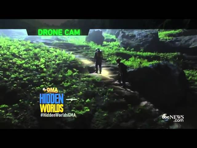
Into the Ice: Using a Drone to Explore Inside a GlacierABC News112,645 views | 468 | January 7 2016 08:17:24 (106 comments)[ Read more … ]
Inside a mammoth glacier in Iceland melting at an alarming rate from warming temperatures.
Advertisement
Flyability Elios Drones Explore Deep Ice Caves in GreenlandOreaco230 views | 2 | September 13 2020 11:47:11 (0 comments)[ Read more … ]
A new video created by Swisscom Ventures highlights a research expedition sponsored by Moncler to explore the deepest ice caves in the world using Flyability’s Elios drone. In partnership with Swisscom, Flyability released a video showcasing the way that its indoor drone technology was used by a team of researchers to explore and document some of the deepest ice caves in the world, located in Greenland.
The expedition was sponsored by apparel company Moncler and took place over two weeks in 2018 on the Greenland ice sheet, the second largest body of ice in the world after Antarctica. Research focused on an area about 80 kilometers east of Kangerlussuaq, where scientists wanted to study the movement of water deep underground to better understand the effects of climate change on the melting ice.
In a past expedition, scientists were only able to repel to a depth of about 130 meters within the giant vertical ice shafts, called moulins, that led to the underground rivers they wanted to study. On this expedition scientists used the Elios, Flyability’s collision-tolerant drone, to reach the very bottom of the moulins and learn more about the movement of the water and the shape and stability of the ice shafts.
The mission was led by Francesco Sauro, Professor of Planetary Geology and Exploration at the University of Bologna. He was supported by a team of world renowned geologists, glaciologists, speleologists, geographers, biologists, and Arctic explorers.
In the same part of Greenland where the mission was made, French speleologist Janot Lamberton achieved the deepest ice cave descent ever in 1996, traveling to a depth of 202 meters. Due to climate change, the caves have become too unpredictable since that time to attempt another deep descent. Using the Elios, which was designed for inspections in confined spaces, researchers were able to reach the bottom of one of the moulins, where they discovered a lake on the icy floor.
Flyability is a Swiss company building solutions for the inspection and exploration of indoor, inaccessible, and confined spaces.
Patryk Alexander is an associate copy editor at 4kVideoDrones.com, where he sharpens articles and helps keep the website's content clean and error-free. With a background in creative writing, Patryk brings a unique perspective to his editing that helps make 4kVideoDrones.com's content engaging and informative. When he's not editing or writing, Patryk enjoys spending time with his family and exploring the great outdoors.