Unlocking Drone Map Accuracy: Ground Control Points Demystified
For drone pilots and professionals leveraging UAVs for mapping and surveying, achieving centimeter-level accuracy isn’t just a desire—it’s a necessity. Whether you’re monitoring construction progress, assessing environmental changes, or generating detailed topographical surveys, the precision of your drone-derived maps hinges on a critical element: Ground Control Points (GCPs). But navigating the nuances of GCP implementation, from optimal placement strategies to efficient processing workflows, can feel like charting a flight path through dense fog. Fortunately, a wealth of practical knowledge is available, and recent video content is illuminating the path to “perfect drone maps.” Let’s explore key insights gleaned from expert drone mapping videos, offering actionable intelligence to elevate your data accuracy and streamline your operations.
Key Takeaways for GCP Mastery
Speed and Precision are Achievable: Video 1, "Surveying at Full Throttle," showcases the power of combining fast-paced drone missions with precise GCP implementation. It’s a clear demonstration that rapid data acquisition doesn’t necessitate sacrificing accuracy. Utilizing RTK-equipped drones like the DJI Mavic 3E RTK, coupled with GNSS for GCP establishment, allows for efficient workflows delivering centimeter-level precision. Visualizing high-speed drone flights paired with meticulously placed GCPs underscores the synergy of speed and accuracy in modern drone surveying.
OPUS for Enhanced Alignment: "Improving drone map alignment using OPUS" (Video 2) tackles a common challenge: ensuring consistent spatial accuracy across multiple datasets, particularly in the absence of permanent ground features. The video highlights the critical role of accurate base station positioning and introduces NOAA’s OPUS (Online Positioning User Service) as a powerful tool for post-processing GNSS data. This refinement of base station coordinates directly translates to improved coregistration of drone maps captured at different times. Imagine datasets snapping into perfect alignment, eliminating spatial discrepancies and enhancing change detection analysis—that’s the power of precise base station correction.
Automated GCPs: Best Practices Unveiled: Video 3, "Best Practice for Automated Ground Control Points," delves into optimizing workflows for efficiency. It emphasizes the practical aspects of automated GCP processing, covering target selection (circular 3M Diamond Grade Reflective Targets), sizing relative to capture methods, strategic spacing along flight paths, and orientation considerations during placement. The video progresses through the entire GCP workflow, from data capture to constellation assignment, data review, and crucial troubleshooting tips. Picture reflective targets strategically placed across your survey area, ready to be automatically identified and processed, drastically reducing manual effort and streamlining your workflow.
Pixels to Points Processing Power: "How To Process Drone-Collected Data with Pixels to Points" (Video 4) provides a hands-on tutorial for leveraging software tools to process drone data efficiently. It spotlights the "Pixels to Points" tool within Global Mapper Pro, showcasing automated GCP identification within the software. This practical demonstration illustrates how to move from raw drone imagery to georeferenced outputs with streamlined GCP integration. Envision software automatically pinpointing your GCPs in the imagery, reducing manual point selection and accelerating your data processing timeline.
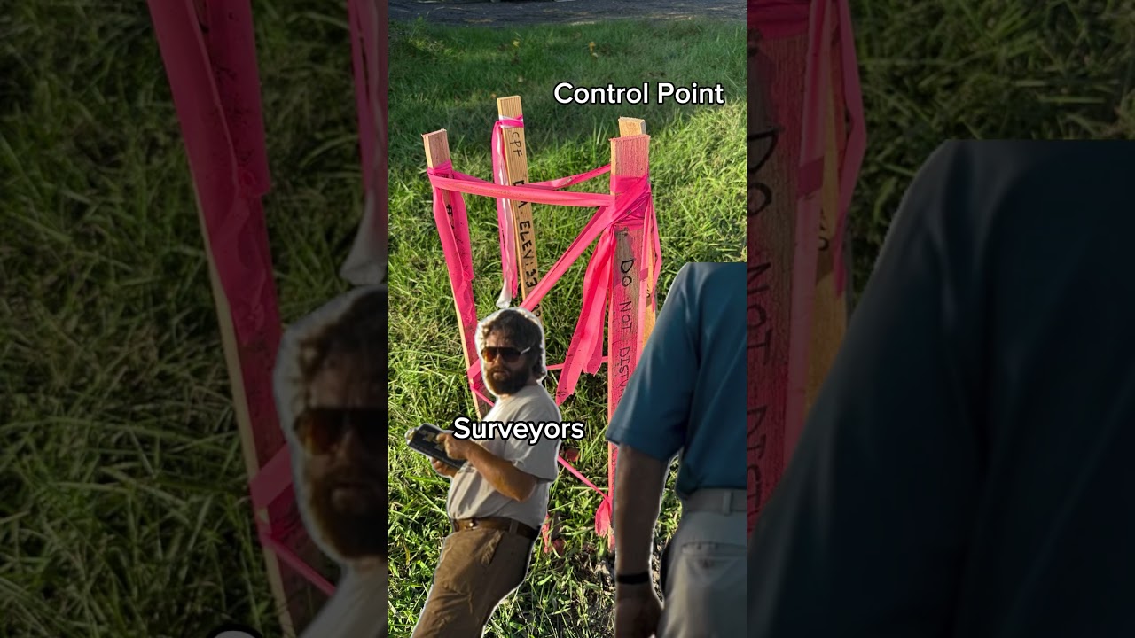
GCP Fundamentals for Beginners: For those new to GCPs, "Emily learns about ground control points" (Video 5) provides a valuable introduction. This educational episode breaks down the concept of GCPs, emphasizing their fundamental role in improving drone map accuracy. It’s a great starting point for understanding the "why" and "what" of GCPs before diving into more advanced techniques. Think of this video as your foundational flight briefing, ensuring you understand the core principles before taking to the skies with GCP-dependent missions.
The Undeniable Secret to Perfect Maps: Video 6, "Ground Control Points | The Secret to Perfect Drone Maps!", reinforces the central theme: GCPs are not optional—they are essential for achieving high-accuracy drone maps. This video offers a comprehensive overview, explaining what GCPs are, optimal usage strategies, and the compelling benefits they bring to drone mapping projects. It serves as a strong advocate for GCP adoption for anyone serious about data precision. Consider this video a firm confirmation: if perfection in drone mapping is your goal, GCPs are not just recommended; they are the key ingredient.
Navigating the Future of GCPs: Automation and Accessibility
Analyzing these video insights, a clear trend emerges: the drive towards greater efficiency and accessibility in GCP workflows. Automated GCP target recognition software and streamlined processing techniques are becoming increasingly sophisticated, reducing the time and expertise required for accurate georeferencing. Furthermore, the growing availability of cost-effective RTK/PPK drone technology is minimizing reliance on extensive GCP networks in some applications. However, the fundamental principle remains unchanged: for applications demanding the highest levels of absolute accuracy, meticulously planned and executed GCP strategies are indispensable. The future likely holds a balance – smarter automation to simplify GCP processes, while skilled drone pilots continue to strategically deploy GCPs to push the boundaries of drone mapping precision.
Elevate Your Drone Mapping Precision
Gaining a solid grasp of Ground Control Points is paramount for anyone aiming to unlock the full potential of drone mapping. The insights shared in these videos provide a practical and accessible pathway to mastering GCP techniques, from fundamental concepts to advanced processing strategies. Ready to take your drone maps to the next level of accuracy? Scroll down to explore the featured videos and delve deeper into each expert’s approach to GCP implementation. Enhance your understanding, refine your workflow, and achieve the perfect drone maps your projects demand.
The curated videos await below
Surveying at Full Throttle: Fast & Accurate Drone Mapping!Erdem Atik40 views | 1 | January 23 2025 07:00:30 (0 comments)[ Read more … ]
🚀High-speed UAV mapping meets precision engineering! Watch as I combine Ground Control Points (GCPs) + UAV photogrammetry for centimeter-level accuracy—all set to AC/DC’s Thunderstruck! ⚡
🚁 What’s in this video? ✅ Setting up GCPs with GNSS ✅ Fast-paced UAV mission ✅ Processing aerial data for high-accuracy maps
Devices: DJI Mavic 3E RTK South G4 GNSS
Softwares: DJI Terra AgiSoft MetaShape AutoCad Civil 3D
Improving drone map alignment using OPUSJason Karl – UI Drone Lab235 views | 11 | January 6 2025 13:00:00 (1 comments)[ Read more … ]
One of the biggest challenges with drone data is getting imagery from multiple dates to line up correctly, or in other words to get it coregistered. Coregistration is relatively straightforward if you have some permanent ground control points or recognizable and unmoving objects in the scenes. But, in many situations, that’s not the case. So, we need strategies for coregistering drone data from different dates that either uses only temporary ground control points or doesn’t need any ground control points at all. In this video, we’ll look at using NOAA’s Online Positioning User Service (OPUS) to post-process our local GNSS base station data to get better positioning and, ultimately, better coregistration of drone map products.
You can find OPUS and learn more about it at https://www.ngs.noaa.gov/OPUS/about.jsp
OPUS is only one tool for correcting GNSS base station location estimates. Here’s a list of some of the other tools: OPUS (US NOAA) – https://www.ngs.noaa.gov/OPUS/index.jsp CSRS-PPP (Natural Resources Canada) – https://webapp.csrs-scrs.nrcan-rncan.gc.ca/geod/tools-outils/ppp.php AUSPos (Geoscience Australia) – https://gnss.ga.gov.au/auspos CenterPoint RTX (Trimble) – https://trimblertx.com/
Get detailed instructions for how to prep and use OPUS to process data from Emlid Reach GNSS receivers at https://uidronelab.org/2024/11/12/post-processing-emlid-gnss-data-with-opus-corrections/
More example datasets and written instructions for drone photogrammetry and lidar tutorials are available at the Drone Lab website https://uidronelab.org.
If you’re finding these videos useful, consider making a donation to the Drone Lab at the University of Idaho at https://www.givecampus.com/campaigns/3269/donations/new (make sure you put “Drone Lab Gifts” in the Designation box). All donations to toward supporting the lab and drone-headed undergraduate and graduate students at UI. Thanks for your support!
Best Practice for Automated Ground Control PointsEmesent431 views | 17 | December 3 2024 01:55:14 (0 comments)[ Read more … ]
Chapters:
00:00 – 00:36 – Best Practice for Automated Ground Control Points 00:36 – 00:53 – Use Circular 3M Diamond Grade Reflective Targets 00:54 – 01:16 – Select a Target Size to Suit the Capture Method 01:17 – 01:40 – Consider Spacing of Targets Along the Capture 01:41 – 04:40 – Consider Orientation when Placing Targets 04:41 – 05:28 – Capture the Scan 05:29 – 10:55 – Starting the GCP Processing Workflow 10:56 – 13:39 – GCP Constellation Assignment 13:40 – 15:40 – Reviewing the Processed Data 15:41 – 19:41 – Trouble Shooting Tips
Advertisement
How To Process Drone-Collected Data with Pixels to Points | Ask The ExpertsBlue Marble Geographics529 views | 20 | November 21 2024 20:14:42 (0 comments)[ Read more … ]
Learn how to process drone/UAV data with the Pixels to Points tool in this Ask The Experts tutorial! Check out What It Takes To Fly A Drone for more drone/UAV resources and workflows: https://youtube.com/playlist?list=PL-HMFuJMarh83R1KwrrbL2ZvoUOsVMMyc&si=lSxJ5EamctXJg0cb
✔ Check out Global Mapper Pro: https://www.bluemarblegeo.com/global-mapper-pro/ ✔ Self-Paced GIS Courses in the Online Classroom: https://training.bluemarblegeo.com/ ✔ Check out our podcast: https://www.bluemarblegeo.com/feed/podcast/geotalks/ ✔ Newsletter: https://go.bluemarblegeo.com/subscribe
Connect with us on LinkedIn: https://www.linkedin.com/company/blue-marble-geographics/ Connect with us on Instagram: https://www.instagram.com/bluemarblegeo/?hl=en Join our user forum: https://www.globalmapperforum.com/
Timestamps: [00:00] – Intro [00:28] – How to process data with Pixels to Points [01:03] – Load picture points in Pixels to Points (P2P) [01:36] – How to automatically ID ground control points (P2P) [02:41] – How to save a P2P workspace file [03:00] – Confirm control point placement in P2P [03:19] – How to define Pixels to Points outputs [04:29] – Review Pixels to Points output [05:26] – Outro
Advertisement
Emily learns about ground control points | What It Takes To Fly A Drone with Emily and MoriahBlue Marble Geographics113 views | 5 | October 31 2024 13:50:26 (0 comments)[ Read more … ]
Emily and Jenna teach us about setting up ground control points for a drone flight in this episode of #WhatItTakesToFlyADrone! Check out the ‘Drone Series Resources’ at the link in our bio to learn more about improving accuracy with ground control points. – #globalmapper #groundcontrol #gismapping #dronelife #dronepilot #uavpilot
Advertisement
Ground Control Points | The Secret to Perfect Drone Maps!Aeroview Drone Tech128 views | 1 | October 25 2024 21:26:16 (2 comments)[ Read more … ]
This weeks episode we cover GCP’s or Ground Control Points. We talk about what they are, how to best utilize them, and why you should be using GCP’s! Hope you enjoy!
We apologize for not uploading last week. This was do to an error when filming and the video had to be scrapped. However we are back on schedule and ready to make new videos for you all to enjoy.
0:00 – 0:11 Intro 0:12-1:33 What are GCP’s? 1:34-2:10 How many should I use? 2:11-4:06 Advice on using GCP’s 4:07-5:15 Benefits of GCP’s 5:16-5:38 Outro
Patryk Alexander is an associate copy editor at 4kVideoDrones.com, where he sharpens articles and helps keep the website's content clean and error-free. With a background in creative writing, Patryk brings a unique perspective to his editing that helps make 4kVideoDrones.com's content engaging and informative. When he's not editing or writing, Patryk enjoys spending time with his family and exploring the great outdoors.