Forget blurry satellite images and painstaking ground surveys! The world of surveying and mapping is undergoing a dramatic transformation thanks to Real-Time Kinematics (RTK) drone technology. These incredibly precise aerial platforms are providing centimeter-accurate data, opening up a world of possibilities for professionals and hobbyists alike. This page dives into key insights from some of the best YouTube tutorials available, exploring how RTK drones work, what equipment you need, and how this technology is changing industries. We’ll cover everything from building your own affordable RTK setup to using readily available software and hardware to achieve survey-grade results with your favorite consumer drones. Get ready to take your mapping game to the next level!
Key Takeaways from Top YouTube Tutorials
Achieving Centimeter-Level Accuracy: Several videos demonstrate how RTK technology, using both base stations and rover (drone) units, significantly improves positional accuracy in mapping, enabling precise measurements down to the centimeter. This level of precision surpasses what’s possible with standard GPS. Methods range from DIY builds using ESP32s and affordable GNSS receivers to sophisticated integrated systems from DJI and others.
Automated Mapping Missions: Tutorials showcase user-friendly software like WaypointMap, allowing automated flight planning and data collection for various DJI drone models, streamlining the mapping workflow even for drones without SDK support. This automation significantly reduces the time and effort needed for data acquisition.
Choosing the Right Equipment: Videos highlight different hardware choices, from professional-grade RTK systems (like the DJI Mavic 3E RTK and Matrice 350 RTK) to more affordable options like the Emlid Reach RS2+, providing valuable comparisons to help you choose the best equipment for your budget and project requirements. These considerations also include factors such as antenna choice and signal quality.
Data Processing and Validation: Experts emphasize the importance of post-processing, ground control points (GCPs), and data validation for ensuring accuracy. Tutorials explain how to calibrate and utilize RINEX data and the significance of GCPs in achieving reliable and accurate map outputs. The importance of understanding Ground Sample Distance (GSD) is also emphasized.
Broad Applications & Financial Opportunities: One video even explores the potential of using affordable RTK setups to earn money by establishing a base station and contributing to a decentralized physical infrastructure network (DePIN). This highlights the growing commercial potential of RTK technology.
RTK Drone Mapping: The Future is Now
The videos reviewed clearly illustrate a shift towards greater accessibility and affordability in RTK drone surveying and mapping. While professional-grade systems remain valuable, the availability of DIY options and user-friendly software is empowering a new wave of drone enthusiasts and professionals alike. We are seeing advancements in the ease of use, decreasing the technical barrier of entry, while continuing to expand the scope of applications. The future will likely involve even more sophisticated automation, integrated data processing, and cloud-based solutions making these technologies even more powerful and accessible.
Take Flight with RTK!
The videos highlighted above represent only a glimpse into the exciting world of RTK drone mapping. Scroll down to watch curated clips from these tutorials and discover how you can revolutionize your own surveying and mapping projects. Whether you’re a seasoned professional or a curious hobbyist, the potential of RTK technology awaits!
Scroll down for a closer look at the videos
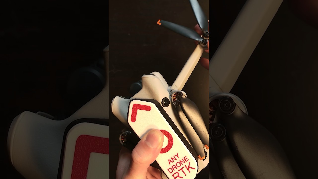
(483) ESP32 precision GPS receiver (incl. RTK-GPS Tutorial). How to earn money with it (DePIN)Andreas Spiess679,427 views | 22,751 | May 5 2024 07:00:13 (1,433 comments)[ Read more … ]
Determine your location to the centimeter around the globe? For everybody, not only for the military? Only with an ESP32 and a decent GPS receiver module? Not possible! Wrong; it is possible by using real-time kinematics. You can even earn money by building a base station and connecting it to a global network (Decentralized physical infrastructure network)!.
When I got a board from Michael, a viewer of this channel, I was hooked on trying to understand this relatively new technology. Are you interested, too? Then, follow along.
My second channel: https://www.youtube.com/HB9BLAWireless
Links:
Book about navigation: https://amzn.to/44sNNts
ESP32 mini: https://s.click.aliexpress.com/e/_DEPSpEb
UM980 RTK-GNSS receiver: https://s.click.aliexpress.com/e/_DDOGigx
RTK all-band GNSS antenna (order the “S” type): https://s.click.aliexpress.com/e/_DDYO6wf or https://s.click.aliexpress.com/e/_DlkTU2P
Cable (TNC male to SMA male): https://www.aliexpress.com/item/1005005478285213.html
Splitter (with a case, not needed for single receiver): https://s.click.aliexpress.com/e/_DmuqsRp
DC Block (for 2 receivers): https://s.click.aliexpress.com/e/_DF9165l
u-blox RTK receiver: https://www.u-blox.com/en/product/zed-f9p-module
Sparkfun RTK solutions: https://www.sparkfun.com/rtk
Michaels project: https://github.com/mazgch/hpg
How to build a base station: https://simeononsecurity.com/guides/budget-diy-gps-gnss-base-station-setup-esp32-um980/
Base software for t services: https://github.com/incarvr6/esp32-ntrip-DUO
RTK2GO: http://rtk2go.com/
Onocoy: https://www.onocoy.com/
euspa report: https://www.euspa.europa.eu/sites/default/files/uploads/euspa_market_report_2022.pdf
The links above are usually affiliate links that support the channel (at no additional cost to you).
Supporting Material and Blog Page: http://www.sensorsiot.org
GitHub: https://www.github.com/sensorsiot
My Patreon Page: https://www.patreon.com/AndreasSpiess
Discord: https://discord.gg/JfgDSa8
If you want to support the channel, please use the links below to start your shopping. No additional charges for you, but I get a commission on your purchases to buy new stuff for the channel
My Amazon.com shop: https://www.amazon.com/shop/andreasspiess
For Banggood https://bit.ly/2jAQEf4
For AliExpress: For AliExpress: bit.ly/3MtXUY8 (just go on from here to your product)
For Amazon US: https://www.amazon.com/shop/andreasspiess
For Amazon.de: http://amzn.to/2r0ZCYI
For Amazon UK: http://amzn.to/2mxBaJf
For ebay.com: http://ebay.to/2DuYXBp
https://twitter.com/spiessa
Please do not try to email me. This communication channel is reserved for my primary job
As an Amazon Associate, I earn from qualifying purchases
#no#midroll#ads
FINALLY DJI Mini 4 Pro, Mavic 3, and Air 3 Automated 3D Drone Mapping and PhotogrammetryJays Tech Vault147,015 views | 3,350 | December 30 2023 17:00:47 (423 comments)[ Read more … ]
We can finally do automated mapping on DJI drones like the DJI Mini 4 pro, DJI Air 3, and DJI Mavic 3 / 3 pro / classic. Today I show you a free tool to do automated mission planning for free on drones that do not have any sdk support. At last we can finally do automated missions on the newest dji drones. DJI mini 4 pro mapping, DJI mini 4 pro mission planning, and dji mini 4 photogrammetry. DJI Air 3 mapping, DJI Air 3 mission planning, and DJI air 3 photogrammetry. DJI mavic 3 pro mapping, DJI mavic 3 pro mission planning, and DJI mavic 3 pro photogrammetry.
This video will use a tool I made called https://www.waypointmap.com . Its a free online tool that lets you generate automated mapping waypoint missions without SDK support. Allowing users to fly waypoint missions to collect data on the newest drones with the waypoint feature. Everything shown in this video on Waypointmap will be free to use forever. I may add additional premium features but these features will be free to use for everyone. Waypointmap.com is a great tool to use.
I am not affiliated or endorsed by DJI.
0:00 – Intro and Setup
2:42 – RC-N1/N2 w/ Apple Device Setup
3:45 – RC 2 or RC-N1/N2 w/ Android Device Setup
4:32 – DJI RC Setup
5:32 – Usage instructions and final setup
Advertisement
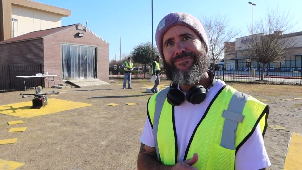
How to be a Drone Mapping Pro | Deep DiveSteel City Drones115,961 views | 2,946 | March 9 2024 19:07:56 (128 comments)[ Read more … ]
If you want to know more about Drone Mapping & Drone Survey’s this is the ultimate guide for you. Dave King breaks down every element of mapping including which drones to use for 2D & 3D maps, which drone equipment to use for Survey work, and what all the work flow processes to consider for Drone Mapping. We review Drone processing software as well as the validation processes that are essential to make sure the drone data collected is as expected.
02:11 Can I create simple 2D or 3D maps easily with my own drone?
02:32 What is Drone Photogrammetry?
02:54 Survey grade accuracy versus Consumer Grade accuracy
04:38 Why some drone cameras are not ideal mapping
06:13 Benefits of RTK GPS
07:00 Benefits of Drone Terrain Following
07:25 What is Ground Sample Distance
08:07 Why Validating the Drone Data is so important
08:50 Introduction to Survey Base stations and why they need reference GEO data
10:14 What is and how to calibrate recorded Rinex data
10:47 Introduction to Drone Ground Control Points
11:44 Recommended practices for GPC’s and cost breakdown
12:18 Difference between Survey base and rovers
13:17 What are Check Points for mapping?
14:30 Limitations of the DJI DRTK2 base station compared to 3rd party base stations
15:45 Complete Price break down for data equipment
16:27 Why we recommend EMLID Reach GNSS Receivers
For more information on which drone’s and equipment to use please visit https://www.steelcitydrones.com or email us at support@steelcitydrones.com or call us at 866-376-6375 866-DRONES5
RTK / PPK and GCPs ExplainedAvios Media4,810 views | 150 | May 17 2024 02:41:24 (41 comments)[ Read more … ]
This is the first video covering this subject. I will add more videos as time allows but this one will cover RTK and PPK, how they are used and some pros and cons for each. It is a subject that can get very complex so this is an introductory level video.
00:00 Introduction
00:10 Credits
00:35 What is covered?
00:49 Why this video?
01:20 GPS accuracy
01:40 RTK and PPK – what are they
02:00 RTK and how it works
03:00 Pros and Cons of RTK
04:00 PPK and how it works
04:30 Processing
05:00 Pros and Cons of PPK
05:30 Why choose?
06:00 Wrap up
How to connect Emlid Reach RS2+ to dji Mavic 3E RTKSOM Survey Instruments3,865 views | 57 | June 11 2024 14:02:51 (10 comments)[ Read more … ]
In this video, we’ll show you how to connect your Reach RS2+ Base Station to your dji Mavic 3E RTK drone for mapping
Establish seamless communication between the Reach RS2+ base and your drone for faster data collection and accumulate next-level results on your next mapping project! ️
Cut back on time spent in the field, no matter the industry💪
Whether it be the Mavic 3E RTK or Matrice 350 RTK, the RS2+ base station will maximize your efficiency and achieve survey-grade accuracy for all your drone mapping needs.
Ready to unlock the full potential of your DJI drone?
Hit that subscribe button, give us a thumbs up, and let’s delve into the power of the Reach RS2+ Base Station and DJI Mavic 3E RTK!
Also, click the link HERE: https://somsurveyinstruments.com/Product?rvdsfpid=som-reach-rs3rs2-combo-complete-surveying-kit-100162 – we’ve got stock available! 🛒
Looking forward to helping you become more profitable.
🔔 Subscribe for more exciting tutorials and guides: https://www.youtube.com/channel/UC8lgweCcmPCa8AjOcr1WZWg
Explore Reach RS2 Plus:
https://somsurveyinstruments.com/buy-now/emlid-gps-receivers/reach-rs2-
To get your DJI Mavic 3E RTK Combo with RS2+ Base Kit, BUY NOW:
https://somsurveyinstruments.com/product/dji-mavic-3e-rtk-combo-with-rs2-base-kit
Previous Reach RS2+ Videos:
Reach RS2+ The Best Alternative Base Station for DJI Drone: https://youtu.be/hm3j1ITn-g8
EMLID Reach RS2+ Unboxing: https://youtu.be/M8EaNLnivEY?si=8IaxTI8vcroGUl1w
EMLID Reach RS2+ Review and Test: https://youtu.be/RLkirWsaiOk?si=bMxPlO520ALAw12e
Reach RS2+ Get Your Fix On: https://youtu.be/bGPbsxR7tgM?si=RtCvnb55WdTOYcc5
Reach RS2+ Comparison Video: https://youtu.be/KF2mE7XTdxk?si=IlnYKXltSClnzFSE
REACH RS3:
Introducing the new Reach RS3: https://youtu.be/WsS0qpVc2gM
Reach RS3 Capabilities: https://youtu.be/-UBxEbINQGE
Reach RS3 – Powerful, Advanced and Cost-Effective: https://youtu.be/F0Un2PRMdnU
How to setup Reach RS3/RS2+ Complete Surveying Kit: https://youtu.be/kuPuP9b8EPc
How to Activate IMU of your Reach RS3 Rover: https://youtu.be/y1aPcbgfzpM
The full NTRIP Setup Guide for DJI RTK DronesUAVISUALS5,701 views | 217 | August 20 2024 22:56:57 (16 comments)[ Read more … ]
Do you need the DJI RTK Mobile Base Station?
Paul takes you through a comprehensive guide to connecting the NTRIP network with the DJI Mavic 3 Enterprise (RTK module needed), Mavic 3 Multispectral, Mavic 3T, Mavic 3E, as well as the M30T, M300, and M350 models. If you are an aspiring drone professional, this tutorial will help you achieve high survey accuracy without needing a DJI DRTK base station.
Check out our online Drone Masterclass Academy courses here: https://dronemasterclassacademy.com/
Skip to the chapters below:
0:00 Intro
1:23 What is RTK?
2:29 What is NTRIP?
3:13 Finding a Service
4:22 How to Connect to NTRIP!
7:18 Need to Know
How to Connect to NTRIP:
To connect your DJI RTK drone to an NTRIP service, start by finding a nearby MOUNT POINT on a GNSS provider’s map—ideally within 15km (10 miles) to ensure accuracy. https://gnss.ga.gov.au/
In your drone’s settings, activate RTK positioning and switch the RTK Service Type to ‘Custom RTK Network’.
Then enter the NTRIP details: Configuration (for quick switching between Mount Points), NTRIP Address, port (usually 2101), your registered email and password, and the CASE SENSITIVE Mount Point name.
Save these settings, and within a few seconds, your drone will be connected, providing a more stable and accurate flight!
—
Patryk Alexander is an associate copy editor at 4kVideoDrones.com, where he sharpens articles and helps keep the website's content clean and error-free. With a background in creative writing, Patryk brings a unique perspective to his editing that helps make 4kVideoDrones.com's content engaging and informative. When he's not editing or writing, Patryk enjoys spending time with his family and exploring the great outdoors.