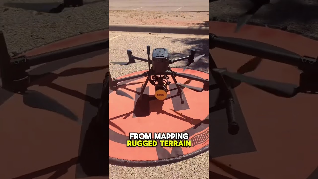
Elevate Your Mapping Game: The ROCK R3 Pro Revolution
Alright folks, strap in! As a drone pilot and instructor, I’ve seen my fair share of tech come and go, but the ROCK R3 Pro is a game changer, and it’s got my full attention. We’re talking about more than just a shiny new sensor here; we’re talking about a real shift in how we approach mapping and surveying. Forget those tedious, time-consuming traditional methods, because this series of YouTube videos cracks open the lid on what’s possible when you combine cutting-edge LiDAR technology with the flexibility of drones. From precisely mapping intricate power substations to analyzing the nuances of ADA ramp compliance, these videos demonstrate that the ROCK R3 Pro isn’t just about collecting data, it’s about unlocking actionable insights with previously unimaginable speed and accuracy. So, grab your coffee, settle in, and let’s explore how this technology is reshaping our field.
Key Takeaways from the Field:
Power Substation Precision: The R3 Pro V2 showcases its ability to capture highly detailed data in complex environments, like power substations with their tangled networks of lines and equipment. This capability proves invaluable for asset management and safety planning (think preventative maintenance to avoid outages).
L2 vs. R3 Pro V2 Showdown: A head-to-head comparison highlights the R3 Pro V2’s competitive edge, especially in scenarios demanding high accuracy and detail. You’ll see side-by-side point cloud analysis, exposing the strengths and weakness of both sensors, which is crucial for smart purchasing decisions.
The New Standard: The R3 Pro V2 isn’t just an incremental upgrade, it’s a "new standard." Upgrades include improved inertial measurement unit (IMU), a Global Navigation Satellite System (GNSS), onboard computer and LiDAR system that translate to significantly superior point cloud accuracy. Plus, the unique photogrammetry and software make a serious difference.
Beyond Drones: Mobile Applications: The R3 Pro’s capabilities extend beyond just aerial surveys. These videos show its effectiveness in mobile mapping, even accurately measuring the slope and features for ADA accessibility on ramps and other locations traditionally measured by hand. That saves time and adds data integrity to projects.
From Data to Deliverable: Witness firsthand how 3D Drone LiDAR data from the R3 Pro merges seamlessly with SLAM LiDAR, all processed in ROCK Cloud. This results in topographic surfaces and precise feature extraction for essential surveys. (SLAM LiDAR refers to Simultaneous Localization and Mapping which allows the user to scan without relying on GNSS).
Analysis and Future Trends
The trend is clear, the ROCK R3 Pro is not just another piece of gear, it’s the cornerstone of a broader push towards integrated geospatial solutions. What I’m seeing in these videos and other real-world use cases shows a clear path for the following areas:
Increased Automation: The advancements demonstrated by the ROCK R3 Pro mean less manual labor, which reduces risks for surveyors and speeds up data collection for everyone. With streamlined processing in ROCK Cloud, this translates directly to faster project timelines and higher data accuracy, which, of course, saves money.
Broader Industry Adoption: From civil engineering to construction and beyond, the versatility of this technology and the speed at which the software processes data suggests that we’ll see many industries adopt drones as a standard tool. We’re already seeing how the R3 Pro is being used in a variety of different industries, it won’t be long before it’s a standard across many of them.
Democratization of High-Accuracy Mapping: The push for user-friendly interfaces and streamlined workflows means even smaller firms and individual surveyors now have access to technology previously only accessible to large corporations. This is huge for our industry as a whole.
Ready to See it in Action?
The ROCK R3 Pro is truly transforming the landscape of mapping and surveying, and it’s crucial for any serious professional to stay on top of this technology. These videos showcase some of the very latest developments and capabilities, offering first hand insights. Now’s your chance to see the details of how this technology is revolutionizing the way we work. Don’t just take my word for it, scroll down and check out the videos for yourself and get ready to raise your mapping game!
Check out the videos below
Drone LiDAR Scanning a Power Substation | ROCK R3 Pro V2 ExampleIndiana Drones21,573 views | 163 | May 1 2024 22:15:27 (14 comments)[ Read more … ]
Join me as I put the R3 Pro V2 Drone LiDAR to the test over challenging terrains including power lines and a power substation. Watch as I tackle mission planning, execute the flight, and dive deep into the data analysis with our sophisticated tools. This video showcases the drone LiDAR capabilities from start to finish, focusing on data collection, processing, and detailed analysis of the results.
📊 Check out the dataset linked below and share your insights. What scenarios or challenges would you like to see addressed in future drone flights? Drop your suggestions in the comments!
👍 If you enjoyed the video, hit like and share it with others.
🔔 Don’t forget to subscribe for more Drone LiDAR content.
Is the DJI Zenmuse L2 LiDAR worth buying? (L2 vs R3 Pro V2)Indiana Drones17,359 views | 267 | April 29 2024 17:15:00 (54 comments)[ Read more … ]
Dive into my comprehensive comparison of DJI’s L2 and ROCK Robotic’s R3 Pro V2 LiDAR mapping systems as I test their abilities in an urban landscape. This video covers their technical specifications, flight plans, and real-world performance for professional mapping and 3D modeling.
Watch as I examine data accuracy, range, and detailed point cloud analysis to help you decide which system takes the cake!🎂
🎥 Video Timestamps:
00:00 – Introduction & Overview
00:19 – Mission Plan & Setup
01:30 – In-Flight Data Collection
05:32 – Data Analysis Back at the Office
10:46 – Point Cloud Comparison & Results
19:37 – Optimizing & Smoothing Data
26:23 – Conclusions & Final Thoughts
🔑 Key Highlights:
✅ Comparison of DJI L2 and R3 Pro V2 LiDAR systems
✅ Detailed look at mission planning and in-flight parameters
✅ Analysis of accuracy and range capabilities
✅ Examination of point clouds and colorization differences
✅ Implications for urban mapping and 3D modeling
🔔 Subscribe for more reviews and tutorials, and hit the bell icon to stay updated! Drop a comment below with your questions or thoughts, and remember to like and share if you enjoyed this video!
The Best Mapping LiDAR (2024)Indiana Drones39,565 views | 291 | April 10 2024 22:36:57 (42 comments)[ Read more … ]
https://www.rockrobotic.com/r3pro-v2
Introducing the ROCK R3 Pro V2 LiDAR – The New Standard in Mapping!
Dive into the heart of innovation with the ROCK R3 Pro V2, where precision meets efficiency in geospatial mapping. Our latest LiDAR masterpiece is not just an upgrade; it’s a revolution designed to empower professionals across various industries. From surveying vast landscapes to intricate urban planning, the R3 Pro V2 is engineered to deliver unparalleled accuracy and detail.
🛒 Buy the R3 Pro V2: https://www.rockrobotic.com/talk-to-sales
🔎 See the Demo Dataset: https://bit.ly/43WcWwp
In This Video:
00:00 Introduction to the ROCK R3 Pro V2: Discover what makes the V2 a game-changer in LiDAR technology.
00:25 Deep Dive into Upgrades: Unpacking the enhancements in IMU, GNSS, onboard computer, and LiDAR system for superior point cloud accuracy.
01:07 ROCK Photogrammetry Explained: A closer look at how our unique photogrammetry technique sets new standards in capturing precise data.
03:00 Introducing ROCK Inspect: Learn about the new tool across our platform for detailed visual inspections and how it integrates with your LiDAR data.
04:17 Enhanced Data Visualization: Witness the improved colorization and clarity in data presentation, making your projects not just accurate but visually striking.
06:36 Showcasing Accuracy and Precision: Explore examples of the enhanced accuracy in corners, the high dynamics of urban environments, and superior data quality from 150 feet in the air.
09:30 Real-world Applications: See the R3 Pro V2 in action, demonstrating its capabilities in various surveying scenarios.
14:16 Upgrade Path for V1 Owners: Details on how existing R3 Pro V1 owners can seamlessly transition to the V2, with incentives that make the upgrade enticing. Email: support@rockrobotic.com
Why the R3 Pro V2?
✅ Improved internal components for unmatched accuracy.
✅ Revolutionary ROCK Photogrammetry for detailed orthomosaic mapping.
✅ ROCK Inspect for enhanced visual inspections.
✅ Superior colorization and clarity in data visualization.
✅ Precision in capturing dynamics of every environment.
➡️ Upgrade Offer for R3 Pro V1 Owners: Already own a R3 Pro V1? We have an exciting upgrade offer for you! Reach out to us to elevate your LiDAR capabilities with the V2.
Email support@rockrobotic.com for more information.
For more details on the ROCK R3 Pro V2 and to keep up with our latest innovations, subscribe to my channel, like this video, and visit our website.
Your journey into the future of geospatial technology starts here!
Can you use ROCK R3 Pro Mobile LiDAR to Capture ADA ramps?Indiana Drones2,303 views | 80 | October 24 2024 19:13:12 (13 comments)[ Read more … ]
In this video, we take the ROCK R3 Pro LiDAR mounted on a vehicle with the Mobile Mount to explore how this cutting-edge technology stacks up against traditional measurement tools for ADA ramp compliance. We compare the precision of the LiDAR data captured from the car with a bubble level and a tape measure, diving deep into the science of accuracy and efficiency.
Join us as we: 🚗 Capture high-quality 3D LiDAR data on the go
📏 Compare it against bubble level and tape measure readings
📊 Analyze the accuracy for ADA ramp compliance
LiDAR technology offers faster, more reliable measurements for ADA accessibility than manual methods, but just how accurate is it? Watch to find out!
Whether you’re a surveyor, engineer, or just curious about the power of mobile mapping, this video is packed with insights on using the ROCK R3 Pro for real-world applications.
🔔 Don’t forget to like, subscribe, and hit the notification bell to stay updated with our latest LiDAR adventures!
3D Drone LiDAR data and SLAM LiDAR from the ROCK R3 Pro V2 3D camera! #drone #lidar #slam #3dIndiana Drones3,612 views | 151 | September 27 2024 15:57:30 (4 comments)[ Read more … ]
I captured 3D Drone LiDAR data and merged it with SLAM LiDAR from the ROCK R3 Pro V2 3D camera using the ROCK Cloud!
Then we used the ROCK Pro Services team to produce a topographic surface and extract all the features for an ALTA survey!
I made a 3D model inside this building using ROCK LiDAR SLAMIndiana Drones7,348 views | 115 | April 18 2024 21:38:54 (13 comments)[ Read more … ]
Introducing: The NEW Colorized ROCK SLAM Dock V2!🤘
Join me in exploring the capabilities of the new ROCK SLAM Dock V2, featuring a 360 camera, GPS, and integration with R3 Pro V2 LiDAR for capturing beautiful Colorized SLAM 3D models. Watch as I transform a complex space into a detailed 3D model, create a Google Earth-like walkthrough, and merge video with laser scans to produce a colorized point cloud viewable on ROCK Cloud data processing platform: https://rockrobotic.com/rockcloud
🙏 Special thanks to Mike and Ryan from CBRE (https://cbre.com) for the quick access to our demo location site.
00:00 – Introduction to ROCK Colorized SLAM Dock V2
00:17 – Detailed Space Walkthrough & 3D Modeling
00:38 – Starting the Data Capture Process
00:45 – Exploring Mechanical Details in 3D
01:10 – Capturing Roof Details
01:45 – Data Acquisition Wrap-up
02:13 – Back at the Office: Data Processing
02:37 – First Look at the Processed Data Set
03:00 – Navigating the Colorized SLAM Data
03:47 – Reviewing the Complete Data Set
04:04 – Exploring Data Set Adjustments
04:40 – Identifying Piping and Insulation Details
05:07 – Verifying Sprinkler Systems in 3D View
05:56 – Final Thoughts on the Data Utility
06:21 – Recap of ROCK Products Enhancements
06:40 – Complete Site Walkthrough Recap
06:57 – Invitation to Explore the Data Set Online
Click the links below to explore the Colorized ROCK SLAM dataset and learn more about the advancements of ROCK SLAM technology firsthand.
🔍 View the Dataset:
https://bit.ly/4aDEKIB
🔗 Learn More (ROCK SLAM Dock V2):
https://rockrobotic.com/slamdock-v2
🔗 Learn More (ROCK R3 Pro V2):
https://rockrobotic.com/r3pro-v2
💬 Talk to ROCK Sales:
https://rockrobotic.com/talk-to-sales
👍 Enjoy the video and don’t forget to like, subscribe, and hit the bell icon! Don’t forget to let me know your thoughts and questions in the comments!
Patryk Alexander is an associate copy editor at 4kVideoDrones.com, where he sharpens articles and helps keep the website's content clean and error-free. With a background in creative writing, Patryk brings a unique perspective to his editing that helps make 4kVideoDrones.com's content engaging and informative. When he's not editing or writing, Patryk enjoys spending time with his family and exploring the great outdoors.