Ever wished you had a bird’s-eye view of your entire construction site, updated daily? These videos dive deep into how drone mapping is transforming the construction industry, offering insights into everything from choosing the right drone and equipment to understanding the data you collect. We’ll explore how this technology not only streamlines workflows but also opens doors to more efficient project management, accurate material tracking, and data-driven decision-making. Ready to ditch the hard hat for a joystick (at least virtually)? Let’s take off!
Key Takeaways: Mapping Out the Benefits
Drone Mapping Basics: Learn the fundamentals of drone photogrammetry, the science of creating 3D models from aerial photographs. We’ll break down the differences between simple 2D maps and complex 3D models, and how these tools can be used in every stage of construction.
Choosing the Right Gear: Not all drones are created equal. We’ll explore the importance of features like Real-Time Kinematic (RTK) GPS for precise positioning, Terrain Following for consistent data capture, and high-resolution cameras for detailed mapping. We’ll even talk about ground control points (GCPs) – marked spots on the ground surveyed with high-accuracy GPS – and why they are essential for getting the most precise maps.
Data is King: Understand why validating your drone data is crucial. We’ll delve into the concept of Ground Sample Distance (GSD) – essentially, the size of each pixel on the ground – and how it impacts the level of detail in your maps. This helps ensure accuracy for measurements, volume calculations, and progress tracking.
Real-World Applications: See how drones are already revolutionizing construction. From monitoring earthworks progress and managing material stockpiles to creating as-built surveys and documenting installations, these videos showcase the practical power of drone mapping.
The $10 Billion Opportunity: Discover why the drone mapping industry is booming. We’ll look at the increasing demand for this technology and explore the career opportunities it presents.
Beyond the Blueprint: The Future of Construction with Drones
As drone technology continues to evolve, we can expect even more powerful tools and applications in the construction industry. Imagine integrating drone data directly into Building Information Modeling (BIM) software for real-time project updates and clash detection. Or using drones equipped with thermal cameras to identify potential construction flaws or energy inefficiencies. The possibilities are truly sky-high!
Ready to Revolutionize Your Site?
Drone mapping isn’t just a futuristic fantasy – it’s a practical tool that is transforming construction sites today. Scroll down to dive into the video highlights and start your journey towards a more efficient, data-driven, and ultimately, more successful construction future. Let’s get building!
Explore the videos below
How to be a Drone Mapping Pro | Deep DiveSteel City Drones114,550 views | 2,912 | March 9 2024 19:07:56 (128 comments)[ Read more … ]
If you want to know more about Drone Mapping & Drone Survey’s this is the ultimate guide for you. Dave King breaks down every element of mapping including which drones to use for 2D & 3D maps, which drone equipment to use for Survey work, and what all the work flow processes to consider for Drone Mapping. We review Drone processing software as well as the validation processes that are essential to make sure the drone data collected is as expected.
02:11 Can I create simple 2D or 3D maps easily with my own drone?
02:32 What is Drone Photogrammetry?
02:54 Survey grade accuracy versus Consumer Grade accuracy
04:38 Why some drone cameras are not ideal mapping
06:13 Benefits of RTK GPS
07:00 Benefits of Drone Terrain Following
07:25 What is Ground Sample Distance
08:07 Why Validating the Drone Data is so important
08:50 Introduction to Survey Base stations and why they need reference GEO data
10:14 What is and how to calibrate recorded Rinex data
10:47 Introduction to Drone Ground Control Points
11:44 Recommended practices for GPC’s and cost breakdown
12:18 Difference between Survey base and rovers
13:17 What are Check Points for mapping?
14:30 Limitations of the DJI DRTK2 base station compared to 3rd party base stations
15:45 Complete Price break down for data equipment
16:27 Why we recommend EMLID Reach GNSS Receivers
For more information on which drone’s and equipment to use please visit https://www.steelcitydrones.com or email us at support@steelcitydrones.com or call us at 866-376-6375 866-DRONES5
Why Drone Mapping is a $10 Billion IndustryUAV Coach3,424 views | 133 | April 12 2024 16:26:40 (6 comments)[ Read more … ]
✅ Check out Drone Mapping Essentials: https://uavcoach.com/online-drone-mapping-course/
📌 Sign up for our Drone Mapping In-Person Workshops: https://uavcoach.com/in-person-drone-mapping-course/
Aerial drone mapping is a great field to be involved with as it offers a unique opportunity to leverage advancements in technology, meet growing market demand, and capitalize on entrepreneurial possibilities. Learn about what it is, why it’s valued as a $10 billion industry, and if it seems like the right field for you to get involved with!
And if drone photogrammetry sounds interesting to you, we have recently launched drone mapping essentials! Guided by industry veteran Dylan Gorman, you’ll acquire the expertise and proficiency required to excel in intricate aerial mapping endeavors and capitalize on opportunities in this fast-growing segment of the drone industry.
If you want hands-on training, we are also offering 2 day live workshops from multiple locations. You’ll receive expert instruction, aerial mapping frameworks, and be able to network with peers. Plus, you’ll receive the online drone mapping course for free!
If either of these options sound intriguing, check them out in the first links above!
🎬 Jump to Section
0:00 Introduction
1:05 What is Aerial Mapping
2:01 Drone Models to Consider
2:12 How the Software Works
2:42 How and Why It’s Used
4:39 Drone Mapping Essentials and Workshops!
📨 Become a drone expert and join our free drone industry newsletter w/ 100,000+ subscribers: https://uavcoach.com/news
🖥 Pass the FAA Part 107 test on your first try with our industry-leading test prep course w/ 60,000+ students: https://dronepilotgroundschool.com
🖥 Climb higher in your drone career with our comprehensive drone mapping course: https://uavcoach.com/online-drone-mapping-course/
👷♂️ Register for a 2-day drone mapping workshop in one of our 6 locations: https://uavcoach.com/in-person-drone-mapping-course/
📣 We are an FAA-approved test administrator of The Recreational UAS Safety Test (TRUST) which is now required for recreational drone flyers. The test is free, online, and takes less than 30 minutes to complete: https://uavcoach.com/faa-recreational-drone-training/
✳️ UAV Coach provides industry-leading training, education, and news for professionals and hobbyists in the drone industry. We offer online and in-person training — over 60,000 people have used our flagship training course, Drone Pilot Ground School, to pass the FAA Part 107 remote pilot certification exam. And we’ve delivered hands-on flight training to more than 2,500+ new drone pilots. Our mission is to help push the drone industry forward by sharing years of knowledge to help drone pilots be safe and smart operators.
Advertisement
How Drones are used in Construction | Construction DeliverablesDrone U8,893 views | 337 | March 5 2024 19:24:04 (40 comments)[ Read more … ]
Discover the cutting-edge role of drones in revolutionizing the construction industry. In this eye-opening video, we delve into how drones are not just a tool for aerial photography but a pivotal part of keeping construction projects on time, providing a permanent record of installations, conducting precise material audits, and facilitating data-driven decisions.
🚀 Key Highlights:
On-Time Project Delivery: Witness real-life stories where drones played a crucial role in keeping construction projects on track, overcoming challenges that traditional methods couldn’t tackle.
Permanent Installation Records: Explore how drones offer a detailed and permanent visual record of installations, aiding in quality assurance and project documentation.
Material Auditing with Precision: See drones in action as they audit materials on-site, ensuring accurate inventory management and reducing waste.
Data-Driven Decisions: Learn about the transformation in construction decision-making processes through comprehensive data collected by drones, enhancing efficiency and productivity.
🔍 Why Watch?:
Whether you’re a construction professional looking to leverage technology, a tech enthusiast curious about the practical applications of drones, or simply fascinated by how modern technology is reshaping traditional industries, this video is for you. Dive into the world of drones in construction with us and discover how these flying marvels are building the future, one project at a time.
✅ Subscribe for more insights into how technology is revolutionizing industries and transforming our world.
📢 Engage with Us:
Like this video if you found it informative.
Comment below with your thoughts or any questions you have about drones in construction.
Share this video with peers and professionals who could benefit from these insights.
🔗 Follow Us for updates and more content on innovative technologies and their impact on various industries.
🔥Become a Member
Learn why more pilots choose Drone U for learning how to fly and turn your passion into profit. https://www.thedroneu.com/become-a-member/
Subscribe to the podcast on iTunes and, if you don’t mind, leave us a 5-star review while you’re there: https://itunes.apple.com/us/podcast/ask-drone-u/id967352832.
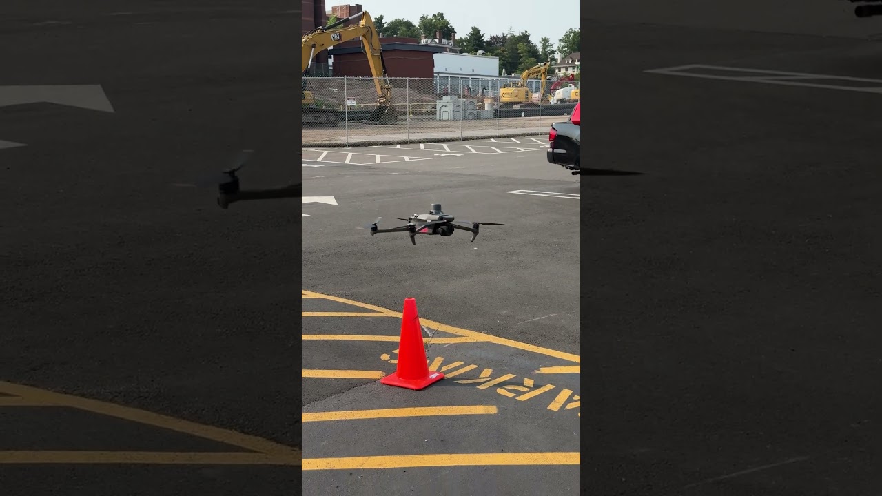
Drone setup for construction earthworks survey!The Drone Life19,159 views | 212 | May 15 2024 16:10:08 (7 comments)[ Read more … ]
On location today setting up for some drone earthworks mapping! The importance of proper grading design and procedures on a construction site can’t be overstated. Although particularly important within civil engineering projects, earthworks touch every sector of the construction industry — from residential, to commercial, to mixed-use and more. Learn more about the challenges for earthworks contractors 👉 Top 5 Challenges for Earthworks Contractors and How Drones Will Solve Them 🔗 https://thedronelifenj.com/earthworks-contractors-how-drones-solve/
#earthworks #contractors #drones
►Our Must-Have Drone Equipment Checklist
✅ Budget Friendly Ground Control Points (GCPs) – http://bit.ly/3nAT2pH
✅ Drone Mapping RTK Base & Rover GNSS Reciever – https://bit.ly/3Jo526a
✅ Most Reliable SD Card for Drone Mapping – http://bit.ly/3lZOhWn
✅ Heavy Duty Landing Pad – http://bit.ly/3zt1hXA
✅ Collapsable Orange Safety Cones – http://bit.ly/40Tr2fp
✅ OSHA Certified Safety Vest -http://bit.ly/3KsycSt
✅ Wind Speed Anemometer Gauge – http://bit.ly/3ZCaYO5
✅ Best Flight Planning Tablet – http://bit.ly/40Dci4q
✅ Handheld VHF Airband Transceiver – http://bit.ly/40AyLPP
►About The Drone Life
The Drone Life is an industry-leading UAS service provider that provides turnkey aerial data solutions nationwide. We proudly specialize in the industrial, environmental, renewable, and construction industries. Our team consists of highly experienced, dependable, and licensed drone professionals that are committed to safety, quality, and customer success.
Mapping before constructing 👷🏻♂️🎥 @DroneDeploySF #dji #drone #mapping #construction #3dmodelingDJI Enterprise9,713 views | 391 | August 16 2024 15:00:04 (12 comments)[ Read more … ]
Mapping before constructing is key to a successful project! Watch as we use drones for mapping and 3D modeling of a pre-construction work site.
___________________________
3D Model, Mapping, Construction, Surveying, DroneDeploy
Advertisement
How to Choose the Best Drone Mapping Software!UAV Coach6,424 views | 203 | July 12 2024 16:00:00 (6 comments)[ Read more … ]
✏️ Drone Mapping Essentials Online Course: https://uavcoach.com/online-drone-mapping-course/
🗣️ Drone Mapping Essentials Workshops: https://uavcoach.com/in-person-drone-mapping-course/
Discover the best drone mapping software to suit your needs in our latest video! Whether you’re just starting out or looking to upgrade, we cover everything from local-based to cloud-based solutions, including popular options like DroneDeploy, Pix4D, and Agisoft Metashape. Make an informed decision and elevate your drone mapping game!
🎬 Jump to Section
0:00 Introduction
0:25 Understanding Your Needs
0:43 Types of Data Processing Software
2:08 Popular Drone Mapping Software Options
3:03 Key Features to Consider
3:44 Final Thoughts
📨 Become a drone expert and join our free drone industry newsletter w/ 100,000+ subscribers: https://uavcoach.com/news
🖥 Pass the FAA Part 107 test on your first try with our industry-leading test prep course w/ 60,000+ students: https://dronepilotgroundschool.com
🖥 Climb higher in your drone career with our comprehensive drone mapping course: https://uavcoach.com/online-drone-mapping-course/
🖥 Level up your drone piloting skills and become a confident drone pilot: https://uavcoach.com/drone-skill-builder-course/
🖥 Climb higher in your drone career with our comprehensive drone mapping course: https://uavcoach.com/online-drone-mapping-course/
👷♂️ Register for a 2-day drone mapping workshop in one of our 6 locations: https://uavcoach.com/in-person-drone-mapping-course/
📣 We are an FAA-approved test administrator of The Recreational UAS Safety Test (TRUST) which is now required for recreational drone flyers. The test is free, online, and takes less than 30 minutes to complete: https://uavcoach.com/faa-recreational-drone-training/
✳️ UAV Coach provides industry-leading training, education, and news for professionals and hobbyists in the drone industry. We offer online and in-person training — over 60,000 people have used our flagship training course, Drone Pilot Ground School, to pass the FAA Part 107 remote pilot certification exam. And we’ve delivered hands-on flight training to more than 2,500+ new drone pilots. Our mission is to help push the drone industry forward by sharing years of knowledge to help drone pilots be safe and smart operators.
Advertisement
About the Author
Patryk Alexander is an associate copy editor at 4kVideoDrones.com, where he sharpens articles and helps keep the website's content clean and error-free. With a background in creative writing, Patryk brings a unique perspective to his editing that helps make 4kVideoDrones.com's content engaging and informative. When he's not editing or writing, Patryk enjoys spending time with his family and exploring the great outdoors.