Autonomous Drone Mapping: Revolutionizing Data Capture 🚀
Senior Associate Copy Editor
Soar into the future of mapping! Autonomous drones unlock precision data. Click to explore!
Soar Above the Ordinary: Unveiling Autonomous Drone Mapping Missions
The hum of the motors, a faint whisper against the wind, is the soundtrack to a data revolution. Autonomous drone mapping isn’t just about getting birds-eye views anymore; it’s about precision, efficiency, and unlocking insights previously obscured by time and manual processes. As a seasoned drone pilot, I’ve witnessed firsthand the transformative power of these missions. Imagine a construction site where progress is meticulously tracked with every automated flight, or vast agricultural fields analyzed for crop health with unparalleled detail. The videos we’ve curated here offer a glimpse into this exciting frontier, showcasing how readily available technology is empowering users to capture and utilize spatial data in groundbreaking ways. Ready to see how autonomous drones are rewriting the rules of data capture? Let’s explore the key insights.
Key Takeaways from Autonomous Drone Mapping Experts
Democratizing Drone Mapping: Believe it or not, you don’t always need expensive, specialized software to create accurate maps. As demonstrated in "Turn Your DJI Drone Into A Mapping Machine For FREE!", clever utilization of waypoint features within the DJI Fly app, coupled with free processing software like Reality Capture, can transform consumer drones like the Mavic 3 and Mini series into capable mapping tools. This opens the door for smaller businesses and individuals to access professional-grade mapping capabilities without a hefty financial barrier. Think about the crisp morning air as you launch a mission, the drone diligently following its pre-programmed path, capturing overlapping images – all without constant stick inputs.
Construction Revolutionized: The video "Drone Mapping for Construction: Complete Guide" vividly illustrates the practical benefits of autonomous drone mapping in the construction industry. Orthomosaic maps, generated from autonomous flights, become invaluable communication tools. Imagine project managers, architects, and clients all viewing the same high-resolution, georeferenced map, facilitating clearer discussions on progress, potential issues, and material stockpiles. The video details flight planning using software like DroneDeploy, emphasizing the importance of overlapping images and consistent flight parameters for accurate results. The midday sun glinting off freshly poured concrete, captured precisely from above – this level of detail was previously time-consuming and costly to obtain.
Small Drone, Big Potential: The "The DJI Mini 3 Just Got BETTER | DJI Mini 3 Photogrammetry" video highlights a significant advancement: SDK support for smaller, more accessible drones like the DJI Mini 3. This unlocks the power of third-party apps like Dronelink, enabling automated mission planning and execution for photogrammetry. The significance? Previously, complex mapping missions often required larger, more expensive platforms. Now, even the compact Mini 3 can autonomously capture the necessary data for creating detailed 3D models, expanding the reach of professional drone mapping into new sectors and applications. Envision the gentle whir of the Mini 3 as it executes a precise grid pattern, the integrated camera capturing the subtle variations in a farmer’s field, all orchestrated autonomously.
Beyond Aerial Photography: The Essence of Autonomy: While not strictly drone mapping, the "DIY Autonomous GPS Mower – Parts List, Schematics, Build Details" video provides a fascinating perspective on the underlying principles of autonomous navigation. It demonstrates how GPS technology, coupled with open-source autopilot systems like Cube Orange (though potentially overkill for mapping), can enable machines to perform tasks without direct human control. This highlights the core technological foundation upon which autonomous drone mapping relies. Think of the meticulous coding and component integration, the silent promise of a machine following a digital path – this same principle empowers our mapping drones.
Unlocking Autonomous Potential with Software: The "DJI Mini 2 – Create Waypoints & Plan Autonomous Flights With Litchi | DansTube.TV" video showcases how third-party applications like Litchi extend the capabilities of even entry-level drones like the DJI Mini 2. By enabling waypoint-based autonomous missions, these apps empower users to pre-plan precise flight paths for capturing specific areas of interest. This moves beyond simple video capture to controlled data acquisition. Picture the precise coordinates being entered into the app, the drone then faithfully executing the flight, capturing imagery for a specific purpose, the cool morning dew on the grass as it takes off.
Combining Mission Types for Comprehensive Data: For advanced applications, the video "Fly a Mapping and Facade Mission to Create Orthos and 3D Models with WebODM Lightning" demonstrates the power of combining different autonomous mission types. Using Dronelink, users can plan missions that incorporate both nadir (straight down) shots for orthomosaics and oblique (angled) shots for capturing vertical structures (facades). This comprehensive approach, coupled with open-source processing software like WebODM Lightning, allows for the creation of highly detailed 3D models. Imagine the drone seamlessly transitioning from a top-down mapping grid to orbiting a building, capturing the intricate details of its facade – a testament to sophisticated autonomous control.
Charting the Course: Autonomous Missions and the Future of Spatial Data
The convergence of accessible drone technology, intuitive flight planning software, and powerful processing capabilities is accelerating the adoption of autonomous drone mapping. We’re moving beyond simply capturing images to orchestrating intelligent data acquisition missions. The trends are clear: smaller drones are gaining sophisticated autonomous capabilities, open-source software is democratizing access to advanced processing, and the integration of different mission types is enabling more comprehensive data capture. Looking ahead, we can anticipate even greater levels of autonomy, with drones capable of adapting to environmental conditions and making real-time adjustments to their flight paths. The potential for artificial intelligence to further optimize mission planning and data analysis is immense, promising even more efficient and insightful applications in the years to come.
Time to Take Flight: Explore the Autonomous Mapping Revolution
These videos offer valuable insights into the practical applications and technological advancements driving the autonomous drone mapping revolution. Scroll down to explore the video highlights and witness firsthand how these missions are transforming industries and unlocking the power of spatial data. The future of data capture is airborne, and it’s intelligently autonomous.
Continue reading to see the videos
Turn Your DJI Drone Into A Mapping Machine For FREE!Dylan Gorman193,904 views | 8,269 | November 8 2024 18:00:27 (528 comments)[ Read more … ]
Discover how to transform your DJI Mavic 3, Air 3, or Mini 4 Pro into a powerful mapping tool without spending a dime on expensive software. This guide unveils the best free drone mapping solutions, allowing you to create professional-grade 2D maps and 3D models.
Become a MASTER at drone mapping with our extensive online course: https://www.pilotbyte.com/drone-mapping-mastery
BEST DRONES TO USE WITH THIS WORKFLOW: DJI Mavic 3 Classic: https://amzn.to/4figwWC DJI Mavic 3 Pro: https://amzn.to/4ff4EEP DJI Air 3: https://amzn.to/3Avugy8 DJI Mini 4 Pro: https://amzn.to/3YGMWmp
Access to sample data: https://bit.ly/4hE9UDo — ► Join us on Pilot Byte! Our platform provides current and aspiring drone operators with information and resources to promote growth and development in the drone industry: https://www.pilotbyte.com
► Subscribe to my channel here: https://www.youtube.com/c/dylangorman — My Camera Equipment! Canon R5: https://amzn.to/36YsAP1 Canon 24-70 2.8L: https://amzn.to/2S2KVCK Rode Microphone: https://amzn.to/3pfokiM Drone: https://amzn.to/3x9GHLW __ Follow me online!
— Chapters 00:00 Intro 01:17 Why Can’t You Use 3rd Party Apps Anymore? 02:22 How To Get Any DJI Drone To Map Autonomously 02:52 Compatible Drones 03:40 Getting Our Drones Ready For Mapping 05:00 Mission Planning 07:40 Mission Upload To DJI FLY App 10:26 Capturing Data Live In The Field Autonomously 13:58 Processing A 2D & 3D Model For FREE 17:06 Master Drone Mapping Online 17:42 Closing
Drone Mapping for Construction: Complete GuideThe Drone Life323,937 views | 9,094 | November 17 2021 22:43:05 (170 comments)[ Read more … ]
Claim Your FREE GUIDEBOOK to Using Drones in Construction 👇 https://bit.ly/42MY2b9
In this video, you will learn what are orthomosaic drone maps, the benefits of drone mapping in construction, and how to map a construction site using a drone.
So if you are a construction company looking to get started in drone mapping or if you’re a pilot looking to expand your service offerings, this video is for you.
We’ve been producing 2D orthomosaic maps at this 500,000 Sq Ft warehouse job site. These maps are greatly beneficial for improving communication, planning construction phases, keeping records, monitoring progress, and sharing with project stakeholders.
Using a Mavic 2 Pro drone and mapping software Dronedeploy, we’re going to share our mapping workflows, best practices, and tips!
►Resources ➡️ Start Your FREE 14-Day DroneDeploy Trial Now – http://bit.ly/3EPADdN
►Our Must-Have Drone Equipment Checklist ✅ Budget Friendly Ground Control Points (GCPs) – http://bit.ly/3nAT2pH ✅ Most Reliable SD Card for Drone Mapping – http://bit.ly/3lZOhWn ✅ Heavy Duty Landing Pad – http://bit.ly/3zt1hXA ✅ Collapsable Orange Safety Cones – http://bit.ly/40Tr2fp ✅ OSHA Certified Safety Vest -http://bit.ly/3KsycSt ✅ Wind Speed Anemometer Gauge – http://bit.ly/3ZCaYO5 ✅ Best Flight Planning Tablet – http://bit.ly/40Dci4q ✅ Handheld VHF Airband Transceiver – http://bit.ly/40AyLPP
►About The Drone Life The Drone Life is an industry-leading UAS service provider that provides turnkey aerial data solutions nationwide. We proudly specialize in the industrial, environmental, renewable, and construction industries. Our team consists of highly experienced, dependable, and licensed drone professionals that are committed to safety, quality, and customer success.
►Chapters 0:00 Intro 0:34 What are orthomosaic drone maps? 1:21 Benefits of drone mapping 3:58 Flight planning 14:28 Flying the site 18:49 Conclusion
#dronemapping #dronesinconstruction #construction
The DJI Mini 3 Just Got BETTER | DJI Mini 3 PhotogrammetryDylan Gorman197,583 views | 4,059 | April 22 2023 16:30:06 (413 comments)[ Read more … ]
The DJI Mini 3 has finally received its long-awaited SDK support which now allows it to work with 3rd party software. Unleash the potential of this compact powerhouse for industries like aerial photogrammetry, agriculture, and more. Watch as we demonstrate the versatility of the DJI Mini 3, showcasing its first 3rd party app integration, and offering insights into the future of drone technology.
— ► Join us on Pilot Byte! Our platform provides current and aspiring drone operators with information and resources to promote growth and development in the drone industry: https://www.pilotbyte.com
► Subscribe to my channel here: https://www.youtube.com/c/dylangorman — My Camera Equipment! Canon R5: https://amzn.to/36YsAP1 Canon 24-70 2.8L: https://amzn.to/2S2KVCK Rode Microphone: https://amzn.to/3pfokiM Drone: https://amzn.to/3x9GHLW __ Follow me online!
LinkedIn: https://www.linkedin.com/in/dylan-g-099961101/ Instagram: https://www.instagram.com/dylang_1 — Chapters 00:00 Intro 01:03 Mini 3 SDK Support 01:42 What you need to fly automated missions 02:42 Mission planning with Mini 3 05:11 Air2s Giveaway & Virtual Workshop Info 06:08 Automated data capture with Mini 3 07:57 Processed Mini 3 data review 11:19 Key takeaways 12:08 Outro
DJI Mini 3, Mini 3 Mapping, Mini 3 Photogrammetry, Mini 3 Pro, Mini 3 Pro Mapping, Mini 3 Pro Photogrammetry
DIY Autonomous GPS Mower – Parts List, Schematics, Build DetailsNathanBuildsDIY181,832 views | 3,185 | March 8 2023 21:53:57 (403 comments)[ Read more … ]
This is a follow on video to my previous overview Autonomous GPS powered mower. Jump to 2:00 to get right into the details.
BOM – Total $1301 cube orange costs more than 1/2 of that, I had one from a separate project so my build was less than $1000, you may be able to use a much cheaper pixhawk autopilot instead to get the cost below $1k 1 20A Cytron mdd20a dual motor controller (ESC) – $36 (https://www.amazon.com/gp/product/B08JFXBHXH/ref=ppx_yo_dt_b_search_asin_title?ie=UTF8&psc=1) 1 cube orange, 1 here 3+ GPS, 1 900MHz radio – $679 (https://irlock.com/collections/combos/products/combo-cube-orange-w-here3-rfd900x-telemetry-set) 2 Bemonoc 24V 350W MY1016Z3 electric motor with 9 tooth sprocket – $192 (https://www.amazon.com/gp/product/B06XH56PK7/ref=ppx_yo_dt_b_search_asin_title?ie=UTF8&psc=1) 1 3s battery – $30 (https://www.amazon.com/GOLDBAT-2200mAh-Airplane-Quadcopter-Helicopter/dp/B07W7CW6NV/) ethernet cable – $5 4 utility wheels – $120 (https://www.amazon.com/gp/product/B07S24TWLG/ref=ppx_yo_dt_b_search_asin_title?ie=UTF8&psc=1) 1/2″ rod (axle) – $7 (https://www.amazon.com/Forney-49359-Round-Rolled-Carbon/dp/B003X5MBME/) 1 1/8 inside diam pipe – $10 (https://www.amazon.com/1-25-Wall-Steel-Seamless-Tubing/dp/B0BLTVFZ96/) angle iron (bed frame) – Free, go to your recycling center/dump or side of road 8 ball bearings – $24 (https://www.amazon.com/gp/product/B08SH67QKX/ref=ppx_yo_dt_b_search_asin_title?ie=UTF8&psc=1) Use the outside diameter of this to determine the inside diameter of the steel pipe above 4 bike sprocket – $56 (https://www.amazon.com/gp/product/B000AO7I24/ref=ppx_yo_dt_b_asin_title_o06_s00?ie=UTF8&psc=1) 4 bike chains – $28 (https://www.amazon.com/gp/product/B0089WXYHW/ref=ppx_yo_dt_b_search_asin_title?ie=UTF8&psc=1) bag of washers (1/2″ inside diam, 2″ outside diam) – $14 (20ct) (https://www.amazon.com/Stainless-Washer-Finish-Nominal-Thickness/dp/B009OL5ARY/) You can probably get a better price at your local hardware store 1 bike chain tool (to link up chains) – $10 (https://www.amazon.com/gp/product/B0179JC31I/ref=ppx_yo_dt_b_search_asin_title?ie=UTF8&psc=1) 12v wire – $5 18 gauge wire – $5 car battery – $50 Push Mower – $30 (Craigslist or FB Marketplace – used)
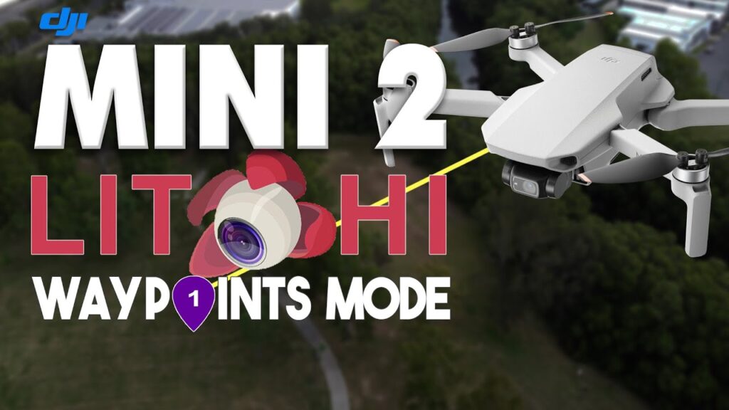
DJI Mini 2 – Create Waypoints & Plan Autonomous Flights With Litchi | DansTube.TVDansTube.TV58,818 views | 623 | January 31 2022 12:03:36 (151 comments)[ Read more … ]
The DJI Mini 2 recently received a major update – you can now use waypoints with your Mini 2. All you have to do is download the Litchi app and then you can start planning autonomous missions. Litchi and the Mini 2 are only compatible with Android devices at the moment, an iOS version should be available in April. Sign up to the ultimate online drone course for beginners: https://fearlessdrone.academy/ 🚀 (Use code: “DANSTUBE” to save 10%).
Litchi is a flight controller for your DJI drones. Litchi allows you to plan autonomous flight missions, create waypoints, panoramas, orbits, and even use tracking/follow modes with a variety of DJI drones. Download Litchi: https://flylitchi.com/
If you are looking for the latest drone news, reviews, comparisons, tips, and giveaways then you are in the right place – I have been called Dan the drone man on way too many occasions 😂 DansTube.TV is the best DJI drone channel on YouTube and Dan is the leading drone expert in Australia – you can expect videos on the #Mavic3, #Air2S, #Mini3, Mavic 2 Pro, Mavic Air 2, Mavic Mini, Mini 2, Mini SE and more 🚀📷 Get 10% off your drones and accessories with http://bit.ly/D1DansTubeTV (code: DANSTUBE).
Shop fresh new drone merch: https://eyeinthesky.creator-spring.com/ 🚀 ——————————— Subscribe to DansTube.TV: https://www.youtube.com/channel/UCa10m04VDy8yJghT3eJET9Q?sub_confirmation=1 ⭐ ——————————— Connect With Me 👉 https://linktr.ee/danstubetv My YouTube Filming Gear 👉 https://www.amazon.com/shop/danstubetv
Email: hello@danstube.tv Subscribe, Like and Comment. ——————————— Amazon & DJI affiliate disclosure: I do receive a small amount of commission if you purchase a product using my Amazon or DJI links. Purchasing through my links adds NO additional cost to your purchase. #CommissionsEarned ———————————
Fly a Mapping and Facade Mission to Create Orthos and 3D Models with WebODM LightningDronelink14,938 views | 199 | December 13 2022 17:26:00 (10 comments)[ Read more … ]
Learn how to create and fly a combined mapping and facade mission with Dronelink, to capture data autonomously, for processing into orthomosaics, point clouds and 3D models with WebODM Lightning. View data output with QGIS and CloudCompare.
Deals for WebODM and Dronelink: WebODM Lighting users get 20% off Dronelink Professional Plans. Dronelink Users get 1000 free processing credits with WebODM Lighting.
Redeem Promo and Discount here: https://dronelink.com/webodm
Dronelink allows you to create mission plans with maps, facades (vertical maps), waypoints, obits and more to automate flight and data capture with the most popular drones.
See supported drones here: https://support.dronelink.com/hc/en-us/articles/360025829933-What-are-the-system-requirements-
0:00 – Intro 00:24 – Map Mission Planning 00:39 – Continue Mission Planning in Mobile 01:00 – Duplicate Map and Setup Crosshatch for better 3D models 01:12 – Add Facade Missions around Structures 01:36 – 3D Mission Preview 01:51 – Fly Mission to Capture Data and Resume after Battery Swap 02:15 – Upload to WebODM Lightning for Processing 02:34 – Download and Review Processing Output Files 03:08 – Open Maps and Models in QGIS and CloudCompare
About the Author
Patryk Alexander is an associate copy editor at 4kVideoDrones.com, where he sharpens articles and helps keep the website's content clean and error-free. With a background in creative writing, Patryk brings a unique perspective to his editing that helps make 4kVideoDrones.com's content engaging and informative. When he's not editing or writing, Patryk enjoys spending time with his family and exploring the great outdoors.