Capturing the World, Pixel by Pixel: Drone Orthomosaics Take Flight
The drone revolution isn’t just about cool aerial shots; it’s fundamentally changing how we interact with and understand our physical world, especially in industries like construction. Imagine stitching together hundreds of high-resolution aerial images, like a massive, digital jigsaw puzzle, to create a single, geometrically accurate map: that’s the power of orthomosaics. These aren’t just pretty pictures; they are precise, measurable representations of a site, offering unparalleled insights for planning, progress tracking, and collaboration. This collection of YouTube videos explores the nuts and bolts of drone orthomosaics, how they’re created, and how they’re reshaping construction and beyond. We’ll dive into practical workflows, software, and the exciting future of this tech. It’s a deep dive into how this technology is not just a passing fad, but a fundamental shift in how we document and manage our projects.
Key Insights From the Sky
Orthomosaics Defined: An orthomosaic is a geometrically corrected aerial photograph where distortions caused by camera angle, lens, and terrain have been removed, resulting in a true-to-scale map. This means you can measure distances, areas, and volumes directly from the image.
Construction Game Changer: Drone mapping significantly improves communication, planning, and record-keeping on construction sites. Orthomosaics allow for detailed monitoring of progress, identification of potential issues early on, and seamless sharing of information with all project stakeholders.
Workflow Essentials: Creating orthomosaics involves meticulous flight planning, careful data acquisition with drones like the Mavic 2 Pro, and processing the images with specialized software, such as DroneDeploy and Drone Harmony.
Software Power: Software is key to orthomosaic creation. Tools like DroneDeploy offer automated flight planning and image processing, while Drone Harmony provides free options for beginners, particularly those using DJI Mini and Air series drones.
Beyond Construction: While construction is a major application, orthomosaics are also valuable in various fields, from environmental monitoring and agriculture to urban planning, where they enable detailed analysis of land use and infrastructure.
Deep Learning Integration: Emerging technologies like deep learning are being used to automatically identify and extract features from orthomosaics, such as buildings, further enhancing the value of these maps.
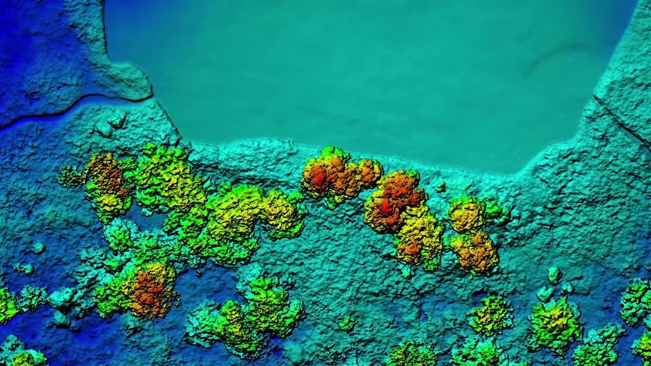
From Pixels to Models: Orthomosaics are not just 2D maps; they’re the foundation for creating 3D models, Digital Terrain Models (DTM), and Digital Surface Models (DSM), offering even more comprehensive data.
Budget-Friendly Entry: You don’t need top-of-the-line equipment to start exploring drone orthomosaics. Software like Drone Harmony allows entry-level drones to produce high-quality results.
Efficiency and Precision: Drone mapping is far more efficient and accurate than traditional surveying methods, saving time and resources while providing a more detailed view of a site.
Progress Monitoring: Orthomosaics are ideal for tracking construction progress over time, allowing for more effective project management and helping keep projects on schedule and within budget.
The Future is Mapped
The future of orthomosaics is bright, with several trends pointing towards even more powerful applications. We’re seeing increased integration of artificial intelligence to automatically analyze and extract data from these maps. Imagine a future where algorithms identify structural weaknesses or predict potential risks just by analyzing a drone-captured image. The accessibility of drone technology and processing software is also continually improving, making it easier for more people to get involved. We’ll also see the technology being applied to new areas, such as infrastructure inspection, disaster response, and even precision agriculture, where orthomosaics can provide detailed information about crop health and yield.
Dive Deeper Into the Data
Drone orthomosaics are transforming how we see and interact with the world around us. The ability to create accurate, measurable maps from the air is a game-changer, and the videos below offer a fantastic glimpse into this exciting technology. Scroll down to explore the highlights and see how these aerial perspectives are pushing the boundaries of construction and beyond.
Watch the selected videos below
Drone Mapping for Construction: Complete GuideThe Drone Life325,916 views | 9,151 | November 17 2021 22:43:05 (170 comments)[ Read more … ]
Claim Your FREE GUIDEBOOK to Using Drones in Construction 👇 https://bit.ly/42MY2b9
In this video, you will learn what are orthomosaic drone maps, the benefits of drone mapping in construction, and how to map a construction site using a drone.
So if you are a construction company looking to get started in drone mapping or if you’re a pilot looking to expand your service offerings, this video is for you.
We’ve been producing 2D orthomosaic maps at this 500,000 Sq Ft warehouse job site. These maps are greatly beneficial for improving communication, planning construction phases, keeping records, monitoring progress, and sharing with project stakeholders.
Using a Mavic 2 Pro drone and mapping software Dronedeploy, we’re going to share our mapping workflows, best practices, and tips!
►Resources ➡️ Start Your FREE 14-Day DroneDeploy Trial Now – http://bit.ly/3EPADdN
►Our Must-Have Drone Equipment Checklist ✅ Budget Friendly Ground Control Points (GCPs) – http://bit.ly/3nAT2pH ✅ Most Reliable SD Card for Drone Mapping – http://bit.ly/3lZOhWn ✅ Heavy Duty Landing Pad – http://bit.ly/3zt1hXA ✅ Collapsable Orange Safety Cones – http://bit.ly/40Tr2fp ✅ OSHA Certified Safety Vest -http://bit.ly/3KsycSt ✅ Wind Speed Anemometer Gauge – http://bit.ly/3ZCaYO5 ✅ Best Flight Planning Tablet – http://bit.ly/40Dci4q ✅ Handheld VHF Airband Transceiver – http://bit.ly/40AyLPP
►About The Drone Life The Drone Life is an industry-leading UAS service provider that provides turnkey aerial data solutions nationwide. We proudly specialize in the industrial, environmental, renewable, and construction industries. Our team consists of highly experienced, dependable, and licensed drone professionals that are committed to safety, quality, and customer success.
►Chapters 0:00 Intro 0:34 What are orthomosaic drone maps? 1:21 Benefits of drone mapping 3:58 Flight planning 14:28 Flying the site 18:49 Conclusion
#dronemapping #dronesinconstruction #construction
Advertisement
How Drone Mapping and 2D Orthomosaics is Revolutionizing Construction ProjectsAerial Aspectz100 views | 1 | December 16 2024 16:00:41 (0 comments)[ Read more … ]
Discover how drone mapping and 2D orthomosaics are revolutionizing the construction industry! In this video, we explore the power of high-resolution aerial imagery, showing how it enhances construction planning, boosts accuracy, and fosters seamless collaboration among teams.
Learn about the cutting-edge tools and software that make 2D orthomosaics possible, while understanding their benefits compared to traditional mapping methods. We’ll dive into real-life examples of successful projects and discuss the future trends in drone technology that promise even greater efficiency.
00:00 Introduction to Drone Mapping and 2D Orthomosaics 00:45 What is a 2D Orthomosaic? 01:31 Benefits of Using Drone Mapping for Construction Site Surveys 02:35 Creating 2D Orthomosaics from Drone Imagery 03:16 How 2D Orthomosaics Enhance Precision in Construction Planning 04:31 How 2D Orthomosaics Are Used in Large-Scale Projects 05:16 Software & Tools for Creating 2D Orthomosaics 05:58 Drone Mapping for Progress Monitoring & Project Documentation 06:39 How Drone Mapping Will Evolve in Construction 07:18 Conclusion
Advertisement
How to Use DroneDeploy to Create an Orthomosaic Mapdronegenuity48,201 views | 753 | December 3 2019 19:32:29 (25 comments)[ Read more … ]
A step-by-step tutorial on how to create an orthomosaic map using DroneDeploy. See the full article here → https://www.dronegenuity.com/create-orthomosaics-dronedeploy/ ⬇︎SHOW MORE⬇︎
What is an Orthomosaic? Orthomosaic Maps & Orthophotos Explained (article) ▸ https://www.dronegenuity.com/orthomosaic-maps-explained/
DroneDeploy Troubleshooting – How To Connect Your Drone (article) ▸ https://www.dronegenuity.com/dronedeploy-troubleshooting-connect-drone/
About Dronegenuity is a leading nationwide provider of aerial drone photography, video production, and mapping services. We operate across a wide range of industries including real estate & development, construction & engineering, energy, financial services, and work with thousands of skilled pilots in North America.
💡Learn More – https://www.dronegenuity.com/
_________________________________________
🚁Apply to be a Drone Pilot – https://www.dronegenuity.com/pilot-application/
📰Join our newsletter – https://conta.cc/2L7sMjz
_________________________________________
You May Also Like:
What is an Orthomosaic? Orthomosaic Maps & Orthophotos Explained https://youtu.be/g8mapLUXyGI
How Big Can You Print A Drone Photo? https://youtu.be/FYTlrPJY7Es
How to Take Amazing HDR Drone Photos & Save Time Editing https://youtu.be/4u5FdDeexj0
Point of Interest Tutorial https://youtu.be/ou2iV0u-U2o
What does a drone see from 400, 300, 200, and 100 feet? https://youtu.be/JIfLuTQbCJ8
How to Take Amazing Long Exposure Photos – DJI Drones https://youtu.be/CvE7lAlPZYw
How to Take Great Drone Photos https://youtu.be/54qv-3EPTvE
How to Connect Your Drone to DroneDeploy https://youtu.be/YtGxdAMFFd4
Best Camera Settings – DJI Mavic Pro https://youtu.be/D8EIkoHRi0Q
DroneDeploy Review – Aerial 3D Mapping Software https://youtu.be/i2vJYv0aIcE
Controller Display Screen Overview – DJI Mavic Pro https://youtu.be/W4xC2GCWTgE
Drone Beginner Essentials: Mapping and Orthomosaics on a Budget | Drone HarmonyJust Tech Guy Things566 views | 8 | October 6 2022 18:54:27 (2 comments)[ Read more … ]
Did you just buy your first drone to augment your mapping and inspection work but have no idea of what software or how to do it? Drone Harmony’s free plan is a great start to those of us who chose the DJI Mini and Air series (Mini 2, Air 2, Air 2S) and offers a decent amount of functionality for free with room to grow. This video covers the data acquisition portion, a processing video will come soon so get subscribed.
Songs (in order of appearance): Top Flow – Emotional & Abstract Epic Pop Music
AliveSound – Through The Sky https://tunetank.com/track/3878-through-the-sky
Amazon Wishlist: Always sort by lowest price if you’d like to get me something. 3D Printer filament is always needed here. https://www.amazon.com/hz/wishlist/genericItemsPage/EGNFONB6G0RW?type=wishlist&filter=all&sort=price-asc&viewType=list
Tips: https://withkoji.com/@JustTechGuyThings
Advertisement
Deep Learning tools in Building Detection from Drone & Satellite imageryARQIsolution studios32,855 views | 266 | March 9 2022 15:02:50 (4 comments)[ Read more … ]
Satellite imagery and orthomosaics developed from drone imagery can contain a wealth of information.
With improvements in computing power and new, accessible tools for deep learning, one can easily train a detector to do the work of identifying and extracting these features from imagery with ease.
#Deeplearning #Machinelearning #Drones #AEC
Advertisement
Drone mapping tutorial -flying, processing, Orthomosaic, DTM, DSM, 3D , Point cloud, NVDI,Rasika Kahandagamage RSP10,026 views | 42 | May 7 2017 17:08:07 (2 comments)[ Read more … ]
2D or Orthomosaic map, Digital Terrain Model (DTM), Digital Surface model (DSM), 3D map, Point cloud, Normalized Difference Vegetation Index (NVDI), Learn about US Drone Strikes, DroneDeploy: Powerful Drone & UAV Mapping Software, Mapping Drones, Commercial Drone Platform, Introduction To UAV Photogrammetry, Drones for Surveying, Pix4D – Drone Mapping Software for Desktop + Cloud + Mobile, Maps Made Easy – Drone Mapping, Drone Mapper Imagery Processing, Aerial Mapping Drones, UAV Drones: Introduction to 3D mapping, DJI Drones ,The Best Drones, drone mapping and photogrammetry, Aerial Surveying with a Drone and Photogrammetry, Drone Mapping and Photogrammetry, UAV Mapping and Photogrammetry, Photogrammetry, Drone Photogrammetry, Creating 3D Model with Phantom 4, Photogrammetry Mapping. Agisoft, drone mounted lidar, lidar drone cost, best drone for photogrammetry, uav photogrammetry software, best camera for uav photogrammetry, uav mapping software, uav photogrammetry for mapping and 3d modeling, Introduction To UAV Photogrammetry, Drone 3D, photogrammetry Tips, agisoft photoscan photogrammetry, Photoscan Tutorial, Generate a 3D model from photos using Agisoft PhotoScan, Generate a 3D model from photos using Agisoft PhotoScan, Photogrammetry tutorial,
Advertisement
About the Author
Patryk Alexander is an associate copy editor at 4kVideoDrones.com, where he sharpens articles and helps keep the website's content clean and error-free. With a background in creative writing, Patryk brings a unique perspective to his editing that helps make 4kVideoDrones.com's content engaging and informative. When he's not editing or writing, Patryk enjoys spending time with his family and exploring the great outdoors.