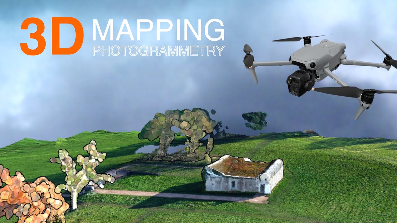
Unlock the Skies: Free Drone Mapping with Your DJI Mini 2 – No Cost, Just Pure Aerial Potential! 🗺️
For us drone enthusiasts, the DJI Mini 2 is a pocket-sized powerhouse. I remember the thrill of unboxing mine – so compact, yet packing serious photographic punch. But beyond stunning photos and smooth cinematic video, did you know this little bird can unlock a whole new dimension: aerial mapping? Forget hefty software subscriptions and complicated workflows – the digital skies have opened up, and they’re brimming with free tools to transform your Mini 2 into a lean, mean mapping machine.
Intrigued? I’ve been diving deep into the buzzing online community, scouring YouTube for the best tips and tricks. Turns out, fellow drone pilots are pushing the limits of the Mini 2 and sharing their incredible discoveries. From crafting detailed orthomosaic maps to generating immersive 3D models, the ingenuity is contagious. And the best part? Many of these methods are absolutely free. Imagine transforming a simple flight into valuable spatial data – surveying your property, creating digital twins of structures, or even just capturing a unique perspective of your favorite landscapes. Let’s explore the free software and techniques that are making DJI Mini 2 mapping accessible to everyone, transforming hobby flights into powerful aerial surveys. Get ready to see your world from a whole new perspective, without spending a dime extra on software.
Key Takeaways: Free Flight, Free Maps – Your Mini 2’s Hidden Talents Revealed
WebODM: Open Source Powerhouse in Your Corner: Video 1 spotlights WebODM, an open-source software suite, proving you don’t need deep pockets to process drone imagery. This is pure DIY spirit! Imagine, transforming those microSD card images into detailed maps using free software. The video author even tests it in snowy, tricky conditions – proving that even with a manual flight and less-than-perfect captures, WebODM can deliver impressive results. Think about it – realtors showcasing properties, hobbyists documenting their land – all powered by the free might of WebODM and the Mini 2.
Maps Made Easy & Map Pilot Pro: Cloud-Based Simplicity Takes Flight: Videos 2 and 3 rave about Maps Made Easy and its flight app, Map Pilot Pro. The real kicker? It’s cloud-based! No need for a super-powered, expensive computer crunching data for hours. Upload your Mini 2 images, and let their servers do the heavy lifting. And yes, the basic processing is free. This is a game-changer for accessibility. The videos highlight how easy it is to create maps, point clouds, and even 3D models, and it’s not just for DJI drones – impressive versatility right there. Plus, Map Pilot Pro’s drone compatibility is extensive, including the Mini 2 and many others.
Unlock 3D Modeling with Meshroom & Blender: Sculpting Reality Digitally: Video 5 gets into the exciting world of 3D modeling, showing how to harness the open-source giants Meshroom and Blender completely for free. These tools might have a learning curve, but the power they unleash is incredible. Think about turning that Mini 2 footage into detailed 3D replicas of buildings, landscapes, or anything you can fly over. This is where drone mapping goes beyond simple 2D orthomosaics and enters the realm of immersive digital twins – and it’s all within reach without spending a cent on software licenses.
Mapping for More Than Just Maps: Construction & Inspection Potential: Video 4, while featuring DroneDeploy (a paid platform), underscores the real-world value of drone mapping, especially in industries like construction. Orthomosaic maps aren’t just pretty pictures; they are powerful tools for site monitoring, progress tracking, and communication. This video, although not focused on free software, provides crucial context: the mapping capabilities we’re unlocking with our Mini 2 have serious applications. It broadens our horizons, showing that the skills we hone with free tools are directly transferable to valuable professional contexts.
Beyond Content Creation: Inspection Ready Mini 3 Pro (and Mini 2 by Extension): Video 6 shifts focus slightly to the DJI Mini 3 Pro, highlighting its suitability for inspection work and 3D modeling. While it mentions Skand.io software (potential freemium/trial model), the underlying message resonates for Mini 2 users: the Mini series drones are capable of professional-grade outputs beyond just stunning vacation photos. The improved camera of the Mini 3 Pro amplifies these capabilities, but the foundational principles of drone mapping and 3D modeling demonstrated are equally applicable to the Mini 2. It subtly reinforces that even our Mini 2 can contribute to inspection tasks or create basic 3D models, even if with slightly lower resolution than the Pro models.
The Future is Open Source and Sky-High
The drone mapping landscape is rapidly evolving, and what’s truly exciting is the rise of accessible, free, and open-source solutions. We’re witnessing a democratization of aerial data. No longer is drone mapping solely the domain of expensive software suites and specialized professionals. Enthusiasts with a DJI Mini 2 and a thirst for exploration can now contribute to this field, creating valuable spatial data and pushing the boundaries of what’s possible.
Imagine the possibilities: community mapping projects, environmental monitoring by citizen scientists, or simply documenting the changing seasons across your favorite landscapes with precise, georeferenced maps, all generated with your trusty Mini 2 and free software. The videos highlighted here are just the tip of the iceberg. As processing power becomes more accessible and open-source communities thrive, we can expect even more innovation in free drone mapping tools.
Ready to Map Your World for Free?
The proof is in the flight! Dive into these insightful YouTube videos. See these free mapping workflows in action, and then, more importantly, try it yourself! Grab your DJI Mini 2, download some free software, and take to the skies. Unleash the hidden mapping potential of your drone, and discover a whole new dimension to your aerial adventures. The sky’s the limit – and the software is free!
Watch the selected videos below
Free DJI Mini 2 Drone Mapping with WebODM OverviewChris Gardiner Photography20,729 views | 315 | December 29 2021 14:00:10 (52 comments)[ Read more … ]
August 2022 Update: Watch this next about how to get your 3d drone model onto the internet for all to see and enjoy! https://www.youtube.com/watch?v=iMXCP2jbp50
Aerial mapping with your DJI Mini 2 drone is possible, now, in 2022! You don’t need special SDK, software, hosting or subscription plans either. All Free!!
I go over the steps of using WebODM to map a simple set of photos on a small waterfront property.
This was a test project, with the intention of difficult shooting conditions in snowy winter landscape, and irregular captures from manual flight pattern.
These are the results, impressive if you ask me! Totally feasible to make this an add-on service for realtors who want to showcase their properties and more of it’s surroundings, on the internet. It is not without some challenges. Watch this video to see some more information about this amazing ODM – open drone map software!
Thanks for watching and please subscribe for more! www.youtube.com/cgardinerphoto
No matter when and where the mess strikes, stay on top of it with this compact, lightweight shop vacuum. The highly portable design is perfect for quick pick-ups around the house. Never before have we offered so much power and versatility in one portable package. The impressive 6.0 peak HP motor can handle any task, and when detached will blow you away.
Drone Photogrammetry Processing for FREE!Geospatial Tips172,272 views | 3,188 | March 31 2023 10:49:35 (120 comments)[ Read more … ]
Use your drone to perform drone mapping and photogrammetry, create maps, point clouds and 3D models for FREE with this MapsMadeEasy tutorial! It’s cloud based, so you don’t need a powerful computer either.
Maps Made Easy makes it so simple for anyone who owns a drone or UAV to use photogrammetry and create a map for free and then share it online! But not just DJI drones, their cloud processing app will process any drone images.
See how it compares to commercial offerings such as Agisoft Metashape and Pix4D.
Autel drones are supported as well in their flying app. It’s amazing what they offer free of charge.
Map Pilot Pro (https://dronesmadeeasy.com/map-pilot) supports all of these drones:
Mini 2 Air 2 Air 2S Air Mavic 3 Enterprise (on M3E remote) Mavic 3 Multispectral (on M3M remote) Mavic 2 (Pro, Zoom, and Enterprise – No SMART CONTROLLER support) Mavic 2 Enterprise Advanced Mavic Pro Phantom 4 Phantom 4 Pro * (v2 included) Phantom 4 Advanced Phantom 4 RTK Phantom 3 Professional Phantom 3 Advanced Phantom 3 Standard Inspire 1 Inspire 1 Pro Inspire 2 M30 (on RC Pro Plus remote) M30T(on RC Pro Plus remote) Matrice 100 (M100) Matrice 200 (M200, including V2) Matrice 210 (M210, including V2) Matrice 210 RTK (M210RTK) Matrice 600 (M600) Matrice 600P (M600P) Autel EVOII ( no “V2” support)
*This is not a sponsored video*
How you can support my work ————————————————-
Book a consulting session with me: https://tinyurl.com/4rz33j2d
Support my work on Buy Me a Coffee: https://buymeacoffee.com/geospatialtips
Hire me on Upwork: https://www.upwork.com/freelancers/~016ba4a9bb38699a0e
00:00 – Looking for a Free Alternative? 00:17 – Map Pilot Pro Image Capture 01:20 – Maps Made Easy Data Processing 09:40 – Global Mapper Additional Processing
Advertisement
Drone Mapping with a DJI mini 2 FOR FREE!Hayden Sill220,541 views | 4,858 | July 11 2022 00:58:14 (227 comments)[ Read more … ]
Maps made easy is a free application that has an android and IOS application that makes mapping with any drone fun and easy. The application is called Map Pilot Pro and the link is below.
Check this out! https://www.amazon.com/dp/B08JGX61H7?ref_=cm_sw_r_ud_dp_67PXZV7ZFJT2VRYCGN83
Thanks for watching!
Advertisement
Drone Mapping for Construction: Complete GuideThe Drone Life326,524 views | 9,166 | November 17 2021 22:43:05 (170 comments)[ Read more … ]
Claim Your FREE GUIDEBOOK to Using Drones in Construction 👇 https://bit.ly/42MY2b9
In this video, you will learn what are orthomosaic drone maps, the benefits of drone mapping in construction, and how to map a construction site using a drone.
So if you are a construction company looking to get started in drone mapping or if you’re a pilot looking to expand your service offerings, this video is for you.
We’ve been producing 2D orthomosaic maps at this 500,000 Sq Ft warehouse job site. These maps are greatly beneficial for improving communication, planning construction phases, keeping records, monitoring progress, and sharing with project stakeholders.
Using a Mavic 2 Pro drone and mapping software Dronedeploy, we’re going to share our mapping workflows, best practices, and tips!
►Resources ➡️ Start Your FREE 14-Day DroneDeploy Trial Now – http://bit.ly/3EPADdN
►Our Must-Have Drone Equipment Checklist ✅ Budget Friendly Ground Control Points (GCPs) – http://bit.ly/3nAT2pH ✅ Most Reliable SD Card for Drone Mapping – http://bit.ly/3lZOhWn ✅ Heavy Duty Landing Pad – http://bit.ly/3zt1hXA ✅ Collapsable Orange Safety Cones – http://bit.ly/40Tr2fp ✅ OSHA Certified Safety Vest -http://bit.ly/3KsycSt ✅ Wind Speed Anemometer Gauge – http://bit.ly/3ZCaYO5 ✅ Best Flight Planning Tablet – http://bit.ly/40Dci4q ✅ Handheld VHF Airband Transceiver – http://bit.ly/40AyLPP
►About The Drone Life The Drone Life is an industry-leading UAS service provider that provides turnkey aerial data solutions nationwide. We proudly specialize in the industrial, environmental, renewable, and construction industries. Our team consists of highly experienced, dependable, and licensed drone professionals that are committed to safety, quality, and customer success.
►Chapters 0:00 Intro 0:34 What are orthomosaic drone maps? 1:21 Benefits of drone mapping 3:58 Flight planning 14:28 Flying the site 18:49 Conclusion
#dronemapping #dronesinconstruction #construction
Advertisement
DJI Mini 2 | Make a 3D Model for free with dronesIulian Praz25,535 views | 734 | November 2 2021 07:57:37 (63 comments)[ Read more … ]
Hi there. In today’s tutorial we are going to learn how to “Make a 3D Model for Free with drones” and two open source softwares Meshroom and Blender. Thanks for supporting my channel.
Meshroom download link : https://alicevision.org/#meshroom Blender download link : https://www.blender.org/download/ The music I use : https://www.epidemicsound.com/referral/bkia02
DJI Mini 2 | How to create a 3D Map : https://youtu.be/GxpNwJEcJLE DJI Mini 2 | How to create a 3D Map updated and upgraded : https://youtu.be/wb_i8dvYXXc
We made this 3D model with the DJI Mini 3 Pro!UAVISUALS95,632 views | 2,153 | July 25 2022 23:30:12 (76 comments)[ Read more … ]
Not just for content creators!… did you know you can use the DJI Mini 3 Pro for inspection work and create 3D models (digital twins)!?
The Mini 3 has four times the resolution of its predecessor (Mini 2) in terms of megapixels, producing amazing photos for content creators, real estate photography, or even inspection work. Is this the ultimate roof inspection drone?
This tiny house 3D model was completely shot by a DJI Mini 3 Pro & using state of the art inspection software.
Interested in our Drone Masterclasses? Check out our courses here: https://dronemasterclassacademy.com/drone-inspections-sales
Chapters: 0:00 Intro 1:17 Features of the Mini 3 Pro 1:49 Inspection work 2:53 Making 3D models 4:06 Capture Process 5:40 Software
3D modeling Software: https://skand.io/ (Extra 100GB of storage for new subscribers to the platform with mention of ‘UAVSUALS’)
Buy the Mini 3 here: https://click.dji.com/APsiVyO9WnA2K7tzL6dT8g?pm=link
Patryk Alexander is an associate copy editor at 4kVideoDrones.com, where he sharpens articles and helps keep the website's content clean and error-free. With a background in creative writing, Patryk brings a unique perspective to his editing that helps make 4kVideoDrones.com's content engaging and informative. When he's not editing or writing, Patryk enjoys spending time with his family and exploring the great outdoors.