Drone Eyes on Infrastructure: Top Picks & Trends ✈️
Ever looked at a skyscraper and wondered how they inspect those dizzying heights for damage? Or a vast bridge network and thought about how they ensure structural integrity across miles of spans? For years, these inspections were risky, time-consuming, and expensive. But the drone revolution has changed everything! This page dives into the insights from top YouTube videos focusing on the best drones for infrastructure inspection, revealing the technology and trends shaping this exciting field. We’ll explore which drones are leading the charge, from budget-friendly options to high-end professional models, and consider the software that makes them truly powerful tools. Get ready for a bird’s-eye view of the future of infrastructure maintenance!
Key Takeaways from Top Drone Inspection YouTube Videos
Drone Mapping is Key: Several videos highlighted the importance of drone-based mapping for creating detailed 3D models and orthomosaics of infrastructure, crucial for identifying potential problems. Software like Pix4D and DroneDeploy were frequently mentioned as industry standards.
Best Drones for the Job: The DJI Mavic 3 Enterprise series and the Autel Robotics EVO II Pro Enterprise V3 consistently appeared as top choices for professional-grade inspections due to their high-resolution cameras, long flight times, and advanced features. For larger areas, fixed-wing drones like the Wingtra One Gen 2 were recommended. Budget-conscious inspectors found suitable options in the sub-$2000 range, though feature sets naturally differed.
Beyond Visual Inspection: Thermal imaging capabilities were repeatedly emphasized, pointing to the ability of drones to detect heat loss, moisture problems, and other hidden structural issues—a major advantage over traditional methods.
Software is Crucial: The videos highlighted that the right software is as important as the drone itself. This includes not only mapping and modeling software, but also software that helps manage flight plans and securely store data.
Soaring Above the Competition: Drone Inspection Trends
The videos clearly show a move towards more integrated solutions, where drones, advanced sensors, and sophisticated software work together seamlessly. We’re seeing the rise of AI-powered analysis, allowing for automated defect detection and faster report generation. This helps bridge the gap between data acquisition and actionable insights, ultimately making inspections more efficient and cost-effective. Furthermore, the increasing adoption of RTK (Real-Time Kinematic) technology is dramatically improving accuracy, giving inspectors confidence in the precision of their findings. The future looks bright for drone inspection – expect to see even greater levels of automation, improved sensor technologies (like LiDAR integration), and more user-friendly software.
Ready for Liftoff?
This quick look at some of the best YouTube resources reveals a dynamic and rapidly evolving field. Whether you’re a seasoned professional or just starting out, the world of drone infrastructure inspection offers incredible opportunities. Scroll down to watch curated video highlights and discover the perfect drone to take your inspection capabilities to new heights!
Check out the videos just below
How to do Drone Mapping | Best Mapping Drones & SoftwareDrone U72,712 views | 2,359 | November 27 2023 23:54:03 (143 comments)[ Read more … ]
🚀 Download your free guide and learn the secrets of drone mapping: https://join.thedroneu.com/optin1635325864490
Check out our Comprehensive Drone Mapping Guide: https://www.thedroneu.com/blog/drone-mapping-guide/ ✈️
Ever wondered how cutting-edge technology is transforming the way we view and interact with our world? Join us in this fascinating journey into the realm of drone mapping as we explore the essentials of this groundbreaking technology.
🌍 Understanding the Basics of Map Quality:
Discover the key elements that contribute to high-quality drone maps. From resolution and accuracy to data processing techniques, we break down the fundamentals that make drone mapping an indispensable tool for various industries.
🛰️ Autonomous Flight Paths: Navigating the Skies with Precision:
Explore the magic behind autonomous flight paths. Learn how drones can navigate and capture data seamlessly, ensuring every inch of your project area is mapped with unprecedented accuracy. We delve into the technology that makes autonomous flights a game-changer for efficiency and data integrity.
💻 Choosing the Right Mapping Software for Your Deliverables:
Not all mapping software is created equal. Join us as we evaluate the top players in the field, examining their features and capabilities. Whether you’re focused on 3D modeling, crop analysis, or construction site mapping, we guide you in selecting the best software based on your unique project deliverables.
🚁 The Best Drones for Drone Mapping:
Explore the skies with confidence using the most advanced drones tailored for mapping applications. From industry giants to compact yet powerful options, we compare and contrast the best drones, considering factors like camera capabilities, flight time, and durability. Make an informed choice for your next mapping mission!
🎓 Knowledge is Power:
Whether you’re a seasoned professional or a curious enthusiast, this video provides a comprehensive understanding of the drone mapping landscape. Elevate your knowledge and skills as we demystify the technology shaping the future of mapping and surveying.
Best Processing Software: Pix4d Mapper
Best Cloud Processing Software: Drone Deploy
Best Rapid Orthomosaic Software: Pix4d React
Best Life Like 3D Modeling Software: Capturing Reality
Best Industrial Mapping Software: Optelos
Best Software to integrate maps with government Entities: ESRI
Yes, you can make life like 3d Models with the Mini 4 Pro and Luma Labs!
Download and listen to the audio version of the Ask Drone U podcast, and get your drone and business related questions answered here: http://askdroneu.com/.
Check out our latest Live Classes for Drone Mapping/Operations
| https://thedroneu.clickfunnels.com/all2020trainingevents |
🔥Drone U Recommended Drones:
Best Travel Drone: https://click.dji.com/ADXzWsLrapRo93aNU2HZ_g?pm=link&as=0001&ch=DUPAAW
Best Video Drone: https://amzn.to/2HnRElC
Best Photography Drone: https://amzn.to/2HjQbg2
🔥Become a Member
Learn why more pilots choose Drone U for learning how to fly and turn your passion into profit. https://www.thedroneu.com/become-a-member/
Subscribe to the podcast on iTunes and, if you don’t mind, leave us a 5-star review while you’re there: https://itunes.apple.com/us/podcast/ask-drone-u/id967352832.
BEST COMMERCIAL DRONE 2024 – PROFESSIONAL ENTERPRISE DRONES 2024 – BUSINESS/INSPECTION/SEARCH/RESCUEHonest Review2,481 views | 245 | March 25 2024 18:00:25 (2 comments)[ Read more … ]
Welcome to our guide to the Top 5 Best Commercial Professional Enterprise Drones of 2024, tailored for industrial applications like mapping, inspection, search and rescue, photogrammetry, and surveying, or if you need an enterprise thermal camera drone to detect heat loss, poor insulation, water leaks, and much more. From budget-friendly options to cutting-edge technology, these drones redefine performance and precision. Whether you’re a professional seeking unparalleled accuracy or a business aiming to streamline operations, our selection ensures you have the perfect tool for the job. Join us as we explore the pinnacle of drone innovation, designed to elevate your enterprise to new heights. Don’t miss out on the ultimate drone solutions for your industrial needs.
0:00 – Intro
0:46 ✪ Autel Robotics EVO II Pro Enterprise V3 Bundle, 2024 NEWEST 6K 1″ CMOS Sensor UAV, 15KM Video Transmission, 42Mins Flight, ADS-B Receiver & Data Encryption, for Public Safety/Traffic/Power Inspection/Solar Roof Inspection
● 🌎 ► https://amzn.to/49BZdga ◄
7:06 ✪ DJI Mavic 3 Enterprise Drones – The DJI Mavic 3 Enterprise drones are versatile tools for professionals, offering high-resolution imaging, advanced flight capabilities, and modular accessories for various applications. With robust construction and intelligent features, they empower industries like public safety, infrastructure, and inspection to achieve superior results with ease and efficiency.
● 🌎 ► https://amzn.to/3uTUSpK ◄
18:55 ✪ Autel Drone Robotics EVO MAX 4T, Visiable/ Zoom / Thermal camera drone/ L-aser 4 Cameras in One UAV, 50MP&1/1.28″ CMOS 8K Camera, 1-160x Super Zoom, 640×512 High-Resolution Thermal Sensor, 16.4–3737 ft Laser Range, A-Mesh 1.0 Networking, 720° No Blind Spot, 42 Minutes Fly, SkyLink 3.0 for 20KM (12.4 Miles) Transmission, Moonlight Algorithm 2.0, Data Security, Multiple Mission Types, for Public Safety/Search & Rescue/Inspection/Firefighting
● 🌎 ► https://amzn.to/3TgZsHT ◄
22:55 ✪ DJI Matrice 30 Series – Industrial grade mapping inspection drones –
The DJI Matrice 30 Series drones are versatile aerial platforms designed for demanding industrial applications. Solid choice for tasks like mapping, inspection, and surveillance. Trusted by professionals worldwide for critical missions and operations.
● 🌎 ► https://amzn.to/48FCRsU ◄
28:00 ✪ DJI Matrice 350 RTK Drone – 350 RTK from DJI is a powerhouse of precision and efficiency, featuring real-time kinematic (RTK) technology for centimeter-level accuracy. Ideal for industrial applications like surveying, mapping, and inspections, its advanced capabilities make it a trusted tool for professionals seeking outstanding performance in data collection and analysis.
● 🌎 ► https://amzn.to/3wEIHO6 ◄
40:51 – Outro
#drone #commericaldrone #drones #uav for roof and solar panel inspections, best inspection drone, best drone for business, best thermal drones 2024, drone buying guide 2024, best drone for mapping, best drones for home inspectors, best drones for inspections, best drone for solar inspection, best DJI thermal drone, Industrial drones are utilized across various sectors for tasks like aerial mapping, surveying, inspections of infrastructure, monitoring crops, delivering goods, search and rescue operations, environmental monitoring, filmmaking, and even entertainment events. Professional Drones for Serious Commercial UAV Pilots.
✮✮✮ Try Amazon Prime 30-Day FREE Trial | Unlimited Fast and Free Two-Day Shipping with Amazon Prime ► https://amzn.to/3oJ04DB ◄
✮✮✮ Get a FREE 6 Month Amazon Prime Shipping, if you’re a STUDENT: ► https://amzn.to/2MlVRZG ◄
✮✮✮ Try FREE Audible Plus and Get Two Free Audiobooks ► https://amzn.to/3ar4Dxn ◄
✮✮✮ Try 30 Days Free Amazon Prime Video ► https://amzn.to/36CQnk2 ◄
✮✮✮ Try 30 Days Free Amazon Prime Music ► https://amzn.to/2YHtdEC ◄
Amazon Affiliate Disclosure Notice: Honest Review is a participant in the Amazon Services LLC Associates Program, an affiliate advertising program designed to provide a means for sites to earn advertising fees by advertising and linking to Amazon.com.
Business inquiries: honestreviewofficialyt[at]gmail[dot]com
Disclaimer: The footage in this video falls under fair use and was created as promotional/educational material. Some of the footage of these products were gathered from multiple sources including, manufactures, fellow creators, and various other sources. However, If you are the creator or owner of the footage and have reservations please notify us via email at [honestreviewofficialyt[at]gmail.com] and we will be happy to discuss the issue.
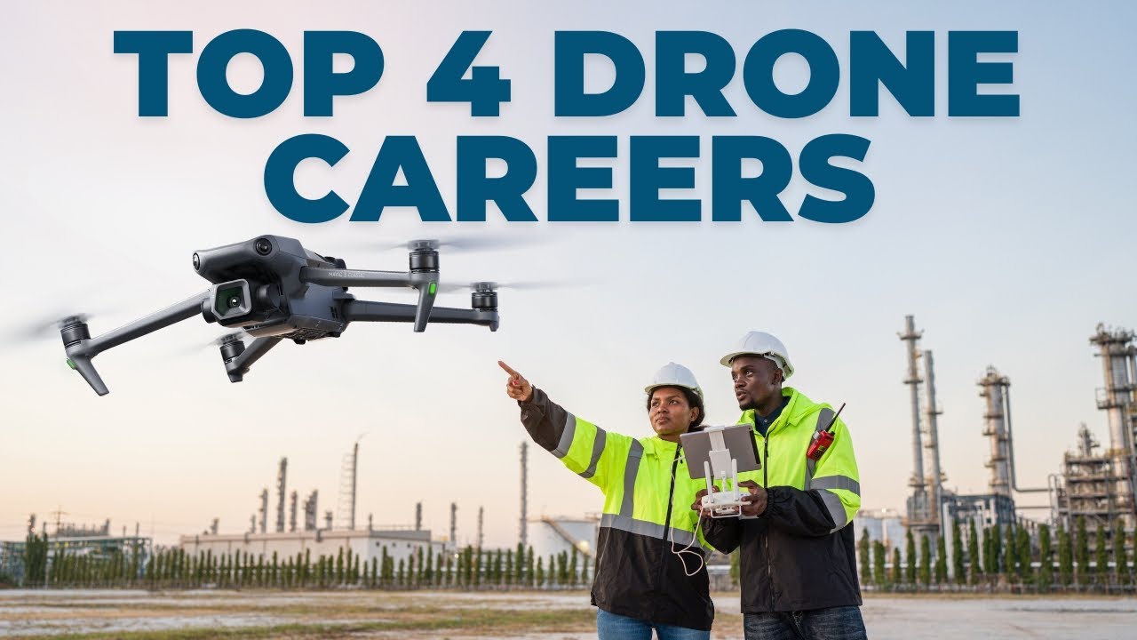
Top 4 DRONE CAREERS in 2024!UAV Coach28,585 views | 793 | April 19 2024 16:19:09 (44 comments)[ Read more … ]
📽️ Watch our Drone Mapping Video: https://youtu.be/6yAs_9v2e0I?si=gObTo0_LW5Gv2dcd
✅ Check out Drone Pilot Ground School: https://www.dronepilotgroundschool.com/
Considering a career with drones? This video dives into the most lucrative drone pilot jobs in 2024. Whether you’re a seasoned pilot or just curious about the possibilities, there’s something for you. Explore how drones are revolutionizing industries like filmmaking, where they can capture breathtaking aerial footage for movies, real estate listings, and tourism. Learn how they’re making infrastructure inspection safer and more efficient for bridges, buildings, and power lines. See how drones are assisting in emergency response and public safety by helping with search and rescue missions and enhancing law enforcement efforts. The final career we explore is the use of drones in agriculture and environmental monitoring, where they’re optimizing farms, tracking wildlife populations, and monitoring pollution levels. And don’t worry about robots taking all of the drone jobs – we explain why human expertise, client education, and the ability to adapt to new technology will keep drone pilots in high demand!
🎬 Jump to Section
0:00 Introduction
0:46 Artificial Intelligence and Drone Piloting
2:05 Aerial Photography and Videography
2:49 Infrastructure Inspection and Maintenance
3:32 Emergency Response and Public Safety
4:27 Agriculture and Environmental Monitoring
5:32 Further Learning and Part 107 Certification
📨 Become a drone expert and join our free drone industry newsletter w/ 100,000+ subscribers: https://uavcoach.com/news
🖥 Pass the FAA Part 107 test on your first try with our industry-leading test prep course w/ 60,000+ students: https://dronepilotgroundschool.com
🖥 Climb higher in your drone career with our comprehensive drone mapping course: https://uavcoach.com/online-drone-mapping-course/
👷♂️ Register for a 2-day drone mapping workshop in one of our 6 locations: https://uavcoach.com/in-person-drone-mapping-course/
📣 We are an FAA-approved test administrator of The Recreational UAS Safety Test (TRUST) which is now required for recreational drone flyers. The test is free, online, and takes less than 30 minutes to complete: https://uavcoach.com/faa-recreational-drone-training/
✳️ UAV Coach provides industry-leading training, education, and news for professionals and hobbyists in the drone industry. We offer online and in-person training — over 60,000 people have used our flagship training course, Drone Pilot Ground School, to pass the FAA Part 107 remote pilot certification exam. And we’ve delivered hands-on flight training to more than 2,500+ new drone pilots. Our mission is to help push the drone industry forward by sharing years of knowledge to help drone pilots be safe and smart operators.
Advertisement
What’s the best drone for Inspections? – The ultimate breakdown!UAVISUALS72,128 views | 1,517 | June 13 2021 23:46:50 (64 comments)[ Read more … ]
Looking at getting into drone inspection but no idea which drone to buy?
How much does it cost to get into drone inspections? How can I make money with drone inspections?
I have broken down all the various drones that are out there in the market by price range giving you a detailed summary of each. You don’t need to spend thousands of dollars on a high-end drone, you may find a small lightweight drone could do the work required!
Skip to the price range in the video below:
1:50 – From $500 ($750AUD)
4:54 – From $1000 ($1300AUD)
7:43 – From $2000 ($2500AUD)
8:49 – From $2500 (3000AUD)
9:43 – From $3000 ($3400AUD)
11:22 – From $6000 ($7500AUD)
12:55 – From $20,000++ ($26,000AUD+)
This video plus more is in our online drone inspection course: https://dronemasterclassacademy.com/drone-inspections-sales
—
Check out our drone online courses & resources here: http://dronemasterclassacademy.com
► FREE drone safety sign template: https://dronemasterclassacademy.com/a-frame-safety-design-template
► Starter Drone Business documents: https://dronemasterclassacademy.com/business-starter-documents-sales
► FREE Job Profit calculator: https://dronemasterclassacademy.com/job-profit-calculator-sales-page927828
► Operational Checklists: https://dronemasterclassacademy.com/drone-operational-checklists-sales
► FREE Drone cinematic LUTS: https://dronemasterclassacademy.com/5-free-drone-cinematic-luts-pack-sales
Roof Inspection With a DroneInternational Association of Certified Home Inspectors (InterNACHI)47,027 views | 613 | August 31 2021 18:13:45 (123 comments)[ Read more … ]
Follow along with InterNACHI’s Ben Gromicko as he performs a roof inspection while using a drone. One way to thoroughly and safely inspect a roof is by using a drone. Become drone certified today by visiting nachi.org/certification.
Advertisement
Drones in Telco – Opportunity, Background & Gear explained!UAVISUALS23,694 views | 741 | October 12 2021 04:00:14 (59 comments)[ Read more … ]
Let’s face it, we cannot live without our mobile phones & the internet…and with that comes an industry that is so important to everyone… Telecommunications!
Mobile (cell towers) and its infrastructure plays a big role across the globe. Drones are not only being used to inspect these assets but can also provide crucial info for the commissioning, maintenance and servicing for the carriers.
If you are a drone operator and looking to get into this industry… start here! There are plenty of opportunities for businesses and individuals out there if you have the gear & knowledge. This video will help get you on the right foot. More in our online courses!
Skip to the sections below:
0:28 – Industry background
1:35 – Types of antennas
3:58 – Traditional methods
5:30 – LOS (Line Of Sight survey)
8:30 – Best drones/ cameras for telco
9:50 – Software
—
This video plus more is in our online drone inspection course:
https://dronemasterclassacademy.com/drone-inspections-sales
More resources here: http://dronemasterclassacademy.com
Patryk Alexander is an associate copy editor at 4kVideoDrones.com, where he sharpens articles and helps keep the website's content clean and error-free. With a background in creative writing, Patryk brings a unique perspective to his editing that helps make 4kVideoDrones.com's content engaging and informative. When he's not editing or writing, Patryk enjoys spending time with his family and exploring the great outdoors.